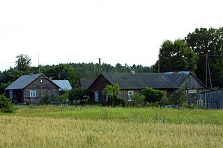
Lipa is a village in the administrative district of Gmina Ziębice, within Ząbkowice Śląskie County, Lower Silesian Voivodeship, in south-western Poland. Prior to 1945 it was in Germany.

Wierzchy is a village in the administrative district of Gmina Osie, within Świecie County, Kuyavian-Pomeranian Voivodeship, in north-central Poland. It lies approximately 7 kilometres (4 mi) west of Osie, 25 km (16 mi) north-west of Świecie, and 57 km (35 mi) north of Bydgoszcz.
Kurzejewo is a village in the administrative district of Gmina Warlubie, within Świecie County, Kuyavian-Pomeranian Voivodeship, in north-central Poland.

Młyny is a village in the administrative district of Gmina Strzelno, within Mogilno County, Kuyavian-Pomeranian Voivodeship, in north-central Poland. It lies approximately 5 kilometres (3 mi) south-east of Strzelno, 19 km (12 mi) east of Mogilno, 55 km (34 mi) south-west of Toruń, and 59 km (37 mi) south of Bydgoszcz.

Łagiewniki is a village in the administrative district of Gmina Niemce, within Lublin County, Lublin Voivodeship, in eastern Poland. It lies approximately 7 kilometres (4 mi) south of Niemce and 7 km (4 mi) north of the regional capital Lublin.

Siucice-Kolonia is a village in the administrative district of Gmina Aleksandrów, within Piotrków County, Łódź Voivodeship, in central Poland. It lies approximately 5 kilometres (3 mi) south-east of Aleksandrów, 30 km (19 mi) south-east of Piotrków Trybunalski, and 72 km (45 mi) south-east of the regional capital Łódź.

Stare Baraki is a village in the administrative district of Gmina Zaklików, within Stalowa Wola County, Subcarpathian Voivodeship, in south-eastern Poland. It lies approximately 8 kilometres (5 mi) north-west of Zaklików, 25 km (16 mi) north of Stalowa Wola, and 86 km (53 mi) north of the regional capital Rzeszów.

Kępa Wólczyńska is a village in the administrative district of Gmina Kozienice, within Kozienice County, Masovian Voivodeship, in east-central Poland. It lies approximately 5 kilometres (3 mi) north-east of Kozienice and 81 km (50 mi) south-east of Warsaw.

Przewóz is a village in the administrative district of Gmina Kozienice, within Kozienice County, Masovian Voivodeship, in east-central Poland. It lies approximately 3 kilometres (2 mi) north of Kozienice and 79 km (49 mi) south-east of Warsaw.

Zawady is a village in the administrative district of Gmina Troszyn, within Ostrołęka County, Masovian Voivodeship, in east-central Poland. It lies approximately 11 kilometres (7 mi) east of Troszyn, 22 km (14 mi) east of Ostrołęka, and 110 km (68 mi) north-east of Warsaw.

Poniatowo is a village in the administrative district of Gmina Małkinia Górna, within Ostrów Mazowiecka County, Masovian Voivodeship, in east-central Poland.

Żebry-Idźki is a village in the administrative district of Gmina Czernice Borowe, within Przasnysz County, Masovian Voivodeship, in east-central Poland. It lies approximately 2 kilometres (1 mi) north-west of Czernice Borowe, 13 km (8 mi) west of Przasnysz, and 94 km (58 mi) north of Warsaw.

Leśnik is a village in the administrative district of Gmina Krajenka, within Złotów County, Greater Poland Voivodeship, in west-central Poland. It lies approximately 6 kilometres (4 mi) south-east of Krajenka, 10 km (6 mi) south of Złotów, and 98 km (61 mi) north of the regional capital Poznań.

Grądzień is a settlement in Gmina Miastko, Bytów County, Pomeranian Voivodeship, in northern Poland. It lies approximately 24 kilometres (15 mi) south-west of Bytów and 104 km (65 mi) south-west of Gdańsk.
Kleszczewo is a village in the administrative district of Gmina Trzebielino, within Bytów County, Pomeranian Voivodeship, in northern Poland.

Żabiniec is a settlement in the administrative district of Gmina Ustka, within Słupsk County, Pomeranian Voivodeship, in northern Poland. It lies approximately 17 kilometres (11 mi) east of Ustka, 17 km (11 mi) north of Słupsk, and 102 km (63 mi) west of the regional capital Gdańsk.

Polesie is a settlement in the administrative district of Gmina Tczew, within Tczew County, Pomeranian Voivodeship, in northern Poland. It lies approximately 10 kilometres (6 mi) south-west of Tczew and 37 km (23 mi) south of the regional capital Gdańsk.

Starza is a village in the administrative district of Gmina Świerzno, within Kamień County, West Pomeranian Voivodeship, in north-western Poland. It lies approximately 6 kilometres (4 mi) east of Świerzno, 17 km (11 mi) east of Kamień Pomorski, and 67 km (42 mi) north-east of the regional capital Szczecin.

Nizinne is a village in the administrative district of Gmina Szczecinek, within Szczecinek County, West Pomeranian Voivodeship, in north-western Poland.
Lime Kiln Mountain is a long ridge in Taney County in the Ozarks of southern Missouri. The ridge reaches an elevation of 1,330 feet (410 m) at 36°36′13″N92°53′22″W. US Route 160 traverses the ridgeline from Rueter in the southeast to Hilda in the northwest for a distance of approximately 7.5 mi (12.1 km). Cane Creek runs roughly parallel to the ridge along the northeast.


