
Itäkeskus is a quarter in the neighbourhood of Vartiokylä in the eastern part of Helsinki. The district's main attraction is the largest covered-in shopping mall in the Nordic countries, Itis. The district has a station on the Helsinki Metro.

Poggioreale is a neighbourhood of Naples, southern Italy. It is at the extreme east end of the city and includes the areas of the central train station, the vast new Civic Center, the adjacent Poggioreale prison, and the industrial section to the east.

Frydrychowo is a village in the administrative district of Gmina Wąbrzeźno, within Wąbrzeźno County, Kuyavian-Pomeranian Voivodeship, in north-central Poland. It lies approximately 4 kilometres (2 mi) north-east of Wąbrzeźno and 39 km (24 mi) north-east of Toruń.
Kołatnik is a village in the administrative district of Gmina Wałcz, within Wałcz County, West Pomeranian Voivodeship, in north-western Poland. It lies approximately 4 kilometres (2 mi) north of Wałcz and 127 km (79 mi) east of the regional capital Szczecin.
Gajówka is a village in the administrative district of Gmina Choceń, within Włocławek County, Kuyavian-Pomeranian Voivodeship, in north-central Poland.
Kolonie Jasionowo is a village in the administrative district of Gmina Sztabin, within Augustów County, Podlaskie Voivodeship, in north-eastern Poland.
Gałąźnia Wielka is a village in the administrative district of Gmina Kołczygłowy, within Bytów County, Pomeranian Voivodeship, in northern Poland. It lies approximately 10 kilometres (6 mi) north-east of Kołczygłowy, 23 km (14 mi) north-west of Bytów, and 86 km (53 mi) west of the regional capital Gdańsk.

Təkyə is a village in the Davachi Rayon of Azerbaijan. The village forms part of the municipality of Çaraq.
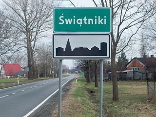
Świątniki is a village in the administrative district of Gmina Pabianice, within Pabianice County, Łódź Voivodeship, in central Poland. It lies approximately 9 kilometres (6 mi) north-west of Pabianice and 15 km (9 mi) south-west of the regional capital Łódź.

Imbramowice is a village in the administrative district of Gmina Trzyciąż, within Olkusz County, Lesser Poland Voivodeship, in southern Poland. It lies approximately 7 kilometres (4 mi) east of Trzyciąż, 22 km (14 mi) east of Olkusz, and 28 km (17 mi) north of the regional capital Kraków. Imbramowice is the site of a Premonstratensian (Norbertine) monastery.
Ludwinów is a village in the administrative district of Gmina Jędrzejów, within Jędrzejów County, Świętokrzyskie Voivodeship, in south-central Poland. It lies approximately 3 kilometres (2 mi) south of Jędrzejów and 38 km (24 mi) south-west of the regional capital Kielce.
Broniszów is a village in the administrative district of Gmina Kazimierza Wielka, within Kazimierza County, Świętokrzyskie Voivodeship, in south-central Poland. It lies approximately 4 kilometres (2 mi) north-east of Kazimierza Wielka and 65 km (40 mi) south of the regional capital Kielce.
Michniowiec is a village in the administrative district of Gmina Czarna, within Bieszczady County, Subcarpathian Voivodeship, in south-eastern Poland, close to the border with Ukraine. It lies approximately 6 kilometres (4 mi) south-east of Czarna, 18 km (11 mi) south-east of Ustrzyki Dolne, and 97 km (60 mi) south-east of the regional capital Rzeszów.
Drogosławiec is a village in the administrative district of Gmina Stęszew, within Poznań County, Greater Poland Voivodeship, in west-central Poland.
Róża is a village in the administrative district of Gmina Słupca, within Słupca County, Greater Poland Voivodeship, in west-central Poland. It lies approximately 3 kilometres (2 mi) east of Słupca and 69 km (43 mi) east of the regional capital Poznań.
Katarzynki is a settlement in the administrative district of Gmina Lipnica, within Bytów County, Pomeranian Voivodeship, in northern Poland. It lies approximately 9 kilometres (6 mi) south-west of Lipnica, 25 km (16 mi) south-west of Bytów, and 99 km (62 mi) south-west of the regional capital Gdańsk.
Mały Podleś is a village in the administrative district of Gmina Kościerzyna, within Kościerzyna County, Pomeranian Voivodeship, in northern Poland. It lies approximately 5 kilometres (3 mi) south-east of Kościerzyna and 51 km (32 mi) south-west of the regional capital Gdańsk.
Stacze is a village in the administrative district of Gmina Kowale Oleckie, within Olecko County, Warmian-Masurian Voivodeship, in northern Poland. It lies approximately 8 kilometres (5 mi) west of Kowale Oleckie, 18 km (11 mi) north-west of Olecko, and 125 km (78 mi) east of the regional capital Olsztyn.
Młyniska is a settlement in the administrative district of Gmina Polanów, within Koszalin County, West Pomeranian Voivodeship, in north-western Poland.
Němčice is a village and municipality in Kolín District in the Central Bohemian Region of the Czech Republic.


