The Central Ferry Piers are situated on the northeast part of Central, Hong Kong Island. The ferries mostly depart to Outlying Islands in the New Territories, with the exception of Pier 1 serving as a government pier, and ferries from Pier 7 going to Kowloon.

Paulina is a village in the administrative district of Gmina Kcynia, within Nakło County, Kuyavian-Pomeranian Voivodeship, in north-central Poland. It lies approximately 12 kilometres (7 mi) north of Kcynia, 9 km (6 mi) south-west of Nakło nad Notecią, and 35 km (22 mi) west of Bydgoszcz.
Dalny Las is a village in the administrative district of Gmina Płaska, within Augustów County, Podlaskie Voivodeship, in north-eastern Poland, close to the border with Belarus.

Kleosin is a village in the administrative district of Gmina Juchnowiec Kościelny, within Białystok County, Podlaskie Voivodeship, in north-eastern Poland. It lies approximately 9 kilometres (6 mi) north of Juchnowiec Kościelny and 5 km (3 mi) south-west of the regional capital Białystok.

Kolonia Kociszew is a village in the administrative district of Gmina Zelów, within Bełchatów County, Łódź Voivodeship, in central Poland. It lies approximately 6 kilometres (4 mi) north-east of Zelów, 15 km (9 mi) north of Bełchatów, and 36 km (22 mi) south of the regional capital Łódź.

Lisowice-Kolonia is a village in the administrative district of Gmina Działoszyn, within Pajęczno County, Łódź Voivodeship, in central Poland. It lies approximately 4 kilometres (2 mi) south-west of Działoszyn, 14 km (9 mi) south-west of Pajęczno, and 89 km (55 mi) south-west of the regional capital Łódź.

Niedźwiedź is a village in the administrative district of Gmina Słomniki, within Kraków County, Lesser Poland Voivodeship, in southern Poland. It lies approximately 3 kilometres (2 mi) south of Słomniki and 22 km (14 mi) north-east of the regional capital Kraków.

Hadle Kańczuckie is a village in the administrative district of Gmina Jawornik Polski, within Przeworsk County, Subcarpathian Voivodeship, in south-eastern Poland.
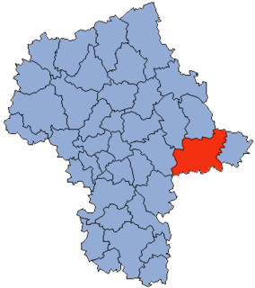
Chruszczewka Włościańska is a village in the administrative district of Gmina Kosów Lacki, within Sokołów County, Masovian Voivodeship, in east-central Poland.

Hornówek is a village in the administrative district of Gmina Izabelin, within Warsaw West County, Masovian Voivodeship, in east-central Poland. It lies approximately 2 kilometres (1 mi) south-west of Izabelin, 8 km (5 mi) north of Ożarów Mazowiecki, and 16 km (10 mi) north-west of Warsaw.
Andrzejów is a village in the administrative district of Gmina Przyłęk, within Zwoleń County, Masovian Voivodeship, in east-central Poland.
Chorzałki is a settlement in the administrative district of Gmina Kostrzyn, within Poznań County, Greater Poland Voivodeship, in west-central Poland.

Kępa is a settlement in the administrative district of Gmina Kartuzy, within Kartuzy County, Pomeranian Voivodeship, in northern Poland. It lies approximately 11 kilometres (7 mi) north-west of Kartuzy and 36 km (22 mi) west of the regional capital Gdańsk.

Nowy Ostrów is a village in the administrative district of Gmina Stężyca, within Kartuzy County, Pomeranian Voivodeship, in northern Poland. It lies approximately 10 kilometres (6 mi) north of Stężyca, 21 km (13 mi) west of Kartuzy, and 49 km (30 mi) west of the regional capital Gdańsk.
Wróble is a village in the administrative district of Gmina Grunwald, within Ostróda County, Warmian-Masurian Voivodeship, in northern Poland.

Warnkowo is a village in the administrative district of Gmina Nowogard, within Goleniów County, West Pomeranian Voivodeship, in north-western Poland. It lies approximately 3 kilometres (2 mi) north-west of Nowogard, 24 km (15 mi) north-east of Goleniów, and 45 km (28 mi) north-east of the regional capital Szczecin.

Břežany II is a village and municipality in Kolín District in the Central Bohemian Region of the Czech Republic.

Throne is an unincorporated community in central Alberta within the County of Paintearth No. 18, located on Highway 12, 150 kilometres (93 mi) southeast of Camrose, and 12 kilometres (7.5 mi) southeast of Coronation, Alberta.
Nuussuaq Peninsula is a mainland peninsula in northwestern Greenland, located at the northern end of Upernavik Archipelago, approximately 70 km (43 mi) to the south of Melville Bay. It is much smaller than its namesake in western Greenland.

Huangmugang station is a Metro station of Shenzhen Metro Line 7. It opened on 28 October 2016.


