Dąbrowa, Gmina Dobra

Last updated
Dąbrowa
Village
Poland adm location map.svg
Red pog.svg
Dąbrowa
Location in Poland
Coordinates: 52°04′N18°42′E / 52.067°N 18.700°E / 52.067; 18.700 Coordinates: 52°04′N18°42′E / 52.067°N 18.700°E / 52.067; 18.700
Country Flag of Poland.svg Poland
Voivodeship Greater Poland
County Turek
Gmina Dobra
Elevation 94 m (308 ft)
Population 121

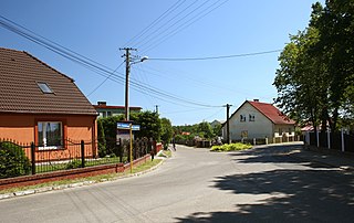
Dąbrowa [dɔmˈbrɔva] is a village in the administrative district of Gmina Dobra, within Turek County, Greater Poland Voivodeship, in west-central Poland. [1]

Village Small clustered human settlement smaller than a town

A village is a clustered human settlement or community, larger than a hamlet but smaller than a town, with a population ranging from a few hundred to a few thousand. Though villages are often located in rural areas, the term urban village is also applied to certain urban neighborhoods. Villages are normally permanent, with fixed dwellings; however, transient villages can occur. Further, the dwellings of a village are fairly close to one another, not scattered broadly over the landscape, as a dispersed settlement.

Gmina Dobra, Greater Poland Voivodeship Gmina in Greater Poland, Poland

Gmina Dobra is an urban-rural gmina in Turek County, Greater Poland Voivodeship, in west-central Poland. Its seat is the town of Dobra, which lies approximately 15 kilometres (9 mi) south-east of Turek and 128 km (80 mi) south-east of the regional capital Poznań.

Turek County County in Greater Poland, Poland

Turek County is a unit of territorial administration and local government (powiat) in Greater Poland Voivodeship, west-central Poland. It came into being on January 1, 1999, as a result of the Polish local government reforms passed in 1998. Its administrative seat and largest town is Turek, which lies 117 kilometres (73 mi) east of the regional capital Poznań. The county also contains the towns of Tuliszków, lying 16 km (10 mi) north-west of Turek, and Dobra, 15 km (9 mi) south-east of Turek.

The village has a population of 121.

Related Research Articles

Poland republic in Central Europe

Poland, officially the Republic of Poland, is a country located in Central Europe. It is divided into 16 administrative subdivisions, covering an area of 312,696 square kilometres (120,733 sq mi), and has a largely temperate seasonal climate. With a population of approximately 38.5 million people, Poland is the sixth most populous member state of the European Union. Poland's capital and largest metropolis is Warsaw. Other major cities include Kraków, Łódź, Wrocław, Poznań, Gdańsk, and Szczecin.

Magdeburg rights set of town privileges first developed by Otto I (936–973) and based on the Flemish law

Magdeburg rights were a set of town privileges first developed by Otto I, Holy Roman Emperor (936–973) and based on the Flemish law, which regulated the degree of internal autonomy within cities and villages, granted by the local ruler. Named after the German city of Magdeburg, these town charters were perhaps the most important set of medieval laws in Central Europe thus far. They became the basis for the German town laws developed during many centuries in the Holy Roman Empire. Even more importantly, adopted and modified by numerous monarchs including the rulers of Bohemia, Hungary, and Poland, the laws were a milestone in urbanization of the entire region and prompted the development of thousands of villages and cities.

Nisko Place in Subcarpathian, Poland

Niskopronounced [ˈɲiskɔ] is a town in Nisko County, Subcarpathian Voivodeship, Poland on the San River, with a population of 15,534 inhabitants as of 2 June 2009. Together with neighbouring city of Stalowa Wola, Nisko creates a small agglomeration. Nisko has been situated in the Subcarpathian Voivodship since 1999.

LIPA or Lipa may refer to:

Borek may refer to:

Dobra may refer to:

Janów may refer to:

Biskupice is the name of several locations in central Europe:

Gaj or GAJ may refer to:

Ruda may refer to:

Huta may refer to:

Rudnik may refer to:

Żarnów Village in Łódź, Poland

Żarnów is a historical village in Opoczno County, Łódź Voivodeship, in central Poland. It is the seat of the administrative district called Gmina Żarnów. It lies approximately 18 kilometres (11 mi) south-west of Opoczno and 77 km (48 mi) south-east of the regional capital Łódź. Between 1415 and 1876 the village had a status of a town.

Gorzeń Dolny Village in Lesser Poland, Poland

Gorzeń Dolny is a village in the administrative district of Gmina Wadowice, within Wadowice County, Lesser Poland Voivodeship, in southern Poland. It lies approximately 2 kilometres (1 mi) west of Wadowice and 39 km (24 mi) south-west of the regional capital Kraków.

Spytkowice, Wadowice County Village in Lesser Poland, Poland

Spytkowice is a village in Wadowice County, Lesser Poland Voivodeship, in southern Poland. It is the seat of the gmina called Gmina Spytkowice. It lies approximately 13 kilometres (8 mi) north of Wadowice and 33 km (21 mi) west of the regional capital Kraków.

Łękawica, Wadowice County Village in Lesser Poland, Poland

Łękawica is a village in the administrative district of Gmina Stryszów, within Wadowice County, Lesser Poland Voivodeship, in southern Poland. It lies approximately 4 kilometres (2 mi) west of Stryszów, 8 km (5 mi) south-east of Wadowice, and 37 km (23 mi) south-west of the regional capital Kraków.

Odry, Poland Village in Pomeranian, Poland

Odry is a village in the administrative district of Gmina Czersk, within Chojnice County, Pomeranian Voivodeship, in northern Poland. It lies approximately 12 kilometres (7 mi) north of Czersk, 38 km (24 mi) north-east of Chojnice, and 67 km (42 mi) south-west of the regional capital Gdańsk.

DAB, dab or dabs may refer to:

References