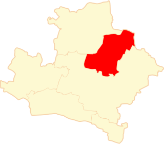
Brudzyń is a village in the administrative district of Gmina Janowiec Wielkopolski, within Żnin County, Kuyavian-Pomeranian Voivodeship, in north-central Poland. It lies approximately 4 kilometres (2 mi) north-west of Janowiec Wielkopolski, 18 km (11 mi) south-west of Żnin, and 52 km (32 mi) south-west of Bydgoszcz.
Osówka is a village in the administrative district of Gmina Czyże, within Hajnówka County, Podlaskie Voivodeship, in north-eastern Poland. It lies approximately 4 kilometres (2 mi) east of Czyże, 9 km (6 mi) north-west of Hajnówka, and 43 km (27 mi) south-east of the regional capital Białystok.
Ołdaki is a village in the administrative district of Gmina Mońki, within Mońki County, Podlaskie Voivodeship, in north-eastern Poland. It lies approximately 8 kilometres (5 mi) north of Mońki and 47 km (29 mi) north-west of the regional capital Białystok.
Żuków is a village in the administrative district of Gmina Miączyn, within Zamość County, Lublin Voivodeship, in eastern Poland. It lies approximately 6 kilometres (4 mi) north-west of Miączyn, 17 km (11 mi) north-east of Zamość, and 82 km (51 mi) south-east of the regional capital Lublin.
Bączki is a village in the administrative district of Gmina Maciejowice, within Garwolin County, Masovian Voivodeship, in east-central Poland. It lies approximately 13 kilometres (8 mi) north-west of Maciejowice, 18 km (11 mi) south-west of Garwolin, and 58 km (36 mi) south-east of Warsaw.
Benice is a village in the administrative district of Gmina Krotoszyn, within Krotoszyn County, Greater Poland Voivodeship, in west-central Poland. It lies approximately 9 kilometres (6 mi) north-west of Krotoszyn and 79 km (49 mi) south-east of the regional capital Poznań.
Romanów is a village in the administrative district of Gmina Krotoszyn, within Krotoszyn County, Greater Poland Voivodeship, in west-central Poland. It lies approximately 7 kilometres (4 mi) north-west of Krotoszyn and 82 km (51 mi) south of the regional capital Poznań.
Różopole is a village in the administrative district of Gmina Krotoszyn, within Krotoszyn County, Greater Poland Voivodeship, in west-central Poland. It lies approximately 8 kilometres (5 mi) north-east of Krotoszyn and 87 km (54 mi) south-east of the regional capital Poznań.
Gościejew is a village in the administrative district of Gmina Koźmin Wielkopolski, within Krotoszyn County, Greater Poland Voivodeship, in west-central Poland. It lies approximately 9 kilometres (6 mi) south-west of Koźmin Wielkopolski, 13 km (8 mi) north-west of Krotoszyn, and 75 km (47 mi) south-east of the regional capital Poznań.
Walerianów is a village in the administrative district of Gmina Koźmin Wielkopolski, within Krotoszyn County, Greater Poland Voivodeship, in west-central Poland. It lies approximately 12 kilometres (7 mi) north-west of Koźmin Wielkopolski, 23 km (14 mi) north-west of Krotoszyn, and 65 km (40 mi) south-east of the regional capital Poznań.
Budy is a village in the administrative district of Gmina Rozdrażew, within Krotoszyn County, Greater Poland Voivodeship, in west-central Poland. It lies approximately 6 kilometres (4 mi) north-east of Rozdrażew, 18 km (11 mi) north-east of Krotoszyn, and 80 km (50 mi) south-east of the regional capital Poznań.
Dzielice is a village in the administrative district of Gmina Rozdrażew, within Krotoszyn County, Greater Poland Voivodeship, in west-central Poland. It lies approximately 4 kilometres (2 mi) south-west of Rozdrażew, 10 km (6 mi) north of Krotoszyn, and 80 km (50 mi) south-east of the regional capital Poznań.
Grębów is a village in the administrative district of Gmina Rozdrażew, within Krotoszyn County, Greater Poland Voivodeship, in west-central Poland. It lies approximately 4 kilometres (2 mi) north of Rozdrażew, 16 km (10 mi) north of Krotoszyn, and 77 km (48 mi) south-east of the regional capital Poznań.
Henryków is a village in the administrative district of Gmina Rozdrażew, within Krotoszyn County, Greater Poland Voivodeship, in west-central Poland. It lies approximately 5 kilometres (3 mi) south-west of Rozdrażew, 9 km (6 mi) north-east of Krotoszyn, and 82 km (51 mi) south-east of the regional capital Poznań.
Maciejew is a village in the administrative district of Gmina Rozdrażew, within Krotoszyn County, Greater Poland Voivodeship, in west-central Poland. It lies approximately 3 kilometres (2 mi) east of Rozdrażew, 15 km (9 mi) north-east of Krotoszyn, and 81 km (50 mi) south-east of the regional capital Poznań.
Nowa Wieś is a village in the administrative district of Gmina Rozdrażew, within Krotoszyn County, Greater Poland Voivodeship, in west-central Poland. It lies approximately 5 kilometres (3 mi) north-east of Rozdrażew, 18 km (11 mi) north-east of Krotoszyn, and 79 km (49 mi) south-east of the regional capital Poznań.
Trzemeszno is a village in the administrative district of Gmina Rozdrażew, within Krotoszyn County, Greater Poland Voivodeship, in west-central Poland. It lies approximately 2 kilometres (1 mi) north of Rozdrażew, 15 km (9 mi) north-east of Krotoszyn, and 79 km (49 mi) south-east of the regional capital Poznań.
Wolenice is a village in the administrative district of Gmina Rozdrażew, within Krotoszyn County, Greater Poland Voivodeship, in west-central Poland. It lies approximately 5 kilometres (3 mi) west of Rozdrażew, 10 km (6 mi) north of Krotoszyn, and 80 km (50 mi) south-east of the regional capital Poznań.
Wyki is a village in the administrative district of Gmina Rozdrażew, within Krotoszyn County, Greater Poland Voivodeship, in west-central Poland. It lies approximately 8 kilometres (5 mi) north-east of Rozdrażew, 20 km (12 mi) north-east of Krotoszyn, and 78 km (48 mi) south-east of the regional capital Poznań.