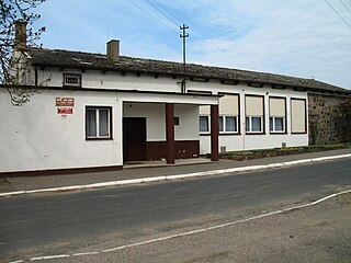
Satory is an area south of Versailles in France. It is mostly known for its military camp, housing:

Dwikozy is a village in Sandomierz County, Świętokrzyskie Voivodeship, in south-central Poland. It is the seat of the gmina called Gmina Dwikozy. It lies approximately 7 kilometres (4 mi) north-east of Sandomierz and 84 km (52 mi) east of the regional capital Kielce.
Bürd is a sum (district) of Övörkhangai Province in southern Mongolia.

National Institute of Fitness and Sports in Kanoya is a national university in Kanoya, Kagoshima, Japan, founded in 1981.
Hristo Botev is a football stadium in Botevgrad, Bulgaria. This is the club stadium of PFC Balkan Botevgrad. The capacity of the stadium is 8,000 seats. The seats are colored in green and white.

Żelebsko is a village in the administrative district of Gmina Biłgoraj, within Biłgoraj County, Lublin Voivodeship, in eastern Poland. It lies approximately 10 kilometres (6 mi) north-east of Biłgoraj and 71 km (44 mi) south of the regional capital Lublin.

Stołpie is a village in the administrative district of Gmina Chełm, within Chełm County, Lublin Voivodeship, in eastern Poland. It lies approximately 13 kilometres (8 mi) north-west of Pokrówka, 12 km (7 mi) west of Chełm, and 53 km (33 mi) east of the regional capital Lublin.

Ciecierzyn is a village in the administrative district of Gmina Niemce, within Lublin County, Lublin Voivodeship, in eastern Poland. It lies approximately 5 kilometres (3 mi) south of Niemce and 9 km (6 mi) north of the regional capital Lublin.

Cırdaxan is a village in the Samukh Rayon of Azerbaijan.
Łysaków Drugi is a village in the administrative district of Gmina Jędrzejów, within Jędrzejów County, Świętokrzyskie Voivodeship, in south-central Poland.

Żerniki is a village in the administrative district of Gmina Baćkowice, within Opatów County, Świętokrzyskie Voivodeship, in south-central Poland. It lies approximately 3 kilometres (2 mi) south-east of Baćkowice, 12 km (7 mi) west of Opatów, and 47 km (29 mi) east of the regional capital Kielce.

Rzeczyca Mokra is a village in the administrative district of Gmina Dwikozy, within Sandomierz County, Świętokrzyskie Voivodeship, in south-central Poland. It lies approximately 1 kilometre (1 mi) south of Dwikozy, 6 km (4 mi) north-east of Sandomierz, and 85 km (53 mi) east of the regional capital Kielce.

Gierałcice is a village in the administrative district of Gmina Głuchołazy, within Nysa County, Opole Voivodeship, in south-western Poland, close to the Czech border. It lies approximately 5 kilometres (3 mi) north-west of Głuchołazy, 15 km (9 mi) south of Nysa, and 57 km (35 mi) south-west of the regional capital Opole.

Sławoszyno is a village in the administrative district of Gmina Krokowa, within Puck County, Pomeranian Voivodeship, in northern Poland. It lies approximately 3 kilometres (2 mi) east of Krokowa, 17 km (11 mi) north-west of Puck, and 55 km (34 mi) north-west of the regional capital Gdańsk.

Klępczewo is a village in the administrative district of Gmina Świdwin, within Świdwin County, West Pomeranian Voivodeship, in north-western Poland. It lies approximately 5 kilometres (3 mi) west of Świdwin and 85 km (53 mi) north-east of the regional capital Szczecin.

Rycerzewko is a village in the administrative district of Gmina Świdwin, within Świdwin County, West Pomeranian Voivodeship, in north-western Poland. It lies approximately 5 kilometres (3 mi) west of Świdwin and 85 km (53 mi) north-east of the regional capital Szczecin.
Aïn El Assel is a town and commune in El Taref Province, Algeria. According to the 1998 census it has a population of 12,482.

Barje is a village in the municipality of Leskovac, Serbia. According to the 2002 census, the village has a population of 372 people.
Tagavere is a village in Lääne-Nigula Parish, Lääne County, in western Estonia.

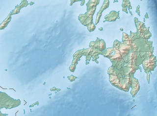
The Pulangi IV Hydroelectric Power Plant, also known as the Pulangi Dam, is located on the Pulangi River near Maramag in Bukidnon province on the island of Mindanao in the Philippines. It uses two reservoirs, produced by damming the Pulangi River, to supply water to a run-of-the-river hydroelectric power plant; the power plant is capable of generating 255 megawatts (342,000 hp) of power. Construction began in 1982; the first two generators became operational in December 1985, with the last generator being commissioned in 1986.


