Transportation in the Dominican Republic is composed of a system of roads, airports, ports, harbours and an urban railway:

Interstate 5 (I-5) is the main Interstate Highway on the West Coast of the United States, running largely parallel to the Pacific coast of the contiguous U.S. from Mexico to Canada. It travels through the states of California, Oregon, and Washington, serving several large cities on the U.S. West Coast, including San Diego, Los Angeles, Sacramento, Portland, and Seattle. It is currently the only continuous Interstate highway to touch both the Mexican border and the Canadian border. Upon crossing the Mexican border at its southern terminus, Interstate 5 continues to Tijuana, Baja California as Mexico Federal Highway 1. Upon crossing the Canadian border at its northern terminus, it continues to Vancouver as British Columbia Highway 99.

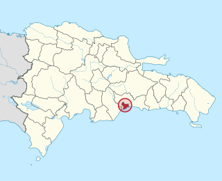
San Cristóbal is a province in the southern Dominican Republic, west of the capital Santo Domingo. It was originally named Trujillo after its founder, dictator Rafael Leónidas Trujillo, taking its present name after his assassination in 1961. It included what is now Monte Plata Province until 1992. The provincial capital is San Cristóbal. In 2007, a documentary was filmed near Hato Damas, about a group of coffee and cacao producers who work together, called Convite. It is available on YouTube.

The South Luzon Expressway, formerly known as the South Superhighway (SSH), Manila South Diversion Road (MSDR), and Manila South Expressway (MSEX), is a network of two expressways that connects Metro Manila to the provinces of the Calabarzon region in the Philippines. The first expressway is the Skyway, operated jointly by the Skyway Operation and Management Corporation (SomCo) and Citra Metro Manila Tollways Corporation (CMMTC). The second expressway, the South Luzon Tollway or Alabang–Calamba–Santo Tomas Expressway (ACTEx), is jointly operated by the South Luzon Tollway Corporation, a joint venture of the Philippine National Construction Corporation and the San Miguel Corporation-backed Citra group of Indonesia via the Manila Toll Expressway Systems, Inc. (MATES).

A bypass is a road or highway that avoids or "bypasses" a built-up area, town, or village, to let through traffic flow without interference from local traffic, to reduce congestion in the built-up area, and to improve road safety. A bypass specifically designated for trucks may be called a truck route.

The Federación Dominicana de Fútbol is the governing body of football in the Dominican Republic.
There are various Highways and Routes in the Dominican Republic. They are listed here.
DR-1 is a dual carriageway highway that forms part of the five designated national highways of the Dominican Republic. DR-1 provides a fast connection between Santo Domingo, the capital, on the southern coast, and the second city Santiago and the rest of the northerly Cibao region, one of the country's main regions.

DR-3 is one of three main dual carriageway highways of the Dominican Republic, connecting Santo Domingo to the eastern cities of the republic. The highway begins at the Plaza de La Bandera, on the western side of Santo Domingo, and travels eastward through downtown Santo Domingo and continues east to Santo Domingo Este. Outside Santo Domingo it runs roughly parallel to the Caribbean Sea toward the eastern cities of the Dominican Republic. DR-3 creates a rapid connection to the Las Américas International Airport, located only 30 kilometers east of Santo Domingo. DR-3 continues eastward to the beach towns of Andrés and Boca Chica. DR-3 then continues east and slightly north to the eastern cities of San Pedro de Macorís, La Romana, and Higüey and has connections to the routes that lead to the resort towns of Bayahibe, Bávaro, and Punta Cana. DR-3 has been part of a long program to improve, expand, and modernize the highways of the Republic. Most of DR-3 has been expanded to two or three lanes of traffic each way.
DR-4 is the fourth numbered highway of the Dominican Republic. It starts from Santo Domingo eastwards to San Pedro de Macorís and then to the north to Hato Mayor del Rey and again eastwards ending in the San Rafael del Yuma.
Interstate 5 (I-5) is a major north–south route of the Interstate Highway System in the United States, stretching from the Mexican border at the San Ysidro crossing to the Canadian border near Blaine, Washington. From San Ysidro, the segment of I-5 in California runs north across the length of the state, and crosses into Oregon south of the Medford-Ashland metropolitan area. It is the more important and most-used of the two major north–south routes on the Pacific Coast, the other being U.S. Route 101 (US 101), which is primarily coastal.
Greater Santo Domingo is a term commonly used referring to the metropolitan area of Santo Domingo in the Dominican Republic.
The proposed Interstate 69 extension from Indianapolis southwest to Texas currently has a short piece completed in the U.S. state of Mississippi, south of Memphis, Tennessee. The south end is an at-grade intersection with the former route of MS 304 near Tunica Resorts, where Mississippi Highway 713 continues west to U.S. Highway 61, and the route continues north to the Mississippi state line. Much of the route overlaps Mississippi Highway 304, which intersects US 61 farther north than MS 713. MS 304 is planned to continue east from I-55, connecting to State Route 385 in Tennessee, forming part of the Interstate 269 Memphis outer beltway.
Autopista 30 de Mayo is a highway in the Dominican Republic. The highway serves as a junction of the capital Santo Domingo, Dominican Republic and its adjacent city, San Cristóbal. It is a small highway, usually with heavy traffic, and passes through the Haina Port, the biggest port in the Dominican Republic. The eastern terminus is at the George Washington Avenue in the city coast and the western terminus lies at the city center of San Cristobal and then unites to the new section of DR-2 in the western part of San Cristobal.
The DR-7, also known as the Santo Domingo-Samana Highway or simply Samana Highway, is the newest addition to the Dominican Republic national highway system.
DR-13 is a highway in the Dominican Republic. It connects Santo Domingo to the province of Monte Plata and Monseñor Nouel. Its two lanes run mostly through metropolitan Santo Domingo and it connects the Distrito Nacional with Santo Domingo Norte and Villa Mella. DR-13 is the only highway in Santo Domingo that crosses Greater Santo Domingo in its entirety. It runs from the coast up to Villa Mella where the highway is then referred to as Avenida Maximo Gomez while in SDN it is known as Avenida Hermanas Mirabal.