Route description
From its southern terminus in the Distrito Nacional (Santo Domingo) to its northern terminus in Monte Cristi on the Dominican-Haitian Border, the highway changes names and quality slightly deteriorates farther from Santo Domingo. DR-1 connects Santo Domingo to the Cibao region known for its fertile valley responsible of producing most of the country's agricultural exports. DR-1 also connects Santo Domingo with the Dominican Republic's second largest city, Santiago de los Caballeros.
Expreso John F. Kennedy
The Expreso John F Kennedy is an urban express corridor parallel to the Expreso 27 de Febrero crossing all of Downtown Santo Domingo and almost the whole Distrito Nacional. In this area, unlike its parallel Expreso, it is not composed of tunnels but instead only by long express viaducts and at ground a three-lane local service road. The beginning of this corridor is marked at the western end of the Avenida Quinto Centenario. This Expreso was finished in 1998–1999 to relieve intense congestion in the growing city of Santo Domingo. The Expreso intercepts the three main north–south avenues of the D.N, the Winston Churchill, Abraham Lincoln, and Maximo Gomez.
The Corridor does not cross the Ozama River, because it begins after that but is connected to Santo Domingo Este by the Avenue Quinto Centenario/San Vicente de Paul.
Corredor Duarte
As of 2011, the Ministry of Public Works and Communications (Ministro de Obras Publicas y Comunicaciones) is involved in the construction of a series of elevated viaducts along DR-1 from Los Alcarrizos to the Winston Churchill Avenue in Distrito Nacional in important intersections along the path. As of the present, overpasses are being constructed in the intersections of Expreso JFK-Defillo, Nunez De Cacerez Avenues and Autopista Duarte-Manoguayabo, and Monumental Avenues. The completion of this Corridor will make the highway express and alleviate the current congestion when entering the capital city. The completion of such viaducts will improve travel speeds for the motorist trying to travel between Santiago de los Caballeros and Santo Domingo. As of June 10, 2010, the project is in very advanced stages and said to be completed by the end of 2010. This project combined with the current construction of Line 2 of Santo Domingo Metro would be of great help for the crosstown commuters that live in Los Alcarrizos and Santo Domingo Oeste and need to travel east into the Distrito Nacional or Santo Domingo Este. Currently many traffic alterations and re-routing are taking place as these projects remain in construction causing temporary discomfort and delay to citizens.
Autopista Juan Pablo Duarte
The highway exits Santo Domingo Oeste and is renamed to Autopista Juan Pablo Duarte in honor of the founding father. Autopista Duarte runs north north-west for much of its run towards the northwest corner of the Republic. On its run it connects Santo Domingo to the suburb Pedro Brand located about 20 kilometers away from the city-center and then goes northwest into the outskirts of Villa Altagracia. Continuing further north it makes a junction with DR-17 which connects it to the small towns of Maimon and Cotuí. To the north DR-1 bypasses the city of Bonao and intersects to DR-12 which serves as a direct connection to the fertile town of Constanza. Father northward almost reaching La Vega DR-1 intersects DR-19 which is the main roadway that leads to the major city of San Francisco de Macorís. DR-1 then proceeds to enter the outskirts of La Vega and connects to DR-21 which serves as a connection to the small town of Moca located slightly south-east of Santiago de los Caballeros. The highway then enters the city center of Santiago de los Caballeros where it currently ends.
Discontinuity in Santiago de los Caballeros and the Completion of Circunvalacion Norte
As DR-1 enters the city of Santiago de los Caballeros, it abruptly ends meters in front of the Monument to the Heroes of Restoration. Before, a highway gap between Autopista Juan Pablo Duarte and Joaquín Balaguer of about 5 kilometers in distance through the city of Santiago had existed and the only alternative to this problem was exiting on Salvador Estrella Sadhala avenue and continuing northwest in the avenue until reaching a junction with the continuation of DR-1 from this point onward renamed as Joaquin Balaguer. The government has fixed this issue in 2014 with the construction of the Circunvalacion Norte avenue and has been completed. The Circunvalacion Norte deviates traffic by going around the north side of Santiago with exits to Licey/Moca, Gurabo and exits to the northern part of Santiago until it merges with Joaquin Balaguer near Navarette.
Autopista Joaquín Balaguer
After the interruption In Santiago de los Caballeros, the highway is renamed again for a third time as Autopista Joaquín Balaguer in honor of the former Dominican president. After Santiago the highway follows the Yaque del Norte River northwest through the Cibao Valley. It runs 25 km to Villa Bisonó where it serves as an important junction to DR-5 which connects to the cities of Puerto Plata Province and the northern coast. The last part of this highway continues through the small towns of the Cibao Valley, the outskirts of Esperanza, Cruce de Guayacanes, Maizal, Villa Elisa and Villa Vasquez, until it reaches its westernmost point, the town of Monte Cristi on the coast. North of Santiago the quality of the highway and the organization deteriorates and is of lesser quality than other national highways. In this northwest extension highway exits are often little more than crossroads, for the most part improvised, and subject to frequent accidents. The highway ends in San Fernando de Monte Cristi close to the northern tip of the Dominican-Haitian Border. There it joins DR-45 which runs south to Dajabón with access to Ouanaminthe, Haiti.

Transport in the Dominican Republic utilizes a system of roads, airports, ports, harbours, and an urban railway.

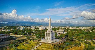
Santo Domingo, once known as Santo Domingo de Guzmán and Ciudad Trujillo, is the capital and largest city of the Dominican Republic and the largest metropolitan area in the Caribbean by population. As of 2022, the Distrito Nacional had a population of 1,484,789, while the total population is 2,995,211 when including the metropolitan area. The city is coterminous with the boundaries of the Distrito Nacional, itself bordered on three sides by Santo Domingo Province.

The Dominican Republic is divided into thirty–one provincias, while the national capital, Santo Domingo, is contained within its own Distrito Nacional.

Monte Cristi is a province in the northwest of the Dominican Republic. The capital city is San Fernando de Monte Cristi. The spelling Montecristi is also seen. The Montecristi province is located in the Cibao frontier region, on the north coast of the country and borders the nation of Haiti. The land area of the Montecristi province is 1,924.35 km2. It is divided into six municipalities and four municipal districts.

Monte Plata is an eastern province of the Dominican Republic, and also the name of its capital city. It was split from San Cristóbal in 1992.
Santiago is a province which currently comprises one of the 32 provinces of the Dominican Republic. It is divided into 10 municipalities and its capital city is Santiago de los Caballeros. Located in north-central Dominican Republic, in the Cibao region, it is bordered by the provinces of Valverde to the north-west, Puerto Plata to the north, Espaillat and La Vega to the east, San Juan to the south and Santiago Rodríguez to the west.
Santiago de los Caballeros, often shortened to Santiago, is the second-largest city in the Dominican Republic and the fourth-largest city in the Caribbean by population. It is the capital of Santiago Province and the largest major metropolis in the Cibao region of the country, it is also the largest non-coastal metropolis in the Caribbean islands. The city has a total population of 1,173,015 inhabitants. Santiago is located approximately 155 km (96 mi) northwest of the capital Santo Domingo with an average altitude of 178 meters (584 ft).

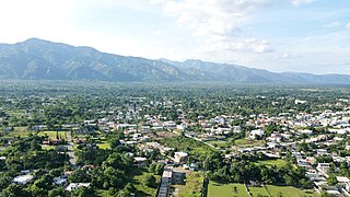
La Vega, is the fourth largest city and municipality of the Dominican Republic. It is in La Vega Province. The city is known as the Carnaval epicenter of the Dominican Republic for its tradition and culture, its large agricultural production methods throughout its province.
Bonao is a city in the Cibao region of Dominican Republic. It is the capital of the Monseñor Nouel province. The city is located in the center of the country, to the northwest of the national capital Santo Domingo.
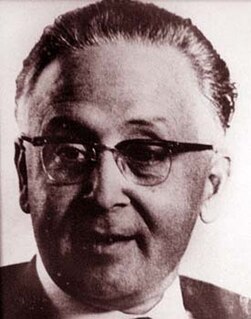
Rafael Filiberto Bonnelly Fondeur was a lawyer, scholar, diplomat, and, from 1962 until 1963, the President of the Dominican Republic. Before he became president, he was vice president of the country from 1960 to 1962.

The Yaque Del Norte River is the longest river in the Dominican Republic, as well as the second longest river on Hispaniola, behind the Artibonite River. It is 296 km long and flows northwest into the Atlantic Ocean.
There are various Highways and Routes in the Dominican Republic. They are listed here.

DR-3 is one of three main dual carriageway highways of the Dominican Republic, connecting Santo Domingo to the eastern cities of the republic. The highway begins at the Plaza de La Bandera, on the western side of Santo Domingo, and travels eastward through downtown Santo Domingo and continues east to Santo Domingo Este. Outside Santo Domingo it runs roughly parallel to the Caribbean Sea toward the eastern cities of the nation. DR-3 creates a rapid connection to the Las Américas International Airport, located only 30 kilometers east of Santo Domingo. DR-3 continues eastward to the beach towns of Andrés and Boca Chica. DR-3 then continues east and slightly north to the eastern cities of San Pedro de Macorís, La Romana, and Higüey and has connections to the routes that lead to the resort towns of Bayahibe, Bávaro, and Punta Cana. DR-3 has been part of a long program to improve, expand, and modernize the highways of the Republic. Most of DR-3 has been expanded to two or three lanes of traffic each way.
The Santiago Light Rail is a planned light rail system within the City of Santiago de los Caballeros, Dominican Republic, and the Cibao International Airport. This will be the second urban rail transit system in the Dominican Republic.
Aerolíneas Mas was an airline with its corporate headquarters in the Ciudad Universitaria in Santo Domingo, Dominican Republic. It offered flights to several domestic destinations. Its flight operations were based at La Isabela International Airport in Santo Domingo.
Central Santo Domingo or better known as Polígono Central is a term used to group several neighborhoods located in central Santo Domingo, Distrito Nacional, Dominican Republic defined as the area delineated by John F Kennedy Avenue on the north, on the west by Winston Churchill avenue, on the east by Maximo Gomez avenue, and on the south by 27 de Febrero avenue.
Los Ríos is a sector in the city of Santo Domingo in the Distrito Nacional of the Dominican Republic. It was founded by ex-president Joaquin Balaguer. Los Ríos is in particular populated by individuals from the middle class. This sector is made up of several districts such as Barrio Azul, Jarro Sucio, Los Multi, Las 8Cienta, La Caña, La Esperanza, Villa Elena, Los Pinos, La Guayubin, and also the areas of large residences, which is next to Diabetes Hospital, the INTEC University and the Botanical Garden. Its main street is the Circunvalacion Avenue.
DR-6 is a designated dual-carriageway highway in the Dominican Republic and gives Santo Domingo a fast connection to the southwestern part of the republic bypassing the city of Bajos de Haina, and San Cristobal. Unlike DR-2 which takes a local route through the center of Haina and San Cristobal, DR-6 bypasses the towns slightly to the north making it easier and faster for travelers to reach destinations farther west of San Cristobal. After bypassing San Cristobal it merges with DR-2 and ends. DR-2 continues to the western towns of the nation.
DR-13 is a highway in the Dominican Republic. It connects Santo Domingo to the province of Monte Plata and Monseñor Nouel. Its two lanes run mostly through metropolitan Santo Domingo and it connects the Distrito Nacional with Santo Domingo Norte and Villa Mella. DR-13 is the only highway in Santo Domingo that crosses Greater Santo Domingo in its entirety. It runs from the coast up to Villa Mella where the highway is then referred to as Avenida Maximo Gomez while in SDN it is known as Avenida Hermanas Mirabal.

Rafael Eduardo Estrella Virella is a civil engineer and Dominican politician, current senator and president of the Senate since 2020. He served as Minister of State for Public Works and Communications of the Dominican Republic during the second term 1991–94, of President Joaquín Balaguer and also he served as Senator for the province of Santiago de los Caballeros during the period 1994–98.
