Related Research Articles
The Australian National Antarctic Research Expeditions is the historical name for the Australian Antarctic Program (AAP) administered for Australia by the Australian Antarctic Division (AAD).
Lillie Glacier is a large glacier in Antarctica, about 100 nautical miles long and 10 nautical miles wide. It lies between the Bowers Mountains on the west and the Concord Mountains and Anare Mountains on the east, flowing to Ob' Bay on the coast and forming the Lillie Glacier Tongue.

Lambert Glacier is a major glacier in East Antarctica. At about 80 km (50 mi) wide, over 400 km (250 mi) long, and about 2,500 m (8,200 ft) deep, it is the world's largest glacier. It drains 8% of the Antarctic ice sheet to the east and south of the Prince Charles Mountains and flows northward to the Amery Ice Shelf. It flows in part of Lambert Graben and exits the continent at Prydz Bay.

The Prince Charles Mountains are a major group of mountains in Mac. Robertson Land in Antarctica, including the Athos Range, the Porthos Range, and the Aramis Range. The highest peak is Mount Menzies, with a height of 3,228 m (10,591 ft). Other prominent peaks are Mount Izabelle and Mount Stinear. These mountains, together with other scattered peaks, form an arc about 420 km (260 mi) long, extending from the vicinity of Mount Starlight in the north to Goodspeed Nunataks in the south.
Moscow University Ice Shelf is a narrow ice shelf, about 120 nautical miles (220 km) long, which fringes the Sabrina Coast of Antarctica between Totten Glacier and Paulding Bay. Dalton Iceberg Tongue extends north from the eastern part of the shelf. The feature was partly delineated from aerial photographs taken by U.S. Navy Operation Highjump in 1946–47, and further photographed and mapped by the Australian National Antarctic Research Expeditions and the Soviet Antarctic Expedition in 1958. It was named by the Soviet expedition after Moscow University.

Mertz Glacier is a heavily crevassed glacier in George V Coast of East Antarctica. It is the source of a glacial prominence that historically has extended northward into the Southern Ocean, the Mertz Glacial Tongue. It is named in honor of the Swiss explorer Xavier Mertz.
The Lazarev Mountains are a chain of mountains in Antarctica. They extend along the west side of Matusevich Glacier southward of Eld Peak, and are about 25 nautical miles long.
Wilson Hills is a group of scattered hills, nunataks and ridges that extend northwest–southeast about 70 nautical miles between Matusevich Glacier and Pryor Glacier in Antarctica.
Pobeda Ice Island, original Russian name остров Победы, is an ice island in the Mawson Sea. It is located 160 km (99 mi) off the coast of Queen Mary Land, East Antarctica. This island, which exists periodically, is formed by the running aground of a tabular iceberg.
Adams Fjord, also variously known as Bukhta Semerka, Bukhta Semyorka or Seven Bay, is a fjord about 13 miles (21 km) long in the northeast part of Amundsen Bay, just south of Mount Riiser-Larsen. Photographed and mapped from ANARE aircraft during 1956. An ANARE party led by Phillip Law entered the fjord by motor launch from the Thala Dan on 14 February 1958 and made a landing at the foot of Mount Riiser-Larsen. Named by ANCA for Ian L. Adams, Officer-in-Charge at Mawson Station in 1958.

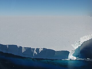
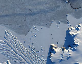
Dibble Iceberg Tongue is an iceberg tongue at the seaward end of Dibble Glacier Tongue. The names Dibble Glacier and Dibble Glacier Tongue were applied by the Advisory Committee on Antarctic Names (US-ACAN) in 1955, concurrent with G.D. Blodgett's delineation of the features from aerial photographs taken by U.S. Navy Operation Highjump (1946–47). The offshore segment of these two related features was photographed by the Australian National Antarctic Research Expeditions in 1956 and 1959, and the Antarctic Names Committee of Australia subsequently recommended that it be named Dibble Iceberg Tongue. US-ACAN has approved the latter name only for the portion lying seaward of Dibble Glacier Tongue.
Kirkby Glacier is a glacier, 20 nautical miles in length, that drains the central Anare Mountains of Antarctica and flows northwest to the sea just north of Arthurson Bluff, northern Victoria Land.
The Porthos Range is the second range south in the Prince Charles Mountains of Antarctica, extending for about 30 miles in an east-to-west direction between Scylla Glacier and Charybdis Glacier. First visited in December 1956 by the Australian National Antarctic Research Expeditions (ANARE) southern party under W.G. Bewsher (1956-57) and named after Porthos, a character in Alexandre Dumas, père's novel The Three Musketeers, the most popular book read on the southern journey.
On the continent of Antarctica, the Aramis Range is the third range south in the Prince Charles Mountains, situated 11 miles southeast of the Porthos Range and extending for about 30 miles in a southwest–northeast direction. It was first visited in January 1957 by Australian National Antarctic Research Expeditions (ANARE) southern party led by W.G. Bewsher, who named it for a character in Alexandre Dumas' novel The Three Musketeers, the most popular book read on the southern journey.
Cape Dalton is a point marking the southeast end of a snow-covered island, located 1 nautical mile (2 km) north of Abrupt Point on the western side of Edward VIII Bay. It was first mapped by Norwegian cartographers from air photos taken by the Lars Christensen Expedition (1936–37) and, though not specifically named on the map, the point appears to have been included as part of two larger features called "Skutenes" and "Skutenesmulen." Skutenes was subsequently mapped by Australian National Antarctic Research Expeditions (ANARE) as two snow-covered islands, making this descriptive name and Skutenesmulen, a derivative, inappropriate. ANARE named the point Cape Dalton for R.F.M. Dalton, officer in charge of ANARE work at Macquarie Island, 1953.
Davies Bay is a bay on the coast of Antarctica, 10 nautical miles wide, between Drake Head and Cape Kinsey.
Pythagoras Peak is the highest peak, 1,275 m, in the central Tula Mountains, standing along the north side of Beaver Glacier, 8 nautical miles (15 km) southeast of Mount Storer. The peak has a prominent notch, the eastern aspect being a right-angled triangle with a perpendicular northern face. It was photographed from Mount Riiser-Larsen in February 1958 by ANARE led by Phillip Law, but was first visited and surveyed in December 1958 by G.A. Knuckey, ANARE surveyor. It was named by the Antarctic Names Committee of Australia (ANCA) after Pythagoras, Greek philosopher, whose theorem concerning a right-angled triangle is well known.

Matusevich Glacier is a broad glacier about 50 nautical miles long, with a well developed glacier tongue, flowing to the coast of East Antarctica between the Lazarev Mountains and the northwestern extremity of the Wilson Hills.
Edward Ridge is a gently rising, snow-covered ridge standing 13 nautical miles (24 km) northwest of Rayner Peak in Enderby Land, Antarctica. It was plotted from air photos taken from Australian National Antarctic Research Expeditions (ANARE) aircraft in 1959, and was named by the Antarctic Names Committee of Australia for Edward Nash, an aircraft mechanic with ANARE, under Phillip Law in 1965.

Amanda Bay, also sometimes known as Hovde Cove, lies in southern Prydz Bay on the Ingrid Christensen Coast of Princess Elizabeth Land, East Antarctica. It is best known for its breeding colony of several thousand pairs of emperor penguins on sea ice at the south-west corner of the bay.
References
 This article incorporates public domain material from "Dalton Iceberg Tongue". Geographic Names Information System . United States Geological Survey.