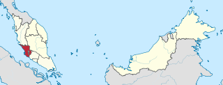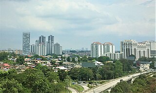
The Damansara River (Malay : Sungai Damansara) is a river in Selangor state, Malaysia. It runs from Sungai Buloh until Shah Alam. [1]

The Damansara River (Malay : Sungai Damansara) is a river in Selangor state, Malaysia. It runs from Sungai Buloh until Shah Alam. [1]

Selangor, also known by the Arabic honorific Darul Ehsan, or "Abode of Sincerity", is one of the 13 states of Malaysia. It is on the west coast of Peninsular Malaysia and is bordered by Perak to the north, Pahang to the east, Negeri Sembilan to the south, and the Strait of Malacca to the west. Selangor surrounds the federal territories of Kuala Lumpur and Putrajaya, both of which were previously part of it. Selangor has diverse tropical rainforests and an equatorial climate. The state's mountain ranges belong to the Titiwangsa Mountains, which is part of the Tenasserim Hills that covers southern Myanmar, southern Thailand and Peninsular Malaysia, with Mount Semangkok as the highest point in the state.

The Petaling District is a district located in the heart of Selangor in Malaysia. Petaling is not to be confused with the city of Petaling Jaya located in it, nor the mukim of Petaling under Subang Jaya City. The district office is located in Subang.
Damansara may refer to:

Bandar Utama Damansara is a residential township located within the Sungai Buloh mukim (subdivision) of the Petaling District, Selangor, Malaysia. It is a residential suburb and home to the popular 1 Utama Shopping Centre. Bandar Utama Damansara, together with neighbouring Kampung Sungai Kayu Ara, form the PJU 6 section of the city of Petaling Jaya.

Petaling Jaya, colloquially referred to as "PJ", is a city in Petaling District, in the state of Selangor, Malaysia. Originally developed as a satellite township for Kuala Lumpur, the capital of Malaysia, it is part of the Greater Kuala Lumpur area. Petaling Jaya was granted city status on 20 June 2006. It has an area of approximately 97.2 square kilometres (37.5 sq mi).

Seri Kembangan, also known as Serdang, formerly known as Serdang New Village, is a town located in Petaling District, Selangor, Malaysia. It is located in between Kuala Lumpur and Putrajaya. The town is now a considerable city in size. It is located near the northern end of the PLUS Expressway Southern Route North–South Expressway Southern Route.

The Damansara–Puchong ExpresswayDamansara–Puchong Expressway, abbreviated as LDP, is a 40.0-kilometre (24.9-mile) major controlled-access highway in the Petaling District of Selangor, Malaysia. The expressway runs in a north–south direction between Bandar Sri Damansara and Putra Permai, near Putrajaya, forming a major thoroughfare in the cities of Petaling Jaya and Puchong. A short east–west spur of the expressway connects Pusat Bandar Puchong to the suburb of UEP Subang Jaya.

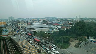
Sungai Buloh, or Sungei Buloh, is a town, a mukim (commune) and a parliamentary constituency in the northern part of Petaling District, Selangor, Malaysia. The name itself means bamboo river in the Malay language. It is located 16 km NW of downtown Kuala Lumpur and 8 km north of the Subang Airport, along the Kuala Selangor highway.

Kota Damansara is an affluent township located in Petaling Jaya, Petaling District, Selangor, Malaysia. It is a township spread across 4,000 acres (1,600 ha).

The Batu Pahat River is a river originating from Sungai Simpang Kiri and Sungai Simpang Kanan near Tongkang Pechah, and flows through Batu Pahat and until it reaches the mouth of the river in Pantai Minyak Beku, a seaside village lying on the west coast of Johor, Malaysia.

Kampung Sungai Penchala is a small Malay village in the Segambut constituency in northwestern Kuala Lumpur, Malaysia, with the postcode 60000 KUALA LUMPUR, lying along the Federal Territory–Selangor border. This village is next to Taman Tun Dr Ismail in Kuala Lumpur, Malaysia which also shares the same 60000 KUALA LUMPUR postcode, and adjacent to Mutiara Damansara and Bandar Utama that were once part of a large oil palm plantation across the interstate border.

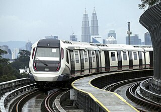
The MRT Kajang Line, previously known as the MRT Sungai Buloh–Kajang Line, is a Mass Rapid Transit (MRT) line servicing the Klang Valley, Malaysia. It is the second fully automated and driverless rail system in the Klang Valley region after the LRT Kelana Jaya Line. Owned by MRT Corp and operated as part of the Rapid KL system by Rapid Rail, it forms part of the Klang Valley Integrated Transit System. The line is numbered 9 and coloured green on official transit maps.
Kampung Sungai Kayu Ara is a small village in the Petaling Jaya Utara (PJU6) section of Petaling Jaya, Selangor, Malaysia. This village is located between Bandar Utama Damansara, Damansara Jaya and Damansara Utama. It shares the postcode 47400 with Damansara Utama which lies to the east and adjacent to PJU6.
Damansara is a suburb in Petaling Jaya, a mukim in Petaling District, as well as a parliamentary constituency in Selangor, Malaysia. It is named after the Damansara River which flows nearby. It is one of the most densely populated areas in Malaysia. According to the 2000 Census of Malaysia, it was the second-largest district subdivision in Malaysia in terms of population with 453,420 residents.

The Damansara–Shah Alam Elevated Expressway (DASH) E31 is an expressway in Klang Valley, Selangor, Malaysia. Estimated cost of the expressway is MYR 11.5 billion.

The Klang District is a district in Selangor, Malaysia. It is located in the western part of Selangor. It borders the Kuala Selangor District to the north, Petaling to the east, Kuala Langat district to the south and Malacca Straits to the west. The district was further divided into two mukims which is Klang and Kapar that covers 626.78 square km of land with 53.75 km of coastline.

The Kwasa Sentral station is a Mass Rapid Transit (MRT) station serving the future development project known as Kwasa Damansara in Section U4 of Shah Alam, Selangor, Malaysia. It is one of the stations of the MRT Kajang Line, formerly known as MRT Sungai Buloh–Kajang Line and was opened on 16 December 2016 under Phase One operations of the line.

The Phileo Damansara station is a mass rapid transit station serving the Phileo Damansara Commercial Centre and the northern sections of Petaling Jaya, Selangor, Malaysia.

Sungai Buloh Depot is a railway yard near Sungai Buloh, Selangor, Malaysia, serving the MRT Kajang Line and the Putrajaya Line. It is located behind Kwasa Damansara MRT station.
The following is an alphabetical list of articles related to Selangor.