Damia, Jordan

Last updated
Damia
Jordan location map.svg
Red pog.svg
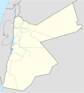
Damia
Location in Jordan
Coordinates: 32°06′14.6″N35°33′09.1″E / 32.104056°N 35.552528°E / 32.104056; 35.552528
CountryFlag of Jordan.svg  Jordan
Governorate Balqa Governorate
Time zone UTC+2 (UTC+2)
  Summer (DST) UTC+3 (UTC+3)
Area code +(962)5

Damia is a town in the Balqa Governorate of Jordan. [1] It has been associated with the biblical City of Adam. It is near the Jisr ed-Damiye or Damiyah Bridge, which crosses the Jordan River to the West Bank.

Contents

Its population includes a number of families that belong to the Abbad clan such as Ramadneh. The land was accordingly owned mainly by the Abbad tribes with land closer to the river belonging to Al Masaeed tribe whose land extends beyond the Jordan to al-Jiftlik and towards the Jericho areas.[ citation needed ]

See also

Related Research Articles

<span class="mw-page-title-main">Jordan River</span> River in West Asia which flows to the Dead Sea

The Jordan River or River Jordan, also known as Nahr Al-Sharieat, is a 251-kilometre-long (156 mi) river in the Middle East that flows roughly north to south through the Sea of Galilee and on to the Dead Sea. Jordan and the Golan Heights border the river to the east, while Israel and the occupied West Bank lie to its west. Both Jordan and the West Bank derive their names in relation to the river.

Ramoth-Gilead, was a Levitical city and city of refuge east of the Jordan River in the Hebrew Bible, also called "Ramoth in Gilead" or "Ramoth Galaad" in the Douay–Rheims Bible. It was located in the tribal territorial allotment of the tribe of Gad.

<span class="mw-page-title-main">As-Salt</span> City in Balqa Governorate, Jordan

As-Salt, also known as Salt, is an ancient trading city and administrative centre in west-central Jordan. It is on the old main highway leading from Amman to Jerusalem. Situated in the Balqa highland, about 790–1,100 metres above sea level, the city is built in the crook of three hills, close to the Jordan Valley. One of the three hills, Jabal al-Qal'a, is the site of a 13th-century ruined fortress. It is the capital of Balqa Governorate of Jordan.

<span class="mw-page-title-main">Litani River</span> River in Lebanon

The Litani River, the classical Leontes, is an important water resource in southern Lebanon. The river rises in the fertile Beqaa Valley, west of Baalbek, and empties into the Mediterranean Sea north of Tyre. Exceeding 140 km in length, the Litani is the longest river in Lebanon and provides an average annual flow estimated at 920 million cubic meters. The waters of the Litani both originate and flow entirely within the borders of Lebanon. It provides a major source for water supply, irrigation and hydroelectricity both within Southern Lebanon, and the country as a whole.

<span class="mw-page-title-main">Allenby Bridge</span> Bridge

The Allenby Bridge, known officially in Jordan as the King Hussein Bridge, and also called the Al-Karameh Bridge or simply Al-Jisr by Palestinian Arabs, is a bridge that crosses the Jordan River near the city of Jericho in the West Bank and the town of Al-Karameh in Jordan.

<span class="mw-page-title-main">Ad Halom</span> Limit of the 1948 Arab advance into Israel

Ad Halom is a site at the eastern entrance to the city of Ashdod, Israel, where three bridges cross the Lakhish River.

<span class="mw-page-title-main">Jisr az-Zarqa</span> Local council in Israel

Jisr az-Zarqa is an Israeli Arab town on Israel's northern Mediterranean coastal plain. Located just north of Caesarea within the Haifa District, it achieved local council status in 1963. According to the Central Bureau of Statistics (CBS) the town had a population of 13,689 in 2014, living on 1,500 dunams (1.5 km2) of coastal land. 80% of residents reportedly live below the poverty line. The name Jisr az-Zarqa is a reference to Taninim Stream, which is known in Arabic as the "Blue Wadi". The mayor is Morad Ammash.

<span class="mw-page-title-main">Mahis</span> Town in Balqa Governorate, Jordan

Mahis is a town in the Balqa Governorate northwest from the governorate's capital Salt, and 10 kilometers (6.2 mi) west of Amman. Its population was 17,754 in 2015. Most of the population of Mahis descends from the Abbadi tribe.. The mountainous town is located at over 800 meters (2,600 ft), with views on the Jordan Valley, West Bank with Jerusalem's walls visible on the horizon. Mahis is known for its orchards and its numerous water fountains and springs, notably the Fountain of Mahis.

<span class="mw-page-title-main">Jisr ash-Shughur</span> Place in Idlib Governorate, Syria

Jisr ash-Shughūr, known in antiquity as Seleucobelus, is a city in the Idlib Governorate in northwestern Syria. Situated at an altitude of 170 metres (560 ft) above sea level on the Orontes river, the city was inhabited by 44,322 people as of 2010. The inhabitants are mostly Sunni Muslims, with a significant Christian minority, mostly Greek Orthodox.

<span class="mw-page-title-main">Gesher Benot Ya'aqov</span>

Gesher Bnot Ya'akov is a bridge that spans the last natural ford of the Jordan River at the southern end of the Hula Basin between the Korazim Plateau and the Golan Heights. It has been a crossing point for thousands of years.

Abbadi or Abbadids is a prominent Arab Muslim dynasty, and one of the largest Arab tribes whose genealogy can be traced back to the Qahtanian "Qahtan" Lakham tribe. However, the tribe's origins are subject to scholarly debate. While some scholars link Abbadi to the Lakhm tribe, others propose a connection to the Judham tribe, which is a sister tribe of Lakhm. Both Lakhm and Judham have been historically documented to have inhabited the same regions in the Arab Levant and Saudi Arabia. Moreover, many researchers posit that Prophet Shuaib belonged to the same tribe (Judham). Abu Ubaid al-Bakri, an erudite Andalusian Arab geographer, writer, polymath, and botanist born in 1030 AD, expounded on the subject, stating that Prophet Shuaib hailed from the Judham tribe and are recognized as the sons-in-law of Prophet Moses.

<span class="mw-page-title-main">Naharayim</span> Disused works situated mainly in Jordan

Naharayim, historically the Jisr Majami area, where the Yarmouk River flows into the Jordan River, was named by the Palestine Electric Company in a letter dated 27 February 1929 to Palestine Railways giving "proper names" to the "different quarters of our Jordan Works" one of these being the "works as a whole including the labour camp" to be called "Naharaim" and another being the site of the "Power House and the adjoining staff quarters, offices" to be called Tel Or. Most of the plant was situated in the Emirate of Transjordan and stretched from the northern canal near the Ashdot Ya'akov in Northern Mandatory Palestine to the Jisr el-Majami in the south.

<span class="mw-page-title-main">Jisr Jindas</span> Bridge in Lod, Israel

Jisr Jindas, Arabic for "Jindas Bridge", also known as Baybars Bridge, was built in 1273 CE. It crosses a small wadi, known in Hebrew as the Ayalon River, on the old road leading south to Lod and Ramla. The bridge is named after the village of Jindas, which until 1948 stood east of the bridge and may have been the Crusader-period "casal of Gendas" mentioned in a Latin charter dated 1129 CE. It is the most famous of the several bridges erected by Sultan Baybars in Palestine, which include the Yibna and the Isdud bridges.

<span class="mw-page-title-main">Yibna Bridge</span> Bridge in Yibna, Israel

The Yibna Bridge or Nahr Rubin Bridge is a Mamluk arch bridge near Yibna, which crosses the river Nahal Sorek. It was previously used by Route 410 to Rehovot, and was known as the Jumping Bridge due to a bump in the middle of the bridge which caused cars to jump if speeding. It is now a part of a recreation ground, next to a new bridge carrying the Route 410.

<span class="mw-page-title-main">Way of the Patriarchs</span> Transportation route in ancient Israel

The Road of the Patriarchs or Way of the Patriarchs is an ancient north–south route traversing the land of Israel and the region of Palestine. The modern Highway 60 (Israel-Palestine) follows roughly the route of the Way of the Patriarchs. The name is used by biblical scholars because of mentions in biblical narratives that it was frequently travelled by Abraham, Isaac and Jacob.

Transjordan, the East Bank, or the Transjordanian Highlands, is the part of the Southern Levant east of the Jordan River, mostly contained in present-day Jordan.

<span class="mw-page-title-main">Jisr ed-Damiye</span> Bridge in Palestinian territories and Jordan

Jisr ed-Damiye, known in English as Damiyah Bridge, as Prince Muhammad Bridge in Jordan, and as Gesher Adam in Israel, stretches over the Jordan River between the Palestinian territories and the town of Damia in the Balqa Governorate of Jordan.

<span class="mw-page-title-main">Balqa (region)</span>

The Balqa, known colloquially as the Balga, is a geographic region in central Jordan generally defined as the highlands east of the Jordan Valley in between the Zarqa River to the north and the Wadi Mujib gorge to the south.

<span class="mw-page-title-main">Jisr el-Majami</span> Bridge over the Jordan river

Jisr el-Majami or Jisr al-Mujamieh is an ancient stone bridge, possibly of Roman origin, over the Jordan River on the border between Israel and Jordan. The name is derived from the bridge's location 200 m (660 ft) south of the confluence of the Yarmouk and Jordan rivers.

<span class="mw-page-title-main">Zvulun Valley</span>

The Zevulun Valley or Zvulun Valley is a fertile coastal territory in the North of Israel, part of the Israeli coastal plain along the Haifa Bay.

References

  1. "Where is Jisr ed Damiye, Jordan?". geotargit.com. Retrieved 27 January 2015.

32°06′14.6″N35°33′09.1″E / 32.104056°N 35.552528°E / 32.104056; 35.552528