Davie is a town in Broward County, Florida, United States about 24 miles north of Miami. The town's population was 110,320 at the 2020 census. Davie is a principal city of the Miami metropolitan area, which was home to an estimated 6,198,782. It is the most populous municipality labelled as a ″town" in Florida, and the third most populous such community in the United States, trailing only Gilbert, Arizona and Cary, North Carolina. Horseback riding is common as much of its historic buildings include ranches and other Western establishments.

Queensbury is a town in Warren County, New York, United States. The population was 27,901 at the 2010 census.

Grid references define locations in maps using Cartesian coordinates. Grid lines on maps define the coordinate system, and are numbered to provide a unique reference to each location on the map. This reference is normally based on projected eastings and northings.

A prefectural-level municipality, prefectural-level city or prefectural city; formerly known as province-administrated city from 1949 to 1983, is an administrative division of the People's Republic of China (PRC), ranking below a province and above a county in China's administrative structure. Prefectural level cities form the second level of the administrative structure. Administrative chiefs (mayors) of prefectural level cities generally have the same rank as a division chief of a national ministry. Since the 1980s, most former prefectures have been renamed into prefectural level cities.

When referring to political divisions of China, town is the standard English translation of the Chinese 镇. The Constitution of the People’s Republic of China currently classifies towns as third-level administrative units, along with townships and ethnic minority townships. A township is typically smaller in population and more remote than a town (zhèn).

The Provinces of India, earlier Presidencies of British India and still earlier, Presidency towns, were the administrative divisions of British governance in India. Collectively, they have been called British India. In one form or another, they existed between 1612 and 1947, conventionally divided into three historical periods:

In geography, statistics and archaeology, a settlement, locality or populated place is a community in which people live. The complexity of a settlement can range from a small number of dwellings grouped together to the largest of cities with surrounding urbanized areas. Settlements may include hamlets, villages, towns and cities. A settlement may have known historical properties such as the date or era in which it was first settled, or first settled particular people.
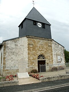
Coole is a commune in the Marne department in north-eastern France.

The Williams River is a perennial stream that is a tributary of the Hunter River, in the Hunter Region of New South Wales, Australia.
The City of Cape Town like most South African metropolitan areas, uses Metropolitan or "M" routes for important intra-city routes, a layer below National (N) roads and Regional (R) roads. Each city's M roads are independently numbered.
Route 100 is a major highway in Newfoundland and Labrador. The highway begins at its northern terminus at the Trans-Canada Highway in the town of Whitbourne, runs for 108 kilometres (67 mi) until it ends at its southern terminus, the town of Branch, where it transitions into Route 92. Motorists can drive along the coast of Placentia Bay and eventually the Atlantic Ocean once traveling south of Point Verde.