
Katoomba is the main town and council seat of the City of Blue Mountains in New South Wales, Australia, and is the administrative centre of Blue Mountains City Council. Katoomba is located on the lands of the Dharug and Gundungurra Aboriginal peoples.
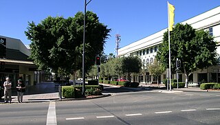
Bathurst is a city in the Central Tablelands of New South Wales, Australia. Bathurst is about 200 kilometres (120 mi) west-northwest of Sydney and is the seat of the Bathurst Regional Council. Founded in 1815, Bathurst is the oldest inland settlement in Australia and had a population of 37,396 in 2021.
Moree is a town in Moree Plains Shire in northern New South Wales, Australia. It is located on the banks of the Mehi River, in the centre of the rich black-soil plains. Newell and Gwydir highways intersect at the town. It can also be reached from Sydney by daily train and air services.

Mudgee is a town in the Central West of New South Wales, Australia. It is in the broad fertile Cudgegong River valley 261 km (162 mi) north-west of Sydney and is the largest town in the Mid-Western Regional Council local government area as well as being the council seat. At the 2021 Census, its population was 11,457. The district lies across the edge of the geological structure known as the Sydney Basin.

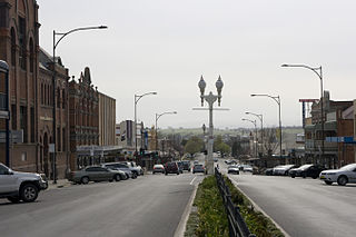
Lithgow is a town in the Central Tablelands of New South Wales, Australia and is the administrative centre of the City of Lithgow local government area. It is located in a mountain valley named Lithgow's Valley by John Oxley in honour of William Lithgow.
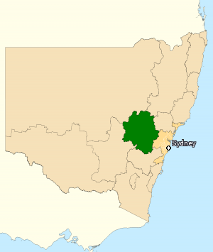
The Division of Calare is an Australian electoral division in the state of New South Wales.

The Central West is a region in central New South Wales, Australia. The region is situated west of Sydney, which stretches from Lithgow in the east and to as far west as Lake Cargelligo, on the Lachlan River. The Central West is known for its attractions such as the Jenolan Caves, near Oberon and also wineries, as well as rural farmland and natural landscapes. The region includes major towns like, Bathurst, Orange, Mudgee, Lithgow, Parkes and Cowra. It has an area of 63,262 square kilometres (24,426 sq mi). The region also includes the sub-region known as the Central Tablelands, located in the eastern part of the region. The region known as the Orana, which includes the area surrounding Dubbo is typically classed as being a part of the Central West also.
Kandos is a small town in the Central Tablelands of New South Wales, Australia, within the Mid-Western Regional Council. The area is the traditional home of the Dabee tribe of the Wiradjuri people. The town sits beneath Cumber Melon Mountain, in a district formerly known as Coomber. Kandos shares its locality, employment and infrastructure with the neighbouring town Rylstone, 6 kilometres away. At the 2021 census, Kandos had a population of 1263.

Lake Cargelligo is a town in the Central West region of New South Wales, Australia, on Lake Cargelligo. It is in Lachlan Shire. Its name is said to be a corruption of the Aboriginal word kartjellakoo meaning 'he had a coolamon'. Alternatively it is derived from Wiradjuri and Ngiyambaa "gajal" for water container with suffix "lugu" for "her" or "his". At the 2021 census, Lake Cargelligo had a population of 1,430. It had an Indigenous population of 257 (18%) and other Australian-born population of 1,153.
Portland is a town in the Central Tablelands of New South Wales, Australia. At the 2016 census, Portland had a population of 2,424 people. The town was named after Australia's first cement works.
Bowenfels is a small town on the western outskirts of Lithgow, New South Wales, Australia.

Sunny Corner is a small village in the central west of New South Wales, Australia and former mining area located between Lithgow and Bathurst just north of the Great Western Highway. At the 2016 census, Sunny Corner had a population of 92 people.
Evans Shire was a local government area which encircled the City of Bathurst in New South Wales, Australia. It was established on 1 October 1977 after the City of Bathurst, Abercrombie Shire and Turon Shire were divided between Bathurst City and Evans Shire. It was dissolved on 26 May 2004.
Yetholme is a village in New South Wales, Australia, originally known as Fryingpan and Frying Pan. The town is near Frying Pan Creek. It is situated 25 kilometres (16 mi) east of Bathurst and 35 kilometres (22 mi) west of Lithgow.
Burraga is located in the Central Tablelands of New South Wales, 47 kilometres south west of Oberon and about 67 kilometres (42 mi) south of Bathurst. It is within Oberon Shire. At the 2016 census, Burraga had a population of 91.

Cathedral of St Michael and St John is a heritage-listed Roman Catholic cathedral at 107 William Street, Bathurst, Bathurst Region, New South Wales, Australia. It was designed by Charles Hansom and built from 1857 to 1861 by Edward Gell. It is also known as Cathedral of Saints Michael and John. The cathedral is the episcopal see of the Roman Catholic Bishop of Bathurst. The property is owned by the Roman Catholic Diocese of Bathurst. It was added to the New South Wales State Heritage Register on 5 June 2012.

St John the Evangelist Church is a heritage-listed Presbyterian church located at Main Street, Wallerawang, City of Lithgow, New South Wales, Australia. It was designed by Edmund Blacket and Blacket and Sons, and built from 1880 to 1881 by George Donald. It is also known as the Church of St. John the Evangelist. It was added to the New South Wales State Heritage Register on 10 September 2004.
Wolla Meranda was an Australian novelist, journalist, editor, and artist.
Caloola is a locality in the Central West region of New South Wales. There once was a small village of the same name but it is a ghost town today. At the 2016 census, the locality had a population of 88.
Lieutenant George Meares Countess Bowen (1803–1889) was a military officer and colonial settler of New South Wales, Australia. He was mainly associated with Bowen Mountain, Mount Tomah, Berambing, and the nearby areas of the Blue Mountains.
