
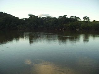
The Tocantins River is a river in Brazil, the central fluvial artery of the country. In the Tupi language, its name means "toucan's beak". It runs from south to north for about 2,450 km. It is not really a branch of the Amazon River, since its waters flow into the Atlantic Ocean alongside those of the Amazon. It flows through four Brazilian states and gives its name to one of Brazil's newest states, formed in 1988 from what was until then the northern portion of Goiás.

Tocantins is one of the 26 states of Brazil. It is the newest state, formed in 1988 and encompassing what had formerly been the northern two-fifths of the state of Goiás. Tocantins covers 277,620.91 square kilometres (107,190.03 sq mi) and had an estimated population of 1,496,880 in 2014. Construction of its capital, Palmas, began in 1989; most of the other cities in the state date to the Portuguese colonial period. With the exception of Araguaína, there are few other cities with a significant population in the state. The government has invested in a new capital, a major hydropower dam, railroads and related infrastructure to develop this primarily agricultural area. The state has 0.75% of the Brazilian population and is responsible for 0.5% of the Brazilian GDP.

Marabá is a municipality in the state of Pará, Brazil. Its greatest geographic reference is the confluence of two large rivers near the historic city center, the Itacaiunas River and the Tocantins River, forming a "Y" if seen from space. It basically consists of six urban centers linked by five highways.

The Araguaia River is one of the major rivers of Brazil though it is almost equal in volume at its confluence with the Tocantins. It has a total length of approximately 2,627 km.
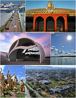
Palmas is the capital and largest city of the state of Tocantins, Brazil. According to IBGE estimates from 2020, the city had 306,296 inhabitants.

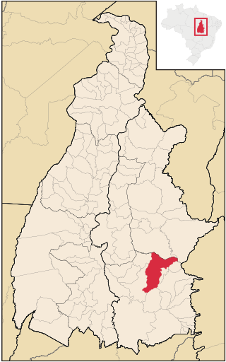
São Domingos is a municipality in northeastern Goiás state, Brazil. It is a large producer of beef cattle but is one of the poorest towns in the state.
The Paranã River is located in Goiás and Tocantins states, Brazil. It divides two regions - the Northeast and north-central Goiás. It is formed by tributaries that descend the Serra Geral, the mountains that divide eastern Goiás and Bahia. One of the most important tributaries is the Crixás, which has its source near Formosa. Farther to the north the Paranã becomes the main tributary of the Tocantins River on the right bank. Today it is crossed by a long concrete bridge between the municipalities of Iaciara and Nova Roma. It forms the valley which makes up a vast region called the Vão do Paranã Microregion.
Almas is a municipality located in the Brazilian state of Tocantins. Its population was 6,979 (2020) and its area is 4,013 km².

The Serra Geral is a mountain range in southern Brazil, constituting the southern portion of the Serra do Mar system which runs along Brazil's southeastern coast. The Serra Geral runs parallel to the Atlantic coast in Santa Catarina and northern Rio Grande do Sul states, separating a narrow coastal plain from an interior plateau. The coastal plain is characterized by short rivers and frequent lagoons and bays, and lies within the humid tropical Serra do Mar coastal forests ecoregion.

Cambará do Sul is a municipality in the state of Rio Grande do Sul, Brazil. Its population was approximately 6,406 in 2020. It has an area of approximately 1212 km².

Serra Geral National Park is a national park in the states of Rio Grande do Sul and Santa Catarina, Brazil.

Jalapão State Park is a state park in the microregion of Jalapão in eastern Tocantins, Brazil. It contains a variety of landscapes including cerrado vegetation, sand dunes and flat-topped plateaus.
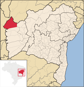
Formosa do Rio Preto is the westernmost and largest city in the Brazilian state of Bahia. It is also the largest in all Northeastern Brazil.

Mateiros is the easternmost city in the state of Tocantins. It is the only city in Tocantins to border the state of Piauí

The Preto River, a tributary of the Rio Grande, is a river of Bahia state in eastern Brazil.
The Sapão River is a river of Bahia state in eastern Brazil.
Rio da Conceição is a municipality in the state of Tocantins in the Northern region of Brazil.

Ponte Alta do Tocantins is a municipality in the state of Tocantins in the Northern region of Brazil.
Serra Geral do Tocantins Ecological Station is an ecological station in the states of Bahia and Tocantins, Brazil. It is one of the largest such units in the country, and protects a sparsely populated area of the cerrado biome. The main threat comes from frequent fires set by the local people in order to create cattle pasturage.
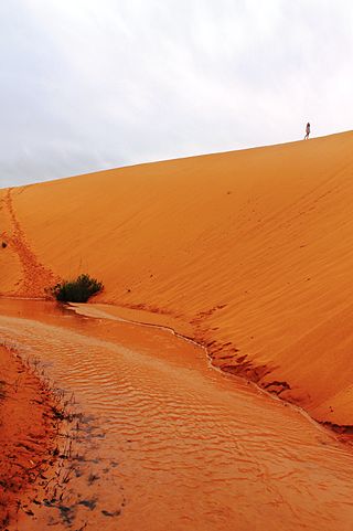
Jalapão is a semi-arid microregion in the state of Tocantins, Brazil. Parts of the microregion have dramatic landscapes with large orange sand dunes, towering rock formations and fast-flowing clear rivers and streams. This is attractive to tourists, and led to Jalapão being chosen for a season of the US version of the Survivor TV series.
