Davda is a panchayat village in the Indian state of Gujarat. It is part of Nadiad (rural) Taluka of Kheda district.[2] It is nine kilometers west of the town of Nadiad.[3] Davda has a branch Post Office with a sub-office in nearby Palana.[4][3]
As of the census of 2011, there were 867 households in the village and its population was 4,005.[1] With a total area of 462.89 hectares (1143.82 acres), it had, in 2011, 407 hectares (1,006 acres) under cultivation, over 90% of which was irrigated land,[5] through Mahi Kadana Irrigation network.[6] There is significant income from fish culture in the village ponds, including Davda Lake.[6]
1 2 Kant, Rajni; Haq, Sarfaraz Ul; Srivastava, Harishchandra; Sharma, V. P. (2013). "Review of the bioenvironmental methods for malaria control with special reference to the use of larvivorous fishes and composite fish culture in central Gujarat, India". Journal of Vector Borne Diseases. 50 (1): 1–12, page 8. PMID23703433.
Related Research Articles
Kheda District is one of the thirty-three districts of Gujarat state in western India. It is part of the region known as Charotar, consisting of Kheda and Anand districts.. Its central city Nadiad is the administrative headquarters of the district.
Mayureswar II is a community development block that forms an administrative division in Rampurhat subdivision of Birbhum district in the Indian state of West Bengal.
Mohammad Bazar is a community development block that forms an administrative division in Suri Sadar subdivision of Birbhum district in the Indian state of West Bengal.
Khayrasol is a community development block that forms an administrative division in Suri Sadar subdivision of Birbhum district in the Indian state of West Bengal.
Mathurapur I is a community development block that forms an administrative division in Diamond Harbour subdivision of South 24 Parganas district in the Indian State of West Bengal.
Jaynagar I is a community development block that forms an administrative division in the Baruipur subdivision of the South 24 Parganas district in the Indian state of West Bengal.
Falta is a community development block that forms an administrative division in the Diamond Harbour subdivision of the South 24 Parganas district in the Indian state of West Bengal.
Suri II is a community development block that forms an administrative division in Suri Sadar subdivision of Birbhum district in the Indian state of West Bengal.
Sainthia is a community development block that forms an administrative division in Suri Sadar subdivision of Birbhum district in the Indian state of West Bengal.
Dubrajpur is a community development block that forms an administrative division in Suri Sadar subdivision of Birbhum district in the Indian state of West Bengal.
Ilambazar is a community development block that forms an administrative division in Bolpur subdivision of Birbhum district in the Indian state of West Bengal.
Labpur is a community development block that forms an administrative division in Bolpur subdivision district of Birbhum district in the Indian state of West Bengal.
Mayureswar I is a community development block that forms an administrative division in Rampurhat subdivision of Birbhum district in the Indian state of West Bengal.
Murarai II is a community development block that forms an administrative division in Rampurhat subdivision of Birbhum district in the Indian state of West Bengal.
Nalhati I is a community development block that forms an administrative division in Rampurhat subdivision of Birbhum district in the Indian state of West Bengal.
Nalhati II is a community development block that forms an administrative division in Rampurhat subdivision of Birbhum district in the Indian state of West Bengal.
Rampur is a village in Kheda district, Gujarat, India. It is located at 22°39'27"N / 72°46'26"E and 3 km far east of Vaso.
Matar is one of the 182 Legislative Assembly constituencies of Gujarat state in India. It is part of Kheda district.
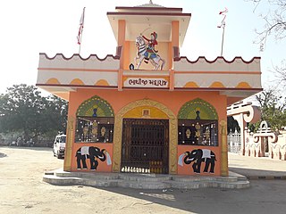
Bhathiji also called Bhathiji Maharaj is a folk deity of Gujarat. He is an eminent warrior-hero of the region.
Ghadiya is a village in the Indian state of Gujarat. It is part of Kapadvanj Taluka of Kheda district. As of the census of 2011, there were 485 households in the village and its population was 2,254.
This page is based on this Wikipedia article Text is available under the CC BY-SA 4.0 license; additional terms may apply. Images, videos and audio are available under their respective licenses.