Day Cottage

Last updated

Day Cottage
Day Cottage (Ellendale), May 2020 03.jpg
Day Cottage in May 2020
Day Cottage
Alternative namesEllendale
General information
TypeCottage
Architectural style Victorian
LocationDay Road, East Rockingham, Western Australia
Coordinates 32°16′24″S115°46′35″E / 32.27333°S 115.77639°E / -32.27333; 115.77639 (Day Cottage)
Official nameDay Cottage
TypeState Registered Place
Designated4 May 2001
Reference no. 4015
Construction started1882

Day Cottage, also referred to as Ellendale, is a State Register of Heritage Places-listed Victorian-style cottage in East Rockingham, Western Australia.

Contents

The cottage is part of the East Rockingham Heritage Precinct.

History

Prior to the construction of Day Cottage, a small cottage stood at the site, with the land owned by prominent landholder Jabez White. White leased 16 hectares (40 acres) of his land to a relative, William Day (1835–1917), in 1858 and Day, his wife Susan (1836–1929), and their oldest two children, Sarah Ann and James, settled on their new property. Susan Hymus, the sister of William Hymus had come to the area with him, her mother, brothers and sisters in 1855 and had married William Day on 21 April 1857. [1] [2]

The Day property was expanded with the construction of a stone shed, and the family did, too, with fifteen children born to the Days between 1857 and 1882. The expanded family made the construction of a larger homestead necessary and Day Cottage was built between 1882 and 1885 by Day, his sons and a stonemason, close to the existing buildings. Day named the place Ellendale. [1] [2] The building was constructed in the Victorian vernacular style, with limestone walls and an iron roof. [1]

For a short time, between 1895 and 1896, the cottage was converted into a hotel, the Rockingham Inn. In 1897, Day joined the Rockingham Roads Board, a forerunner of what is now the City of Rockingham. [1] [2]

William and Susan Day left the property in 1901 to move to Fremantle, transferring it to their youngest three sons. Occupation of the property by the Days ceased in 1919 when it reverted to members of the White family, and ownership and occupation changed frequently until 1962. [1] [2]

Len and Mavis Pike purchased the land where the cottage stood in 1962, as well as additional land holding nearby, and built stables and a new dwelling north of the existing buildings. The Pikes also constructed a thoroughbred training track and horse stables at the location. [1]

Day Cottage, however, remained unoccupied and has deteriorated over the years. [1] [2] It was feared by the director of the Rockingham Museum that a proposed 2016 railway expansion in close proximity to the cottage could have a damaging effect on the building. [3]

Heritage listing

The cottage is part of the East Rockingham Heritage Precinct, which also includes other State Register of Heritage Places, such as Chesterfield Inn, Hymus House, Bell Cottage ruin and the Mead Homestead, as well as heritage listed places on the municipal inventory such as the East Rockingham Cemetery. [4] Day Cottage was added to the State Register of Heritage Places on 4 May 2001. [1]

The cottage's listing is based on the fact that it is a rare, intact and authentic example of a dwelling from the Western Australian colonial era. It stands on one of the earliest land grants in the Rockingham region. [2]

Related Research Articles

<span class="mw-page-title-main">East Rockingham, Western Australia</span> Suburb of Perth, Western Australia

East Rockingham is an industrial suburb within the Kwinana Industrial Area, part of Perth, and located within the City of Rockingham.

<span class="mw-page-title-main">Golden Bay, Western Australia</span> Suburb of Perth, Western Australia

Golden Bay is an outer southern suburb of Perth, the capital city of Western Australia, located within the City of Rockingham. The suburb is located between Secret Harbour and Singleton, and just off the Mandurah Road. Originally known as Peelhurst, the locality name was officially changed in 1985. Golden Bay shore is a segment of the Swan Coastal Plain, which runs along the coast of the Indian Ocean.

<span class="mw-page-title-main">Jarrahdale, Western Australia</span> Suburb of Perth, Western Australia

Jarrahdale is a small historic town located 45 km south-east of Perth, Western Australia in the Darling Range. The name is derived from its situation in a jarrah forest. Established in the late 1800s as the state's first major timber milling operation, it played a key role in the development of Western Australia through the exportation of jarrah around the world. At the 2016 census, Jarrahdale had a population of 1,192. Since 2001, the historic precinct has been managed by the state's National Trust organisation alongside private residential and tourism-oriented developments.

<span class="mw-page-title-main">City of Rockingham</span> Local government area in Western Australia

The City of Rockingham is a council and local government area, comprising the south coastal suburbs of the Western Australian capital city of Perth.

<span class="mw-page-title-main">Shire of Murchison</span> Local government area in the Mid West region of Western Australia

The Shire of Murchison is a 49,500 km² local government area (LGA), within the Murchison sub-region, in the Mid West region of Western Australia. Encompassing most of the Murchison and East Murchison goldfields, the shire is named after the Murchison River. It is Australia's least-populated LGA and the only one without an official town. Five sparsely-populated rural localities, with a collective population of 101, comprise the entire shire. The shire offices, located 300 kilometres (186 mi) northeast of Geraldton, are the focal point of Murchison Settlement, a small part of the Murchison locality.

<span class="mw-page-title-main">Shire of Boyup Brook</span> Local government area in Western Australia

The Shire of Boyup Brook is a local government area located in the South West region of Western Australia, about 270 kilometres (168 mi) southeast of Perth, the state capital. The Shire covers an area of 2,829 square kilometres (1,092 sq mi) and its seat of government is the town of Boyup Brook.

<span class="mw-page-title-main">Shire of Carnamah</span> Local government area in Western Australia

The Shire of Carnamah is a local government area located in the Mid West region of Western Australia, about 310 kilometres (193 mi) north of Perth, the state capital, and about 181 kilometres (112 mi) south of the city of Geraldton. The Shire covers an area of 2,876 square kilometres (1,110 sq mi) and its seat of government is the town of Carnamah.
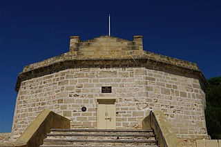
<span class="mw-page-title-main">State Register of Heritage Places</span> Register of historic sites in Western Australia

The State Register of Heritage Places is the heritage register of historic sites in Western Australia deemed significant at the state level by the Heritage Council of Western Australia.
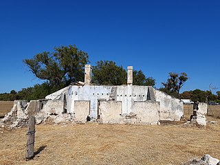
<span class="mw-page-title-main">Bell Cottage ruin</span> Ruined cottage in East Rockingham, Western Australia

The Bell Cottage ruin is a State Register of Heritage Places-listed ruined Victorian Georgian style cottage in East Rockingham, Western Australia. The ruin is on one of the earliest land grants in the Rockingham area and is one of the oldest structures in the area. It is associated with the Bell family, especially James and Jane Bell, early pioneers in the region. Jane Bell gained public attention in 1840 after the death of her child, conceived after being raped; she was incarcerated for two years on Rottnest Island. In 1876 James Bell was an eyewitness to the Fenian escape from Fremantle Gaol and raised the alarm.

<span class="mw-page-title-main">Chesterfield Inn (Western Australia)</span> Former inn in East Rockingham, Western Australia

The Chesterfield Inn and its stables are State Register of Heritage Places-listed buildings in East Rockingham, Western Australia. The Inn was built in 1855 in the vernacular Queen Anne Revival style and is the oldest commercial building in its area.
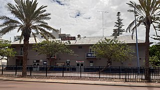
<span class="mw-page-title-main">Rockingham Hotel (Western Australia)</span> Hotel and pub in Rockingham, Western Australia

The Rockingham Hotel is a historic hotel and pub in Rockingham, Western Australia, its origins dating back to 1886, when Rockingham was an important export location for Western Australian timber.
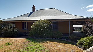
<span class="mw-page-title-main">Hymus House</span> House in East Rockingham, Western Australia

Hymus House is a State Register of Heritage Places-listed Victorian bungalow style house in East Rockingham, Western Australia.

<span class="mw-page-title-main">Kulikup, Western Australia</span> Locality in the Shire of Boyup Brook, Western Australia

Kulikup is a rural locality and small town of the Shire of Boyup Brook in the South West region of Western Australia.

Hester Brook is a rural locality of the Shire of Bridgetown–Greenbushes in the South West region of Western Australia. Hester Brook is located on the South Western Highway, which passes through its north-eastern part. The Blackwood River forms the south-western border of the locality.

Picton is a suburb of the City of Bunbury in the South West region of Western Australia. Both the South Western Highway and the South Western Railway dissect the suburb from east to west.

Stratham is a semi-rural locality of the Shire of Capel in the South West region of Western Australia, located on Geographe Bay and on Bussell Highway. In the south-west, a section of the Tuart Forest National Park is located within Stratham.

References

  1. 1 2 3 4 5 6 7 8 "Day Cottage (Place Number 04015)". inherit.stateheritage.wa.gov.au. State Register of Heritage Places . Retrieved 14 May 2020.
  2. 1 2 3 4 5 6 "Day Cottage Assessment Documentation". inherit.stateheritage.wa.gov.au. State Register of Heritage Places . Retrieved 14 May 2020.
  3. Morton, Arran (14 January 2016). "Freight fears for Rockingham heritage cottage". Sound Telegraph. Retrieved 14 May 2020.
  4. "East Rockingham Heritage Precinct". inherit.stateheritage.wa.gov.au. State Register of Heritage Places . Retrieved 14 May 2020.