
East Rockingham is an industrial suburb within the Kwinana Industrial Area, part of Perth, and located within the City of Rockingham.

Jarrahdale is a small historic town located 45 km south-east of Perth, Western Australia in the Darling Range. The name is derived from its situation in a jarrah forest. Established in the late 1800s as the state's first major timber milling operation, it played a key role in the development of Western Australia through the exportation of jarrah around the world. At the 2016 census, Jarrahdale had a population of 1,192. Since 2001, the historic precinct has been managed by the state's National Trust organisation alongside private residential and tourism-oriented developments.

The City of Rockingham is a council and local government area, comprising the south coastal suburbs of the Western Australian capital city of Perth.

The Shire of Murchison is a 49,500 km² local government area (LGA), within the Murchison sub-region, in the Mid West region of Western Australia. Encompassing most of the Murchison and East Murchison goldfields, the shire is named after the Murchison River. It is Australia's least-populated LGA and the only one without an official town. Five sparsely-populated rural localities, with a collective population of 101, comprise the entire shire. The shire offices, located 300 kilometres (186 mi) northeast of Geraldton, are the focal point of Murchison Settlement, a small part of the Murchison locality.

The Shire of Boyup Brook is a local government area located in the South West region of Western Australia, about 270 kilometres (168 mi) southeast of Perth, the state capital. The Shire covers an area of 2,829 square kilometres (1,092 sq mi) and its seat of government is the town of Boyup Brook.

The Shire of Carnamah is a local government area located in the Mid West region of Western Australia, about 310 kilometres (193 mi) north of Perth, the state capital, and about 181 kilometres (112 mi) south of the city of Geraldton. The Shire covers an area of 2,876 square kilometres (1,110 sq mi) and its seat of government is the town of Carnamah.

The Shire of Laverton is a local government area in the Goldfields-Esperance region of Western Australia, about 370 kilometres (230 mi) northeast of the city of Kalgoorlie and about 950 kilometres (590 mi) east-northeast of the state capital, Perth. The Shire covers an area of 179,798 square kilometres (69,420 sq mi), and its seat of government is the town of Laverton.
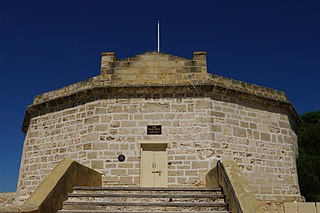
The State Register of Heritage Places is the heritage register of historic sites in Western Australia deemed significant at the state level by the Heritage Council of Western Australia.
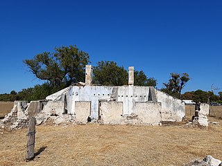
The Bell Cottage ruin is a State Register of Heritage Places-listed ruined Victorian Georgian style cottage in East Rockingham, Western Australia. The ruin is on one of the earliest land grants in the Rockingham area and is one of the oldest structures in the area. It is associated with the Bell family, especially James and Jane Bell, early pioneers in the region. Jane Bell gained public attention in 1840 after the death of her child, conceived after being raped; she was incarcerated for two years on Rottnest Island. In 1876 James Bell was an eyewitness to the Fenian escape from Fremantle Gaol and raised the alarm.

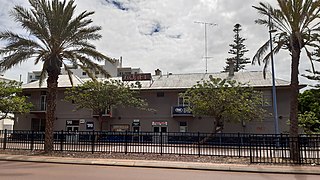
The Chesterfield Inn and its stables are State Register of Heritage Places-listed buildings in East Rockingham, Western Australia. The Inn was built in 1855 in the vernacular Queen Anne Revival style and is the oldest commercial building in its area.
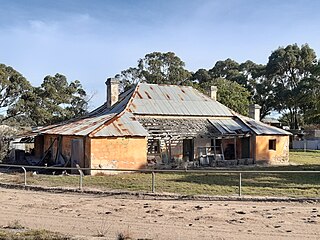
Day Cottage, also referred to as Ellendale, is a State Register of Heritage Places-listed Victorian-style cottage in East Rockingham, Western Australia.
The Rockingham Hotel is a historic hotel and pub in Rockingham, Western Australia, its origins dating back to 1886, when Rockingham was an important export location for Western Australian timber.
Picton is a suburb of the City of Bunbury in the South West region of Western Australia. Both the South Western Highway and the South Western Railway dissect the suburb from east to west.

