Mandurah Road

Last updated

Mandurah Road

Mandurah Road from footbridge, August 2021 01.jpg
Mandurah Road from footbridge near Mandurah railway station
Mandurah Road
General information
TypeHighway
Length41 km (25 mi)
Route number(s)
Major junctions
North endAustralian national route 1.svg Rockingham Road (National Route 1), Kwinana Beach
 
South endAustralian national route 1.svg Old Coast Road (National Route 1), Halls Head
Location(s)
Major settlements Baldivis, Karnup, Meadow Springs, Mandurah
Highway system

Mandurah Road is the name given to two roads in the cities of Perth and Mandurah, Western Australia, which link together at Stakehill Road, Karnup.

Contents

Route description

The northern part starts in the Kwinana Beach industrial area. After 2 km and reaching the City of Rockingham boundary, it becomes a semi-rural single carriageway road which runs past wetlands east of Rockingham such as Lake Cooloongup and Lake Walyungup. It also provides access to the residential and rural-residential sections of the suburb of Baldivis.

The southern part starts at Stakehill Road and is a dual carriageway and part of National Highway 1. It is actually a continuation of Ennis Avenue coming from Rockingham. It continues to Mandurah, where it intersects with Mandjoogoordap Drive at a roundabout before crossing Pinjarra Road and heading west to meet Old Coast Road which was traditionally the main road to Bunbury and South West of Western Australia, until the opening of Forrest Highway superseded it. However Old Coast Road still serves as an alternative route there.

History

Until 2005, the road changed name at the City of Mandurah boundary line (between Singleton and Madora Bay) to "Fremantle Road", but this was changed by a decision of the City of Mandurah in September 2005. [1] [2] This change has been recognised by the Government in the 2007 Streetsmart street directory.

Major intersections

All intersections below are controlled by traffic signals unless otherwise indicated.

LGALocationkmmiDestinationsNotes
Kwinana Kwinana Beach 00.0Australian national route 1.svg Rockingham Road northeast bound / Patterson Road southwest bound (National Route 1)  Naval Base, Perth, Rockingham, Kwinana Beach Northern terminus, continues as Mason Road northbound. Staggered T-intersections favouring Patterson and Rockingham Roads. No right turn possible between Patterson Road northbound and Mandurah Road southbound
KwinanaRockingham boundary Kwinana Beach East Rockingham boundary1.9–
2.0
1.2–
1.2
Wellard Road eastbound / Office Road westbound  Kwinana Beach, Leda, Calista, Wellard .Unsignalised staggered T-intersections favouring Mandurah Road
East Rockingham Leda Cooloongup Hillman quadripoint5.23.2 Gilmore Avenue eastbound / Australian state route 22.svg Dixon Road (State Route 22) westbound  Kwinana Town Centre, Wellard, Rockingham .State Route 22 northern concurrency terminus. Connects to Rockingham Trade Centre and Murdoch University Rockingham Campus
Leda Baldivis Cooloongup tripoint6.44.0Australian state route 22.svg Kulija Road (State Route 22)  Oldbury, Mundijong, Jarrahdale State Route 22 southern concurrency terminus. Connects to the Kwinana Freeway intersection with Mundijong Road. Northbound traffic turns left, southbound traffic turns right at unsignalised T-junction.
Rockingham Baldivis Warnbro Waikiki tripoint11.27.0Australian state route 18.svg Safety Bay Road (State Route 18)  Baldivis, Warnbro, Safety Bay Roundabout, Access to Warnbro railway station
Baldivis Karnup boundary17.711.0Stakehill Road  Karnup, Hopeland, Serpentine Unsignalised T-junction. Northbound traffic turn left, southbound traffic turn right. Connection to Kwinana Freeway via Karnup Road
Port Kennedy Baldivis Karnup tripoint 18.211.3Australian national route 1.svg Ennis Avenue (National Route 1) northbound / Stakehill Road West westbound  Port Kennedy, Rockingham, Kwinana Beach, Fremantle National Route 1 northern concurrency terminus. Northbound traffic turn right, southbound traffic turn left
Karnup Secret Harbour boundary20.913.0Anstey Road  Secret Harbour Unsignalised T-junction.
Karnup Golden Bay boundary23.114.4Dampier Drive  Golden Bay, Secret Harbour, Rockingham Connects to Warnbro Sound Avenue
23.914.9Paganoni Road  Karnup Connects to Kwinana Freeway
Karnup Singleton boundary25.716.0Redwood Avenue eastbound / Singleton Beach Road westbound  Singleton, Karnup
Mandurah Lakelands Madora Bay boundary28.217.5Banksiadale Gate eastbound / Madora Beach Road westbound  Madora Bay, Lakelands
28.617.8Lake Valley Drive  Madora Bay, Meadow Springs Access to Lakelands railway station. Connects to Mandjoogoordap Drive via Lilydale Drive
Meadow Springs Madora Bay boundary29.718.5Broadstone Vista eastbound / Lord Hobart Drive westbound  Madora Bay, Meadow Springs
Meadow Springs San Remo boundary31.319.4Meadow Springs Drive  Madora Bay, Meadow Springs
Meadow Springs Mandurah Silver Sands tripoint32.920.4 Mandurah Terrace – Mandurah Foreshore
Meadow Springs Greenfields Mandurah tripoint33.420.8Gordon Road  Greenfields, Parklands, Nambeelup, North Dandalup Connects to Kwinana Freeway and South Western Highway via Lakes Road
Greenfields Mandurah boundary34.621.5Australian state route 19.svg Mandjoogoordap Drive (State Route 19) northbound / Kirkpatrick Drive eastbound  Greenfields, Stake Hill, Perth Roundabout. Northbound traffic turn left via slip lane, southbound traffic turn right. Access to Peel Education Campus
35.722.2Western Australia MR-SM-1.svg Murdoch Drive eastbound / Allnutt Street westbound  Greenfields, Mandurah Access to Mandurah railway station and Peel Health Campus
Greenfields Coodanup Mandurah tripoint36.722.8 Pinjarra Road   Mandurah, Barragup, Ravenswood, Pinjarra Access to Mandurah Forum
Dudley Park 38.624.0Leslie Street northbound / Mariners Cove Drive southbound  Mandurah, Coodanup
Peel Inlet 39.8–
40.2
24.7–
25.0
Mandurah Estuary Bridge
Mandurah Halls Head Erskine boundary41.025.5 Old Coast Road   Mandurah, Falcon, Dawesville, Bunbury Southern terminus. Continues as Australian national route 1.svg Old Coast Road (National Route 1) southbound
1.000 mi = 1.609 km; 1.000 km = 0.621 mi

See also

Australia road sign W5-29.svg   Australian Roadsportal

Related Research Articles

<span class="mw-page-title-main">Mandurah</span> Coastal city in Western Australia

Mandurah is a coastal city in the Australian state of Western Australia, situated approximately 72 kilometres (45 mi) south of the state capital, Perth. It is the state's second most populous city, with a population of 90,306.

<span class="mw-page-title-main">Great Eastern Highway</span> Highway in Western Australia

Great Eastern Highway is a 590-kilometre-long (370 mi) road that links the Western Australian capital of Perth with the city of Kalgoorlie. A key route for road vehicles accessing the eastern Wheatbelt and the Goldfields, it is the western portion of the main road link between Perth and the eastern states of Australia. The highway forms the majority of National Highway 94, although the alignment through the Perth suburbs of Guildford and Midland, and the eastern section between Coolgardie and Kalgoorlie are not included. Various segments form parts of other road routes, including National Route 1, Alternative National Route 94, and State Route 51.

The Kwinana Freeway is a 72-kilometre (45 mi) freeway in and beyond the southern suburbs of Perth, Western Australia, linking central Perth with Mandurah to the south. It is the central section of State Route 2, which continues north as Mitchell Freeway to Clarkson, and south as Forrest Highway towards Bunbury. A 4-kilometre (2.5 mi) section between Canning and Leach highways is also part of National Route 1. Along its route are interchanges with several major roads, including Roe Highway and Mandjoogoordap Drive. The northern terminus of the Kwinana Freeway is at the Narrows Bridge, which crosses the Swan River, and the southern terminus is at Pinjarra Road, east of Mandurah.

<span class="mw-page-title-main">Mandurah line</span> Commuter rail line in Perth, Western Australia

The Mandurah line is a commuter railway and service on the Transperth network in Western Australia that runs from Perth south to the state's second largest city Mandurah. The service is operated by Transperth Train Operations, a division of the Public Transport Authority. The line is 70.1 kilometres (43.6 mi) long and has 12 stations. At its northern end, the line begins as a continuation of the Joondalup line at Perth Underground, and ends as a continuation of the Joondalup line at Elizabeth Quay. The first 1.3 kilometres (0.81 mi) of the line is underground, passing under the Perth central business district. The line surfaces and enters the median of the Kwinana Freeway just north of the Swan River. It continues south down the freeway's median for 30 kilometres (19 mi), before veering south-west towards Rockingham. The final stretch of the line goes south from Rockingham to Mandurah.

<span class="mw-page-title-main">Wanneroo Road</span> Road in Perth, Western Australia

Wanneroo Road is a 44-kilometre (27 mi) arterial highway in the northern suburbs of Perth, Western Australia linking Joondanna and Yokine in the south with Wanneroo and Yanchep in the north. As part of State Route 60, it begins from Charles Street in the inner city and becomes Indian Ocean Drive up to Dongara.

<span class="mw-page-title-main">Cooloongup, Western Australia</span> Suburb of Perth, Western Australia

Cooloongup is an outer southern suburb of Perth, Western Australia, the capital city of Western Australia, located within the City of Rockingham. It consists mainly of residential dwellings.

<span class="mw-page-title-main">Secret Harbour, Western Australia</span> Suburb of Perth, Western Australia

Secret Harbour is an outer southern suburb of Perth, the capital city of Western Australia, located within the City of Rockingham on the Indian Ocean coast at Comet Bay. Despite its name, Secret Harbour does not have a harbour. The name results from a failed marina development and was approved in 1984.

<span class="mw-page-title-main">Marmion Avenue</span> Road in Perth, Western Australia

Marmion Avenue is a 40-kilometre (25 mi) arterial road in the northern coastal suburbs of Perth, Western Australia, linking Trigg in the south with Yanchep in the north. It forms part of State Route 71 along with West Coast Highway, which it joins onto at its southern terminus.

<span class="mw-page-title-main">Bouvard, Western Australia</span> Suburb of Mandurah, Western Australia

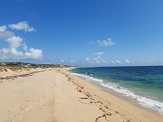
Bouvard is the second southernmost suburb of Mandurah, Western Australia, and is 97 kilometres (60 mi) south of the state capital, Perth. Its local government area is the City of Mandurah.

Stake Hill is a northeastern rural residential suburb of Mandurah, Western Australia. Its local government area is the Shire of Murray. On 10 August 2021 Stake Hill had a population of 469.

<span class="mw-page-title-main">Lake Clifton, Western Australia</span> Town in Western Australia

Lake Clifton is a small town located on the east side of the lake of the same name in the Peel region of Western Australia just off the Old Coast Road, between Mandurah and Bunbury at the north end of the Yalgorup National Park. At the 2016 census, Lake Clifton had a population of 683.

<span class="mw-page-title-main">Preston Beach, Western Australia</span> Town in Western Australia

Preston Beach is a small town located in the Peel region of Western Australia just off the Forrest Highway, between Mandurah and Bunbury in the Yalgorup National Park.

<span class="mw-page-title-main">Herron, Western Australia</span> Town in Western Australia

Herron is a small suburb located in the Peel region of Western Australia just off the Old Coast Road, between Mandurah and Bunbury just beyond Mandurah's urban area. It is on a narrow strip between Lake Clifton and Yalgorup National Park to the west, and Harvey Estuary to the east.

<span class="mw-page-title-main">City of Rockingham</span> Local government area in Western Australia

The City of Rockingham is a council and local government area, comprising the south coastal suburbs of the Western Australian capital city of Perth.

<span class="mw-page-title-main">Safety Bay Road</span> Road in Perth, Western Australia

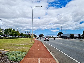
Safety Bay Road is an east-west metropolitan road located in the City of Rockingham, about 50 kilometres (31 mi) south of Perth, Western Australia. The road starts in Rockingham's coastal suburbs and heads south from Peron past Lake Richmond. The road then turns left at the coast with a roundabout with Arcadia Drive which is a coastal road in Shoalwater. Safety Bay Road takes a left turn and extends past Ennis Avenue and Warnbro railway station to the newer suburban estates at Baldivis, before ending just past the Kwinana Freeway. As such, it forms a key link between Rockingham, Perth and Mandurah. Until 2009, the end of the road marked the start of the Kwinana Freeway.

<span class="mw-page-title-main">Forrest Highway</span> Highway in Western Australia

Forrest Highway is a 95-kilometre-long (59 mi) highway in Western Australia's Peel and South West regions, extending Perth's Kwinana Freeway from east of Mandurah down to Bunbury. Old Coast Road was the original Mandurah–Bunbury route, dating back to the 1840s. Part of that road, and the Australind Bypass around Australind and Eaton, were subsumed by Forrest Highway. The highway begins at Kwinana Freeway's southern terminus in Ravenswood, continues around the Peel Inlet to Lake Clifton, and heads south to finish at Bunbury's Eelup Roundabout. There are a number of at-grade intersections with minor roads in the shires of Murray, Waroona, and Harvey including Greenlands Road and Old Bunbury Road, both of which connect to South Western Highway near Pinjarra.

Pinjarra Road is a major west-east road connecting the two major centres of the Peel Region, Mandurah and Pinjarra. Mostly a dual carriageway, it also forms the termini of both the Kwinana Freeway and Forrest Highway.

<span class="mw-page-title-main">Rockingham, Western Australia</span> City in Western Australia

Rockingham is a suburb of Perth, Western Australia, located 47 km south-south-west of the city centre. It acts as the primary centre for the City of Rockingham. It has a beachside location at Mangles Bay, the southern extremity of Cockburn Sound. To its north stretches the maritime and resource-industry installations of Kwinana and Henderson. Offshore to the north-west is Australia's largest naval fleet and submarine base, Garden Island, connected to the mainland by an all-weather causeway. To the west and south lies the Shoalwater Islands Marine Park.

<span class="mw-page-title-main">Beeliar Drive</span> Road in Perth, Western Australia

Beeliar Drive is a major arterial road in the southwestern part of the Perth Metropolitan Area. It provides an important and unbroken east-west link between Kwinana Freeway and Stock Road providing access to residential developments in Beeliar, Yangebup and Lake Coogee in the west to commercial and industrial development in Cockburn Central, Jandakot and Success in the east. It is one of Perth's more recent arterial road constructions with development of the road occurring between the early 1990s and early 2020s.

References

  1. City of Mandurah (7 September 2005). "Name Change Proposed for Entry Roads". Media release. Archived from the original on 23 August 2006. Retrieved 15 January 2007.
  2. City of Mandurah (20 September 2005). "Minutes of Council Meeting (Item G.20)". p. 8. Archived from the original on 27 August 2006. Retrieved 15 January 2007.