Kalamunda is a town and eastern suburb of Perth, Western Australia, located in the Darling Scarp at the eastern limits of the Perth metropolitan area.

The Shire of Serpentine–Jarrahdale is a local government area in the outer southeastern metropolitan area of Perth, the capital of Western Australia, and has an area of 905 square kilometres (349 sq mi) and a population of almost 27,000 as at the 2016 Census. The Shire's seat of government is the town of Mundijong.

The City of Wanneroo is a local government area with city status in the northern suburbs of Perth, Western Australia. It is centred approximately 25 kilometres (15.5 mi) north of Perth's central business district and forms part of the northern boundary of the Perth metropolitan area. Wangara encompasses the federal divisions of Cowan, Moore and Pearce.

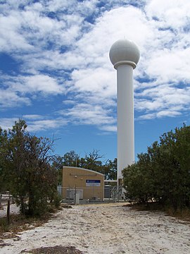
Forrestfield is a suburb of the City of Kalamunda in Western Australia. It lies 15 kilometres to the south-east of Perth at the base of the Darling Scarp and the southern border of Perth Airport.

Inala is a suburb in the City of Brisbane, Queensland, Australia.

Marsden Park is a suburb north west of Sydney, in the state of New South Wales, Australia. Marsden Park is located 49 kilometres (30 mi) north-west of the Sydney central business district, in the Blacktown local government area and is part of the Greater Western Sydney region.

Bertram is a suburb of Perth, Western Australia, located within the City of Kwinana. Bertram derives its name from the family name of a Group Settler of the 1920s who owned land in the area. It was established as a locality name on 17 December 1998.
Kent Town is an inner urban suburb of Adelaide, South Australia. It is located in the City of Norwood Payneham & St Peters.
Westlake is a south-western suburb in the City of Brisbane, Queensland, Australia. In the 2016 census, Westlake had a population of 4,368 people.

Kukerin is a small town in the Wheatbelt region of Western Australia, 308 kilometres (191 mi) south-east of Perth between Dumbleyung and Lake Grace just off Dumbleyung Lake Grace Road on State Route 107. The town itself is small but services a considerable agricultural region in the eastern Shire of Dumbleyung. At the 2016 census, Kukerin and its surrounding areas had a population of 166.

Doolandella is an outer western suburb in the City of Brisbane, Queensland, Australia. In the 2016 census, Doolandella had a population of 4,817 people.

Acton Park is a small town and agricultural district located in the South West of Western Australia inland from Busselton along Jalbarragup Road. It was established as part of the Group Settlement Scheme in the 1920s and the local hall was constructed in 1924. The area was gazetted as a bounded locality in 1987. At the 2016 Australian census the area had a population of 102.

Rochedale is an outer southern suburb of the City of Brisbane, Queensland, Australia. It is 17 kilometres (11 mi) south-east of the Brisbane central business district. At the 2016 Australian Census the suburb recorded a population of 3,175. The suburb's western boundary is partially aligned with the Gateway Motorway and Bulimba Creek.

Cardross is a small town approximately 15 km south east of Mildura, in north western Victoria, Australia. At the 2016 census, Cardross and the surrounding area had a population of 821. It was the site of a road fatality in February 2006, in which six teenagers were killed in a hit-run crash.
Kudardup is a locality in the South West region of Western Australia. The locality is in the Shire of Augusta-Margaret River and on the Bussell Highway, 312 kilometres (194 mi) south of the state capital, Perth.

Hopeland is a rural locality in the Western Downs Region, Queensland, Australia. In the 2016 census, Hopeland had a population of 140 people.
Warrenheip is a suburb of Ballarat, Victoria, Australia on the eastern rural-urban fringe named after nearby Mount Warrenheip. At the 2016 census, Warrenheip had a population of 669.

Munno Para is a northern suburb of Adelaide, South Australia. It is located in the City of Playford.

Crossroads is a rural locality in the Western Downs Region, Queensland, Australia. In the 2016 census, Crossroads had a population of 130 people.