
Mandurah is a coastal city in the Australian state of Western Australia, situated approximately 72 kilometres (45 mi) south of the state capital, Perth. It is the state's second most populous city, with a population of 90,306.

The N11 road is a national primary road in Ireland, running for 129 km (80 mi) along the east side of Ireland from Dublin to Wexford. It passes close to Bray, Greystones, Wicklow, Arklow, Gorey, and Enniscorthy. Beyond Wexford, the route continues to Rosslare as the N25. The road forms part of European route E01. As of July 2019 the N11/M11 is of dual carriageway or motorway standard from Dublin as far as Oilgate in County Wexford.

Marmion Avenue is a 40-kilometre (25 mi) arterial road in the northern coastal suburbs of Perth, Western Australia, linking Trigg in the south with Yanchep in the north. It forms part of State Route 71 along with West Coast Highway, which it joins onto at its southern terminus.

The Mandurah line, also known as the Southern Suburbs Railway, is a suburban railway line and service in Western Australia, linking Perth's central business district (CBD) with Mandurah to the south. Operated by the Public Transport Authority (PTA) as part of the Transperth system, the Mandurah line is 70.8 kilometres (44.0 mi) long and has thirteen stations. It commences in a tunnel under the CBD as a through service with the Yanchep line, where two stations are. South from there, the line enters the median strip of the Kwinana Freeway, where five of the line's stations are. The line diverges from the freeway for the southernmost six stations in the cities of Kwinana, Rockingham and Mandurah.

Leda is a southern suburb of Perth, Western Australia within the City of Kwinana. Leda is one of the five main suburbs of Kwinana.

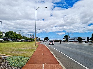
Wellard is a suburb of Perth, Western Australia, located within the City of Kwinana.

Atwell is a suburb within the metropolitan area of Perth, Western Australia, situated 21 kilometres (13 mi) south of Perth City, and located in the City of Cockburn local government area.
The Kwinana Freeway is a 72-kilometre (45 mi) freeway in and beyond the southern suburbs of Perth, Western Australia, linking central Perth with Mandurah to the south. It is the central section of State Route 2, which continues north as Mitchell Freeway to Clarkson, and south as Forrest Highway towards Bunbury. A 4-kilometre (2.5 mi) section between Canning and Leach highways is also part of National Route 1. Along its route are interchanges with several major roads, including Roe Highway and Mandjoogoordap Drive. The northern terminus of the Kwinana Freeway is at the Narrows Bridge, which crosses the Swan River, and the southern terminus is at Pinjarra Road, east of Mandurah.

Reid Highway is a 23-kilometre (14 mi) east-west highway and partial freeway in the northern suburbs of Perth, Western Australia, linking North Beach with Middle Swan. As part of State Route 3, it forms half of Perth's outer ring road along with Roe Highway, which it joins onto at its eastern terminus.

Leach Highway is a 23-kilometre (14 mi) east-west arterial highway in the southern suburbs of Perth, Western Australia, primarily linking Kewdale and Perth Airport with the city of Fremantle.
Marmion Avenue is a 40-kilometre (25 mi) arterial road in the northern coastal suburbs of Perth, Western Australia, linking Trigg in the south with Yanchep in the north. It forms part of State Route 71 along with West Coast Highway, which it joins onto at its southern terminus.

Mandurah Road is the name given to two roads in the cities of Perth and Mandurah, Western Australia, which link together at Stakehill Road, Karnup.
Armadale Road is a major road in the south and south east of the Perth Metropolitan Area. It serves three purposes: firstly, providing a main route from Armadale to Fremantle; secondly, connecting Armadale to the Kwinana Freeway; and thirdly, since 2005, connecting it to the Tonkin Highway which ferries traffic to the eastern suburbs, Perth Airport and the Forrestfield and Kewdale industrial areas.
Ranford Road is a major road in the southeastern suburbs of Perth, Western Australia, and services a number of housing estates in Canning Vale and Southern River, as well as forming part of one of the two major routes between the port city of Fremantle and Armadale. It continues from South Street, a major east–west route in the southern suburbs which now also provides access to the Kwinana Freeway and Murdoch railway station.

Forrest Highway is a 95-kilometre-long (59 mi) highway in Western Australia's Peel and South West regions, extending Perth's Kwinana Freeway from east of Mandurah down to Bunbury. Old Coast Road was the original Mandurah–Bunbury route, dating back to the 1840s. Part of that road, and the Australind Bypass around Australind and Eaton, were subsumed by Forrest Highway. The highway begins at Kwinana Freeway's southern terminus in Ravenswood, continues around the Peel Inlet to Lake Clifton, and heads south to finish at Bunbury's Eelup Roundabout. There are a number of at-grade intersections with minor roads in the shires of Murray, Waroona, and Harvey including Greenlands Road and Old Bunbury Road, both of which connect to South Western Highway near Pinjarra.
Pinjarra Road is a major west–east road connecting the two major centres of the Peel Region, Mandurah and Pinjarra. Mostly a dual carriageway, it also forms the termini of both the Kwinana Freeway and Forrest Highway.
Mandjoogoordap Drive, meaning "meeting place of the heart" in the indigenous Noongar language, is a 6.3-kilometre (3.9 mi) dual carriageway road which links the Western Australian city of Mandurah to the Kwinana Freeway. It was officially opened on 7 October 2010. The road was known as Mandurah Entrance Road during its construction and is usually referred to as the Mandurah Link. Approximately 3.8 kilometres (2.4 mi) of the Mandurah line is located in its median strip.
Beeliar Drive is a major arterial road in the southwestern part of the Perth Metropolitan Area. It provides an important and unbroken east-west link between Kwinana Freeway and Stock Road providing access to residential developments in Beeliar, Yangebup and Lake Coogee in the west to commercial and industrial development in Cockburn Central, Jandakot and Success in the east. It is one of Perth's more recent arterial road constructions with development of the road occurring between the early 1990s and early 2020s.

North Lake Road is a major road in the southwestern suburbs of the Perth metropolitan area functioning as an intermediate arterial collector positioned between the limited-access Stock Road to the west and Kwinana Freeway to the east. North Lake Road's northern terminus is at Canning Highway with its southern end at Armadale Road with the Kwinana Freeway exit as of December 2021. North Lake Road was part of the old State Route 14 until the early 2010s when upgrades and extensions to the more south-westerly Spearwood Avenue and Beeliar Drive resulted in its status being revoked.