Karlamilyi National Park lies in the Pilbara region of Western Australia, 250 kilometres (160 mi) northeast of Newman and 1,250 kilometres (780 mi) north-northeast of Perth. Proclaimed an A Class Reserve on 13 April 1977, it is the largest national park in Western Australia.

Cape Peron is a headland at Rockingham, at the southern end of Cockburn Sound in Western Australia. The cape is locally known as Point Peron, and is noted for its protected beaches, limestone cliffs, reefs and panoramic views. Cape Peron includes the suburb of Peron and "Point Peron" is the designation of a minor promontory on the south side of the cape's extremity.

The Spectacles is a mixed-use suburb located in the City of Kwinana within the Perth Metropolitan Region, the state capital of Western Australia. It comprises almost entirely a wetland reserve, The Spectacles Wetlands, surrounded by degraded native bushland. A small number of residential housing properties lie in the south-eastern corner of the suburb.

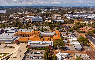
Joondalup is a suburb of Perth, Western Australia, approximately 26 kilometres (16 mi) north of Perth's central business district. It contains the central business district of the regional City of Joondalup and acts as the primary urban centre of Perth's outer northern suburbs.

Hillman is an outer southern suburb of Perth, the capital city of Western Australia, located within the City of Rockingham. It is principally a suburb of residential dwellings, and contains Hillman Primary School.

Beeliar is a suburb of Perth, Western Australia, located within the City of Cockburn. The name refers to the Beeliar people, a group of Aboriginal Australians who had land rights over the southern half of Perth's metropolitan area. The suburb contains the Thomsons Lake Nature Reserve.

Coogee is a southern coastal suburb of Perth, Western Australia, located within the City of Cockburn.

Golden Bay is an outer southern suburb of Perth, the capital city of Western Australia, located within the City of Rockingham. The suburb is located between Secret Harbour and Singleton, and just off the Mandurah Road. Originally known as Peelhurst, the locality name was officially changed in 1985. Golden Bay shore is a segment of the Swan Coastal Plain, which runs along the coast of the Indian Ocean.

Port Kennedy is an outer southern suburb of Perth, the capital city of Western Australia, located within the City of Rockingham.

Stirling is a suburb of Perth, the capital city of Western Australia, about 10 km north of Perth's central business district (CBD) along the Mitchell Freeway. Its local government area is the City of Stirling, whose council offices and administration centre are located in the southwest of the mostly residential suburb.

The City of Rockingham is a local government area in the far southern suburbs of the Western Australian capital city of Perth.

Yellagonga Regional Park is in Perth, Western Australia, in the City of Wanneroo and the City of Joondalup. The park was established in 1989 by the Western Australian government and protects 1,400 hectares of land, including 550 hectares of Wanneroo wetlands – including Lake Joondalup, Beenup Swamp, Walluburnup Swamp and Lake Goollelal.

Beeliar Regional Park is a conservation park approximately 19 kilometres (12 mi) south of the central business district in Perth, Western Australia, located within the Citys of Cockburn, Kwinana and Melville. The regional park is named after the indigenous Beeliar people of the area.

Rockingham Lakes Regional Park is a conservation park approximately 40 kilometres (25 mi) south of Perth, Western Australia, located within the City of Rockingham. The park, established in 1997, covers a non-continuous area of 4,270 hectares and occupies approximately 16 percent of the area of the City of Rockingham.

Banyowla Regional Park, formerly Kelmscott-Martin Regional Park, is a conservation park in the Perth Hills, 20 kilometres south-east of Perth, Western Australia, located within the Cities of Gosnells and Armadale. The regional park was re-named in 2008 after Banyowla, who was a Noongar elder at the time of European settlement.

Lake Walyungup is a shallow saline lake in the suburbs of Warnbro and Port Kennedy, located 55 kilometres (34 mi) south of the central business district of Perth, the capital of Western Australia. It is part of Rockingham Lakes Regional Park. In the local Nyungar language, Walyungup means "place where Noongars talk".

Lake Cooloongup, sometimes also referred to as White Lake, is a shallow saline lake in the suburb of Cooloongup, 50 kilometres (31 mi) south of the central business district of Perth, the capital of Western Australia. It is part of Rockingham Lakes Regional Park. In the local Nyungar language, Cooloongup means "place of children".

Regional parks in Western Australia are conservation areas with the purpose of serving as urban havens to preserve and restore cultural heritage and valuable ecosystems as well as to encourage sustainable nature-based recreation activities.

Yangebup Lake is a freshwater lake in the suburb of Yangebup, 18 kilometres (11 mi) south-west of the central business district of Perth, the capital of Western Australia. It is part of Beeliar Regional Park.

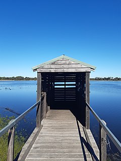
The Spectacles Wetlands is a wetland located in the eponymous suburb, 30 kilometres (19 mi) south of the central business district of Perth, the capital of Western Australia. It is part of Beeliar Regional Park.


