
The City of Kwinana is a local government area of Western Australia. It covers an area of approximately 118 square kilometres in metropolitan Perth, and lies about 38 km south of Perth central business district, via the Kwinana Freeway. Kwinana maintains 287 km of roads and had a population of almost 39,000 as at the 2016 Census.
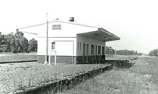
Byford is a suburb on the south-eastern edge of Perth, Western Australia, and has its origins in a township that was gazetted under the name "Beenup" in 1906. "Beenup", a corruption of the Aboriginal name associated with nearby Beenyup Brook, was the spelling that had been applied to a railway siding there. The uncorrupted form, "Bienyup" received mention in surveyor Robert Austin's account of an expedition through the area in 1848. In 1920, the name of the township was changed to Byford.

Warnbro is a southern outer suburb of Perth, the capital of Western Australia, located on Warnbro Sound within the City of Rockingham. It adjoins Port Kennedy which combines residential with retail and light-industrial land use. The suburb, which is named after Warnbro Sound, was gazetted on 5 April 1974.
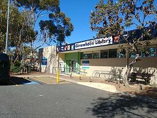
Girrawheen is a northern suburb of Perth, the capital city of Western Australia. Its local government area is the City of Wanneroo.

Quinns Rocks is an outer coastal suburb of Perth, Western Australia, located 38 kilometres (24 mi) north of Perth's central business district. It is part of the City of Wanneroo local government area. The suburb was formerly established in 1962 as a rural townsite, focused around Quinns Beach, the area's main amenity.

Leda is a southern suburb of Perth, Western Australia within the City of Kwinana. Leda is one of the five main suburbs of Kwinana.

Coogee is a southern coastal suburb of Perth, Western Australia, located within the City of Cockburn.
Heathridge is a suburb of Perth, Western Australia, located 33 kilometres (21 mi) south of Yanchep within the City of Joondalup.

Marmion is a northern coastal suburb of Perth, the capital city of Western Australia. Its local government area is the City of Joondalup.

Golden Bay is an outer southern suburb of Perth, the capital city of Western Australia, located within the City of Rockingham. The suburb is located between Secret Harbour and Singleton, and just off the Mandurah Road. Originally known as Peelhurst, the locality name was officially changed in 1985. Golden Bay shore is a segment of the Swan Coastal Plain, which runs along the coast of the Indian Ocean.

Peron is an outer southern suburb of Perth, the capital city of Western Australia, and is located within the City of Rockingham.

Safety Bay is an outer southern suburb of Perth, the capital city of Western Australia, located on the coast within the City of Rockingham.

Secret Harbour is an outer southern suburb of Perth, the capital city of Western Australia, located within the City of Rockingham on the Indian Ocean coast at Comet Bay. Despite its name, Secret Harbour does not have a harbour. The name results from a failed marina development and was approved in 1984.
Beachlands is an inner western suburb of Geraldton, Western Australia in the local government area of the City of Greater Geraldton.
The Becher Point Wetlands site is a wetland nature reserve in Port Kennedy on the Swan Coastal Plain of south-western Western Australia. The 677-hectare (1,670-acre) coastal site lies in the City of Rockingham, about 50 kilometres (31 mi) south of the state capital, Perth, and is largely surrounded on the landward side by residential suburbs. It comprises about 200 very small wetlands among sand ridges between Becher Point the Perth-Mandurah Road.
Lake Newland Conservation Park is a protected area in the Australian state of South Australia located on the west coast of the Eyre Peninsula about 10 kilometres (6.2 mi) north of the town of Elliston. It was proclaimed in 1991 in order to protect Lake Newland, a hypersaline lake, and an associated wetland complex. It lies in the traditional lands of the Wirangu people.

Rockingham is a suburb of Perth, Western Australia, located 47 km south-south-west of the city centre. It acts as the primary centre for the City of Rockingham. It has a beachside location at Mangles Bay, the southern extremity of Cockburn Sound. To its north stretches the maritime and resource-industry installations of Kwinana and Henderson. Offshore to the north-west is Australia's largest naval fleet and submarine base, Garden Island, connected to the mainland by an all-weather causeway. To the west and south lies the Shoalwater Islands Marine Park.
Belt Hill Conservation Park is a protected area located in the Australian state of South Australia in the locality of Thornlea about 317 kilometres (197 mi) south-east of the state capital of Adelaide and about 4 kilometres (2.5 mi) north west of the town centre in Hatherleigh.
Penola Conservation Park is a protected area located in the Australian state of South Australia in the locality of Monbulla about 329 kilometres (204 mi) south-east of the state capital of Adelaide and about 12 kilometres (7.5 mi) west of the town of Penola.

Lake Cooloongup, sometimes also referred to as White Lake, is a shallow saline lake in the suburb of Cooloongup, 50 kilometres (31 mi) south of the central business district of Perth, the capital of Western Australia. It is part of Rockingham Lakes Regional Park. In the local Nyungar language, Cooloongup means "place of children".

