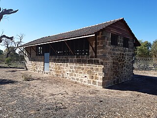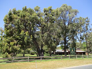
The City of Kwinana is a local government area of Western Australia. It covers an area of approximately 118 square kilometres in metropolitan Perth, and lies about 38 km south of the Perth central business district, via the Kwinana Freeway. Kwinana maintains 287 km of roads and had a population of almost 39,000 as at the 2016 Census.

Hillman is an outer southern suburb of Perth, the capital city of Western Australia, located within the City of Rockingham. It is principally a suburb of residential dwellings, and contains Hillman Primary School.

Baldivis is a semi-rural residential suburb 46 kilometres (29 mi) south of Perth, Western Australia, and 11 kilometres (6.8 mi) southeast of the regional centre of Rockingham. It is located within the City of Rockingham local government area.

Leda is a southern suburb of Perth, Western Australia within the City of Kwinana. Leda is one of the five main suburbs of Kwinana.

Naval Base is a coastal southwestern suburb of Perth, Western Australia, located within the City of Kwinana. It is a traditional industrial suburb in the Perth metropolitan region and contains a significant amount of heavy industry. It is named after Henderson Naval Base, partially constructed in 1913−1920 before being cancelled and eventually replaced by HMAS Stirling in 1978.

Wellard is a suburb of Perth, Western Australia, located within the City of Kwinana.

Henderson is a suburb of Perth, Western Australia, located within the City of Cockburn.

Spearwood is a southern suburb of Perth, Western Australia, located within the City of Cockburn. This suburb derives its name from the Spearwood bush which is a common shrub in the area.

Cooloongup is an outer southern suburb of Perth, Western Australia, the capital city of Western Australia, located within the City of Rockingham. It consists mainly of residential dwellings.

East Rockingham is an industrial suburb within the Kwinana Industrial Area, part of Perth, and located within the City of Rockingham.

Golden Bay is an outer southern suburb of Perth, the capital city of Western Australia, located within the City of Rockingham. The suburb is located between Secret Harbour and Singleton, and just off the Mandurah Road. Originally known as Peelhurst, the locality name was officially changed in 1985. Golden Bay shore is a segment of the Swan Coastal Plain, which runs along the coast of the Indian Ocean.

Karnup is an outer southern suburb of Perth, the capital city of Western Australia, located within the City of Rockingham. It is named after the Karnup townsite, which was declared in 1924 and which, in turn, took its name from an Indigenous name of unknown meaning.

Port Kennedy is an outer southern suburb of Perth, the capital city of Western Australia, located within the City of Rockingham.

Safety Bay is an outer southern suburb of Perth, the capital city of Western Australia, located on the coast within the City of Rockingham.

Secret Harbour is an outer southern suburb of the metropolitan area of Perth, the capital city of Western Australia, located within the City of Rockingham on the Indian Ocean coast at Warnbro Sound. Despite its name, Secret Harbour does not have a harbour. The name results from a failed marina development and was approved in 1984.

Shoalwater is an outer southern suburb of Perth, the capital city of Western Australia, located within the City of Rockingham.

Singleton is an outer suburb of Perth, the capital city of Western Australia, located entirely within the City of Rockingham local government area. It is the southernmost suburb of the Perth metropolitan area and is actually closer to the regional city Mandurah than either the Perth central business district or Rockingham. The area is under development near the school, Singleton Primary, and near the main oval, Laurie Stanford Reserve. There is a petrol service station, a small shopping centre, and a school.

Waikiki is an outer southern suburb of Perth, the capital city of Western Australia. It adjoins and is closely associated with Safety Bay in the City of Rockingham. A prime landmark is the Waikiki Village shopping centre on Read Street, the main road linking Rockingham with Warnbro and Port Kennedy.

The City of Rockingham is a council and local government area, comprising the south coastal suburbs of the Western Australian capital city of Perth.

Rockingham is a suburb of Perth, Western Australia, located 47 km south-south-west of the city centre. It acts as the primary centre for the City of Rockingham. It has a beachside location at Mangles Bay, the southern extremity of Cockburn Sound. To its north stretches the maritime and resource-industry installations of Kwinana and Henderson. Offshore to the north-west is Australia's largest naval fleet and submarine base, Garden Island, connected to the mainland by an all-weather causeway. To the west and south lies the Shoalwater Islands Marine Park.


