
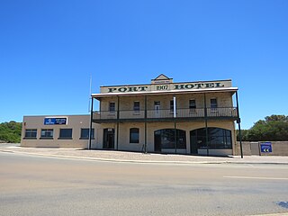
Esperance is a town in the Goldfields–Esperance region of Western Australia, on the Southern Ocean coastline approximately 720 kilometres (450 mi) east-southeast of the state capital, Perth and 391 kilometres (243 mi) south of Kalgoorlie. The urban population of Esperance was 12,003 at June 2018. Its major industries are tourism, agriculture, and fishing.

Albany Highway links Western Australia's capital city Perth with its oldest settlement, Albany, on the state's south coast. The 405-kilometre-long (252 mi) highway travels through the southern Wheatbelt and Great Southern regions, and is designated State Route 30 for most of its length. Outside of Perth the highway is predominately a sealed, single carriageway with regular overtaking lanes in some undulating areas. Albany Highway commences at The Causeway, a river crossing that connects to Perth's central business district. The highway heads south-east through Perth's metropolitan region, bypassed in part by Shepperton Road and Kenwick Link, and continues south-eastwards through to Albany. It intersects several major roads in Perth, including the Leach, Tonkin, Brookton, and South Western highways. The rural section of Albany Highway connects to important regional roads at the few towns and roadhouses along the route, including Coalfields Highway at Arthur River, Great Southern Highway at Cranbrook, and Muirs Highway at Mount Barker.

Great Eastern Highway is a 590-kilometre-long (370 mi) road that links the Western Australian capital of Perth with the city of Kalgoorlie. A key route for road vehicles accessing the eastern Wheatbelt and the Goldfields, it is the western portion of the main road link between Perth and the eastern states of Australia. The highway forms the majority of National Highway 94, although the alignment through the Perth suburbs of Guildford and Midland, and the eastern section between Coolgardie and Kalgoorlie are not included. Various segments form parts of other road routes, including National Route 1, Alternative National Route 94, and State Route 51.

Coolgardie–Esperance Highway is a 370-kilometre (230 mi) Western Australian highway between Coolgardie and Esperance. It runs in a north–south direction linking the state's Eastern Goldfields to the coast.

Ravensthorpe is a town 541 km south-east of Perth and 40 km inland from the south coast of Western Australia. It is the seat of government of the Shire of Ravensthorpe. At the 2021 census, Ravensthorpe had a population of 2,085.

South Western Highway is a highway in the South West region of Western Australia connecting Perth's southeast with Walpole. It is a part of the Highway 1 network for most of its length. It is about 406 kilometres (252 mi) long.
Hopetoun is a town on the south coast of Western Australia in the Shire of Ravensthorpe. Located on Mary Ann Harbour, Hopetoun is 590 kilometres (370 mi) south-east from capital city Perth and 160 kilometres (99 mi) west of Esperance.

Coalfields Road, is a Western Australian highway linking Roelands on the South Western Highway with Arthur River on the Albany Highway. It is signed as State Route 107 and is about 125 kilometres (78 mi) long.

Esperance Plains, also known as Eyre Botanical District, is a biogeographic region in southern Western Australia on the south coast between the Avon Wheatbelt and Hampton bioregions, and bordered to the north by the Mallee region. It is a plain punctuated by granite and quartz outcrops and ranges, with a semi-arid Mediterranean climate and vegetation consisting mostly of mallee-heath and proteaceous scrub. About half of the region has been cleared for intensive agriculture. Recognised as a bioregion under the Interim Biogeographic Regionalisation for Australia (IBRA), it was first defined by John Stanley Beard in 1980.
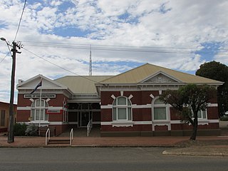
The Shire of Ravensthorpe is a local government area in the southern Goldfields-Esperance region of Western Australia, about halfway between the city of Albany and the town of Esperance and about 530 kilometres (329 mi) southeast of the state capital, Perth. The Shire covers an area of 13,551 square kilometres (5,232 sq mi), and its seat of government is the town of Ravensthorpe.
Transport in Perth, Western Australia, is served by various means, among them an extensive highway/freeway network and a substantial system of commuter rail lines and bus routes. Public transport is managed by the Transperth agency.
The south coast of Western Australia comprises the Western Australian coastline from Cape Leeuwin to Eucla. This is a distance of approximately 1,600 kilometres (1,000 mi), fronting the Great Australian Bight and the Southern Ocean.

Munglinup is a small town located in the Shire of Ravensthorpe in the Goldfields–Esperance region of Western Australia.
The Warren River is a river in the South West region of Western Australia with a catchment encompassing the towns of Manjimup and Pemberton. The river was named by Governor James Stirling, probably after Admiral Sir John Borlase Warren under whom Stirling served whilst in action in North America in 1813.
The Phillips River is an ephemeral river in the Goldfields-Esperance region of Western Australia.

In Western Australia, Highway 1 is a 5,305-kilometre (3,296 mi) long route around the state, from the South Australian border near Eucla to the Northern Territory border near Kununurra. Highway 1 continues around the rest of Australia, joining all mainland state capitals, and connecting major centres in Tasmania. All roads within the Highway 1 system are allocated a road route numbered 1, M1, A1, or B1, depending on the state route numbering system. In Western Australia, most of the highway is designated as National Route 1; however, the sections in the north-east and south-east of the state that are concurrent with the National Highway routes linking Perth to Adelaide and Darwin are designated as National Highway 1.
Tourist Drives in Western Australia are routes through areas of scenic or historic significance, designated by route markers with white numbers on a brown shield. Tourist Drives were introduced into Western Australia while Eric Charlton was the state government Minister for Transport in the 1990s. The 28 numbered routes collectively traverse more than 2,000 kilometres (1,200 mi) across the state. In addition to the Tourist Drives, there are unnumbered routes such as the Golden Pipeline Heritage Trail, and local governments may designate and maintain local scenic drives, generally unnamed and unnumbered.

Highways and main roads in the Wheatbelt region of Western Australia form the basis of a road network, which is primarily used by the mining, agriculture, and tourism industries. Main Roads Western Australia maintains and controls these major roads, with offices based in Northam and Narrogin.
Main Roads Western Australia controls the major roads in the state's Mid West region. There are four main highways through the Mid West: The north-south coastal route of Brand Highway and North West Coastal Highway, the inland alternative Great Northern Highway, and the northern section of Goldfields Highway, which links Meekatharra with Kalgoorlie. A network of main roads connects towns within the Mid West to each other, the highways, and neighbouring regions, with local roads providing additional links and access to smaller townsites. Roads are often named after the towns they connect.
Main Roads Western Australia controls the major roads in the state's Goldfields–Esperance region. While the region is the state's largest, the major roads are restricted to the region's western and southern edges. From the major population centres of Kalgoorlie and Coolgardie, Great Eastern Highway heads west towards Perth via the Wheatbelt ; Coolgardie–Esperance Highway leads south to the port of Esperance via Norseman; and Goldfields Highway proceeds north to Wiluna and then on to the Mid West Region. From Norseman, Eyre Highway takes interstate traffic east across the Nullarbor Plain and into South Australia.
