The City of Belmont is a local government area in the inner eastern suburbs of the Western Australian capital city of Perth, located about 8 kilometres (5 mi) east of Perth's central business district on the south bank of the Swan River. The City covers an area of 39.8 square kilometres (15.4 sq mi), maintains 225 km of roads and had a population of almost 40,000 as at the 2016 Census.]

The Town of Victoria Park is a local government area of Western Australia. It covers an area of 17.62 km² in metropolitan Perth, the capital of Western Australia. It had a population of approximately 35,000 as at the 2016 census.

The Shire of Upper Gascoyne is a local government area in the Gascoyne region of Western Australia, inland from Carnarvon and about 1,000 kilometres (620 mi) north of the state capital, Perth. The Shire has an area of 57,939 square kilometres (22,370 sq mi), much of which is uninhabited land or sparsely vegetated sheep station country, and its seat of government is the small town of Gascoyne Junction. It has a population of 170, 56% of whom identify as Aboriginal.

The Shire of Dundas is a local government area in the Goldfields-Esperance region of Western Australia. The shire covers an area of 93,179 square kilometres (35,977 sq mi) and its seat of government is the town of Norseman. Its territory lies between Norseman and the border with South Australia, and is between 700 and 1,500 kilometres east of the state capital, Perth.

The Shire of Dandaragan is a local government area located in the Wheatbelt region of Western Australia, about 200 kilometres (124 mi) north of the state capital, Perth. The Shire covers an area of 6,716 square kilometres (2,593 sq mi) and its seat of government is the town of Jurien Bay.
The Shire of Gnowangerup is a local government area in the Great Southern region of Western Australia, about 120 kilometres (75 mi) north of Albany and about 370 kilometres (230 mi) southeast of the capital, Perth. The Shire covers an area of 4,268 square kilometres (1,648 sq mi), and its seat of government is the town of Gnowangerup.

The Shire of Cranbrook is a local government area in the Great Southern region of Western Australia, about 92 kilometres (57 mi) north of Albany and about 320 kilometres (200 mi) south-southeast of the state capital, Perth. The Shire covers an area of 3,277 square kilometres (1,265 sq mi), and its seat of government is the town of Cranbrook.
The Shire of Dardanup is a local government area in the South West region of Western Australia, immediately to the east and southeast of the City of Bunbury and about 180 kilometres (112 mi) south of the state capital, Perth. The Shire covers an area of 526.6 square kilometres (203.3 sq mi), and its seat of government is in Eaton in Bunbury's eastern suburbs.
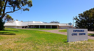
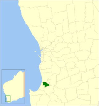
The Shire of Esperance is a local government area in the Goldfields–Esperance region of Western Australia, about 400 kilometres (250 mi) south of the town of Kalgoorlie and about 720 kilometres (450 mi) east-southeast of the state capital, Perth. The Shire covers an area of 42,547 square kilometres (16,427 sq mi), and its seat of government is the town of Esperance, where about three-quarters of the Shire's population resides.

The Shire of Katanning is a local government area in the Great Southern region of Western Australia, about 170 kilometres (106 mi) north of Albany and about 290 kilometres (180 mi) southeast of the state capital, Perth. The Shire covers an area of 1,518 square kilometres (586 sq mi), and its seat of government is the town of Katanning.

The Shire of Laverton is a local government area in the Goldfields-Esperance region of Western Australia, about 370 kilometres (230 mi) northeast of the city of Kalgoorlie and about 950 kilometres (590 mi) east-northeast of the state capital, Perth. The Shire covers an area of 179,798 square kilometres (69,420 sq mi), and its seat of government is the town of Laverton.

The Shire of Leonora is a local government area in the Goldfields-Esperance region of Western Australia, about 240 kilometres (149 mi) north of the city of Kalgoorlie and about 830 kilometres (516 mi) northeast of the state capital, Perth. The Shire covers an area of 32,189 square kilometres (12,428 sq mi), and its seat of government is the town of Leonora.
The Shire of Ravensthorpe is a local government area in the southern Goldfields-Esperance region of Western Australia, about halfway between the city of Albany and the town of Esperance and about 530 kilometres (329 mi) southeast of the state capital, Perth. The Shire covers an area of 13,551 square kilometres (5,232 sq mi), and its seat of government is the town of Ravensthorpe.
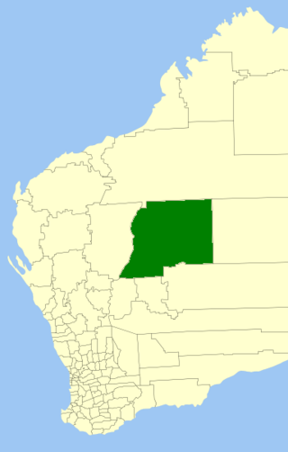
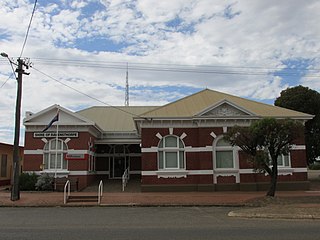
The Shire of Wiluna is a local government area in the Goldfields-Esperance region of Western Australia, about 950 kilometres (590 mi) northeast of the state capital, Perth. The Shire covers an area of 182,155 square kilometres (70,330 sq mi), and its seat of government is the town of Wiluna.
Gibson is a town and locality of the Shire of Esperance in the Goldfields-Esperance region of Western Australia, about 22 kilometres (14 mi) north of Esperance. The Coolgardie–Esperance Highway and Kalgoorlie to Esperance railway the run through the locality from north to south. Esperance Airport and Helms Arboretum Reserve are located in the south-west of Gibson.

Castletown is a north-eastern suburb of Esperance, a town in south-eastern Western Australia. Its local government area is the Shire of Esperance.

Bandy Creek is a north-eastern suburb of Esperance, a town in south-eastern Western Australia. Its local government area is the Shire of Esperance, and it is located 6 kilometres (4 mi) northeast of Esperance's central business district. The east and north of Bandy Creek are covered by the Mullet Lake Nature Reserve while, in the south, it borders the Southern Ocean.

Condingup is a town in the Goldfields–Esperance region of Western Australia, in the Shire of Esperance local government area, 782 kilometres (486 mi) southeast of the state capital, Perth. A small section of the locality is situated on the Southern Ocean, at the Duke of Orleans Bay, while the townsite itself is at the intersection of Fisheries Road and Orleans Bay Road. Condingup borders Cape Le Grand National Park in the south. The Coolinup Nature Reserve is located in the west of Condingup.
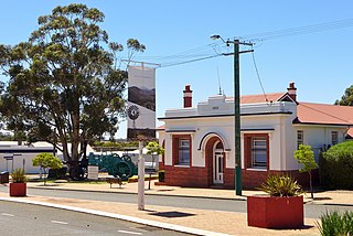
Cascade is a small town in Western Australia located 677 kilometres (421 mi) east of Perth along the South Coast between Ravensthorpe and Esperance in the Goldfields-Esperance region of Western Australia. The Griffiths, Fields and Cascade Nature Reserves are located within Cascade.

Coomalbidgup is a town and locality of the Shire of Esperance in the Goldfields-Esperance region of Western Australia. It is located on the South Coast Highway and the Southern Ocean. Almost the entire coast of the locality is covered by protected area, with the Stokes Inlet and the Stokes National Park in the west and two unnamed nature reserves in the east.


