
The Town of Cambridge is a local government area in the inner western suburbs of the Western Australian capital city of Perth, about 5 kilometres (3 mi) west of Perth's central business district and extending to the Indian Ocean at City Beach. The Town covers an area of 22.0 square kilometres (8.5 sq mi) and had a population of almost 29,000 as of the 2021 Census. It was originally part of the City of Perth before the restructuring by the Western Australian State Government in 1994.
The Shire of Serpentine-Jarrahdale is a local government area in the outer southeastern metropolitan area of Perth, the capital of Western Australia, and has an area of 905 square kilometres (349 sq mi) and a population of 32,173 as at the 2021 Census. Despite being named after two towns in the area, neither Serpentine nor Jarrahdale function as either the Shire's largest settlement (Byford) or the seat of government (Mundijong).

The City of Rockingham is a council and local government area, comprising the south coastal suburbs of the Western Australian capital city of Perth.

The Shire of Dandaragan is a local government area located in the Wheatbelt region of Western Australia, about 200 kilometres (124 mi) north of the state capital, Perth. The Shire covers an area of 6,716 square kilometres (2,593 sq mi) and its seat of government is the town of Jurien Bay.
The Shire of Denmark is a local government area in the Great Southern region of Western Australia, about 55 kilometres (34 mi) west of Albany and about 420 kilometres (261 mi) south-southeast of the state capital, Perth. The Shire of Denmark covers an area of 1,860 square kilometres (718 sq mi), and its seat of government is located in the townsite and locality of Denmark.
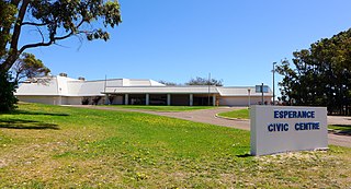
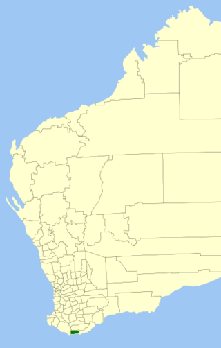
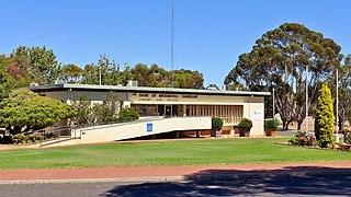
The Shire of Esperance is a local government area in the Goldfields–Esperance region of Western Australia, about 400 kilometres (250 mi) south of the town of Kalgoorlie and about 720 kilometres (450 mi) east-southeast of the state capital, Perth. The Shire covers an area of 42,547 square kilometres (16,427 sq mi), and its seat of government is the town of Esperance, where about three-quarters of the Shire's population resides.

The Shire of Laverton is a local government area in the Goldfields-Esperance region of Western Australia, about 370 kilometres (230 mi) northeast of the city of Kalgoorlie and about 950 kilometres (590 mi) east-northeast of the state capital, Perth. The Shire covers an area of 179,798 square kilometres (69,420 sq mi), and its seat of government is the town of Laverton.
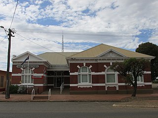
The Shire of Ravensthorpe is a local government area in the southern Goldfields-Esperance region of Western Australia, about halfway between the city of Albany and the town of Esperance and about 530 kilometres (329 mi) southeast of the state capital, Perth. The Shire covers an area of 13,551 square kilometres (5,232 sq mi), and its seat of government is the town of Ravensthorpe.
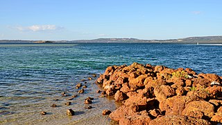
Israelite Bay is a bay and locality of the Shire of Esperance in the Goldfields-Esperance region of Western Australia, located along the Southern Ocean. Except for a small strip in the north-west of the locality, Israelite Bay is completely taken up by the Nuytsland Nature Reserve.
Gibson is a town and locality of the Shire of Esperance in the Goldfields-Esperance region of Western Australia, about 22 kilometres (14 mi) north of Esperance. The Coolgardie–Esperance Highway and Kalgoorlie to Esperance railway the run through the locality from north to south. Esperance Airport and Helms Arboretum Reserve are located in the south-west of Gibson.
The Shire of Broomehill-Tambellup is a local government area in the Great Southern region of Western Australia, 320 kilometres (200 mi) south-southeast of the state capital, Perth. The Shire covers an area of 2,609.1 square kilometres (1,007.4 sq mi), and its seat of government is the town of Tambellup. It came into existence in 2008 through the amalgamation of the former Shire of Broomehill and Shire of Tambellup.

Castletown is a north-eastern suburb of Esperance, a town in south-eastern Western Australia. Its local government area is the Shire of Esperance.

Bandy Creek is a north-eastern suburb of Esperance, a town in south-eastern Western Australia. Its local government area is the Shire of Esperance, and it is located 6 kilometres (4 mi) northeast of Esperance's central business district. The east and north of Bandy Creek are covered by the Mullet Lake Nature Reserve while, in the south, it borders the Southern Ocean.

Chadwick is a northern suburb of Esperance, a town in south-eastern Western Australia. Its local government area is the Shire of Esperance. The eastern terminus of the South Coast Highway is located in Chadwick.
Emu Point is a north-eastern suburb of the City of Albany in the Great Southern region of Western Australia. It is located north-east of Albany's central business district.
Lockyer is a north-western suburb of the City of Albany in the Great Southern region of Western Australia. The suburb has a median age of 33, and was officially named in 1954.

Condingup is a town in the Goldfields–Esperance region of Western Australia, in the Shire of Esperance local government area, 782 kilometres (486 mi) southeast of the state capital, Perth. A small section of the locality is situated on the Southern Ocean, at the Duke of Orleans Bay, while the townsite itself is at the intersection of Fisheries Road and Orleans Bay Road. Condingup borders Cape Le Grand National Park in the south. The Coolinup Nature Reserve is located in the west of Condingup.
Cascade is a small town in Western Australia located 677 kilometres (421 mi) east of Perth along the South Coast between Ravensthorpe and Esperance in the Goldfields-Esperance region of Western Australia. The Griffiths, Fields and Cascade Nature Reserves are located within Cascade.

Coomalbidgup is a town and locality of the Shire of Esperance in the Goldfields-Esperance region of Western Australia. It is located on the South Coast Highway and the Southern Ocean. Almost the entire coast of the locality is covered by protected area, with the Stokes Inlet and the Stokes National Park in the west and two unnamed nature reserves in the east.
Gnowellen is a locality of the City of Albany in the Great Southern region of Western Australia. It borders the Stirling Range National Park in the west while the Pallinup River forms its northern border. The Pallinup Nature Reserve is located in the south-eastern corner of Gnowellen, while the Mailalup Nature Reserve is in its west


