
Sir John Forrest was an Australian explorer and politician. He was the first premier of Western Australia (1890–1901) and a long-serving cabinet minister in federal politics.

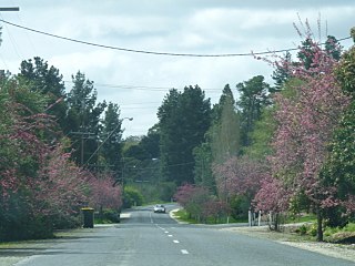
Leonora is a town in the Goldfields-Esperance region of Western Australia, located 833 kilometres (518 mi) northeast of the state capital, Perth, and 237 kilometres (147 mi) north of the city of Kalgoorlie.

Kings Park, is a 400.6-hectare (990-acre) park overlooking Perth Water and the central business district of Perth, Western Australia.

Boddington is a town and shire in the Peel region of Western Australia, located 120 kilometres (75 mi) south-east of Perth. The town sits on the road from Pinjarra to Williams on the Hotham River. The population of the town was 1,844 at the 2016 Census.

Gwalia is a former gold-mining town located 233 kilometres (145 mi) north of Kalgoorlie and 828 kilometres (514 mi) east of Perth in Western Australia's Great Victoria Desert. Today, Gwalia is essentially a ghost town, having been largely deserted since the main source of employment, the Sons of Gwalia gold mine, closed in 1963. Just 4 kilometres (2.5 mi) north is the town of Leonora, which remains the hub for the area's mining and pastoral industries.
Forreston is a locality near Adelaide, South Australia. It is located in the Adelaide Hills Council local government area 3 km northeast of Gumeracha.
Cambridge Gulf is a gulf on the north coast of the Kimberley region of Western Australia. Many rivers flow into the gulf, including the Ord River, Pentecost River, Durack River, King River and the Forrest River, making the environment an estuarine one.
The Fraser River is a river in the Kimberley region of Western Australia.
The Mount Ida Gold Mine is a gold mine located 86 km north-west of Menzies, Western Australia.
Youanmi is an abandoned town in the Murchison region of Western Australia.
Mount Morgans, known as Mount Morgan until 1899, is an abandoned town in Western Australia 900 kilometres (559 mi) northeast of Perth and 40 kilometres (25 mi) southwest of Laverton on the original Malcolm-Laverton Road, in the Goldfields-Esperance region of Western Australia.
Mount Margaret was an abandoned town located 900 kilometres (559 mi) northeast of Perth and 31 kilometres (19 mi) southwest of Laverton in the Goldfields-Esperance region of Western Australia.
Black Flag is an abandoned town in Western Australia, 30 km north west of Kalgoorlie. It is on the Black Flag to Ora Banda Road in the Goldfields-Esperance region of Western Australia.
Bardoc is an abandoned town in the Goldfields-Esperance region of Western Australia. It is situated between Kalgoorlie and Menzies along the Goldfields Highway.
Malcolm is an abandoned town located between Leonora and Laverton in the Shire of Leonora in the Goldfields-Esperance region of Western Australia.
Sir Samuel is an abandoned town located between Leinster and Wiluna in the Goldfields-Esperance region of Western Australia.
Yundamindera, also once known as The Granites, is an abandoned town located between Leonora and Laverton in the Shire of Leonora in the Goldfields–Esperance region of Western Australia.
Paynesville is a ghost town and locality in the Mid West region of Western Australia between the towns of Mount Magnet and Sandstone.
Mulwarrie is an abandoned town in the North Coolgardie Goldfield of the Goldfields-Esperance region of Western Australia, 125 km northwest of Kalgoorlie, between Davyhurst and Mulline.
Mount Elvire Station was a pastoral lease and sheep station located approximately 177 kilometres (110 mi) south west of Leonora in the Goldfields-Esperance region of Western Australia.
