Israelite Bay

Last updated

Israelite Bay
Western Australia
Australia Western Australia location map.svg
Red pog.svg
Israelite Bay
Israelite Bay
Coordinates 33°36′36″S123°52′34″E / 33.61°S 123.876°E / -33.61; 123.876 Coordinates: 33°36′36″S123°52′34″E / 33.61°S 123.876°E / -33.61; 123.876
Population0 (SAL 2016) [1] [2]
Postcode(s) 6452
LGA(s) Shire of Esperance

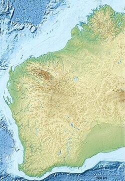
Israelite Bay is a bay and locality on the south coast of Western Australia.

Contents

Situated in the Shire of Esperance local government area, it lies east of Esperance and the Cape Arid National Park, within the Nuytsland Nature Reserve and the Great Australian Bight. [3] Point Malcolm is about 25 km (16 mi) west of Israelite Bay, [4] and there is a long sandy beach there. [5]

Climate data was recorded at Israelite Bay from 1885 to 1927, and it is frequently mentioned in Bureau of Meteorology weather reports as a geographical marker. [6]

It was the site of a significant telegraph station in the early 1900s. [7] [8] It was also a location serviced by the W.A. Government State Steamship Service, the South Coast Service, in the early 1900s. [9]

The Eastern Group, the eastern-most islands of the Recherche Archipelago, identified by Matthew Flinders in January 1802, [10] is offshore of Israelite Bay. [11]

Related Research Articles

<span class="mw-page-title-main">Cape Arid National Park</span> Protected area in Western Australia

Cape Arid National Park is a national park located in Western Australia, 731 kilometres (454 mi) southeast of Perth. The park is situated 120 kilometres (75 mi) east of Esperance and lies on the shore of the south coast from the eastern end of the Recherche Archipelago. The bay at its eastern side is Israelite Bay, a locality often mentioned in Bureau of Meteorology weather reports as a geographical marker. The western end is known as Duke of Orleans Bay.

<span class="mw-page-title-main">Weipa</span> Town in Queensland, Australia

Weipa is a coastal mining town in the local government area of Weipa Town in Queensland. It is the largest town on the Cape York Peninsula. It exists because of the enormous bauxite deposits along the coast. The Port of Weipa is mainly involved in exports of bauxite. There are also shipments of live cattle from the port.

<span class="mw-page-title-main">Esperance, Western Australia</span> Town in Western Australia

Esperance is a town in the Goldfields–Esperance region of Western Australia, on the Southern Ocean coastline approximately 720 kilometres (450 mi) east-southeast of the state capital, Perth. The urban population of Esperance was 12,145 at June 2018. Its major industries are tourism, agriculture, and fishing.

<span class="mw-page-title-main">Eucla, Western Australia</span> Town in Western Australia

Eucla is the easternmost locality in Western Australia, located in the Goldfields-Esperance region of Western Australia along the Eyre Highway, approximately 11 kilometres (7 mi) west of the South Australian border. At the 2016 Australian census, Eucla had a population of 53.

<span class="mw-page-title-main">Flinders Bay</span> Bay and former port in south west Western Australia

Flinders Bay is a bay and locality that is immediately south of the townsite of Augusta, and close to the mouth of the Blackwood River.

<span class="mw-page-title-main">Lake Grace, Western Australia</span> Town in Western Australia

Lake Grace is a town in the eastern Wheatbelt region of Western Australia, 345 kilometres (214 mi) from Perth along State Route 107 between Wagin and Ravensthorpe. It is the main town in the Shire of Lake Grace. At the 2016 census, Lake Grace had a population of 507.

<span class="mw-page-title-main">Salmon Gums, Western Australia</span> Town in Western Australia

Salmon Gums is a small town in Western Australia located 106 km north of Esperance on the Coolgardie-Esperance Highway. The name is derived from a prominent stretch of Eucalyptus salmonophloia trees which formed a landmark in the town's early days. The town is part of the Shire of Esperance. At the 2016 census, Salmon Gums had a population of 191.

<span class="mw-page-title-main">Caiguna, Western Australia</span> Town in Western Australia

Caiguna is a small roadhouse community located on the Eyre Highway in Western Australia. It is the second stop east of Norseman on the journey east across the Nullarbor Plain. Between Balladonia and Caiguna is a 146.6-kilometre (91.1 mi) stretch of the highway which is one of the longest straight stretches of road in the world. The unofficial Central Western Time (CWT) starts shortly east of Caiguna, heading eastward.

<span class="mw-page-title-main">Hamelin Bay, Western Australia</span> Locality in Western Australia

Hamelin Bay is a bay and a locality on the southwest coast of Western Australia between Cape Leeuwin and Cape Naturaliste. It is named after French explorer Jacques Félix Emmanuel Hamelin, who sailed through the area in about 1801. It is south of Cape Freycinet.

<span class="mw-page-title-main">Eyre Bird Observatory</span> Bird observatory on the south east coast of Western Australia

Eyre Bird Observatory is an educational, scientific and recreational facility in the Nuytsland Nature Reserve, Western Australia. Cocklebiddy is the nearest locality on the Eyre Highway, 49 km (30 mi) to the north. It is in the Hampton bioregion, which is sandwiched between the Nullarbor Plain to the north and the Great Australian Bight to the south, in one of the least populated places on the Australian continent. It was established in 1977 by Birds Australia in the disused Eyre Telegraph Station as Australia's first bird observatory, to provide a base for the study and enjoyment of the birds of the area.

<span class="mw-page-title-main">Jurien Bay, Western Australia</span> Town in Western Australia

Jurien Bay is a coastal town in the Wheatbelt region of Western Australia, 220 kilometres (137 mi) north of Perth facing the Indian Ocean.

<span class="mw-page-title-main">Nullarbor, South Australia</span> Town in South Australia

Nullarbor is a locality in the Australian state of South Australia located 295 kilometres (183 mi) to the west of the town of Ceduna in the western part of the state immediately adjoining the border with Western Australia.

<span class="mw-page-title-main">Bremer Bay, Western Australia</span> Town in Western Australia

Bremer Bay is a coastal town situated on the south coast of Western Australia in the Great Southern region between Albany and Esperance, at the mouth of the Bremer River. Bremer Bay is 515 kilometres (320 mi) southeast of the state capital, Perth, and 180 kilometres (112 mi) east of Albany.

<span class="mw-page-title-main">Recherche Archipelago</span> Group of 105 islands in southern Western Australia

The Archipelago of the Recherche, known locally as the Bay of Isles, is a group of 105 islands, and over 1200 "obstacles to shipping", off the south coast of Western Australia. The islands stretch 230 km (140 mi) from east to west and to 50 km (31 mi) off-shore encompassing an area of approximately 4,000 square kilometres (1,544 sq mi). The western group is near Esperance and the eastern group at Israelite Bay. They are located in coastal waters, part of which is designated the Recherche Archipelago Nature Reserve.

<span class="mw-page-title-main">Fowlers Bay, South Australia</span> Town in South Australia

Fowlers Bay, formerly known as Yalata, is a bay, town and locality in the Australian state of South Australia located about 658 kilometres (409 mi) north-west of the state capital, Adelaide. The town is located on Port Eyre, at the western end of the larger Fowlers Bay. It was named Yalata after Yalata station, established in the 1860s and stretching from the Nullarbor Plain across to near Streaky Bay on the Eyre Peninsula, whose homestead was located on the hill nearby. The name Yalata now belongs to a small Aboriginal community further west, which was also situated on station land.

<span class="mw-page-title-main">Lake Hillier</span> Pink-colored lake in Western Australia

Lake Hillier is a saline lake on the edge of Middle Island, the largest of the islands and islets that make up the Recherche Archipelago in the Goldfields-Esperance region, off the south coast of Western Australia. It is particularly notable for its pink colour. A long and thin shore divides the Southern Ocean from the lake.

<span class="mw-page-title-main">HMS Investigator Anchors</span>

The HMS Investigator Anchors are the two anchors that jettisoned from HMS Investigator on the morning of Saturday, 21 May 1803, by her commander, Matthew Flinders, in order to avoid running aground on Middle Island in the Archipelago of the Recherche on the south coast of New Holland. In 1973, the anchors were located and recovered by members of the Underwater Explorers Club of South Australia (UEC). The recovered anchors became the subject of an ownership dispute between various governments, particularly those of South Australia and Western Australia due to their historic significance as artefacts of a major voyage of European exploration. The dispute was resolved with the ownership of the anchors going to the Australian Government who subsequently gifted one of the anchors to the South Australian Government. The pair of artefacts is also known as Flinders' Anchors.

<span class="mw-page-title-main">Jussieu Peninsula</span> Place in South Australia

Jussieu Peninsula is a peninsula located at the south east end of Eyre Peninsula in South Australia. It is bounded by Proper Bay and Spalding Cove within the natural harbour known as Port Lincoln to the north, Spencer Gulf to the east and the Great Australian Bight to the south. While it was first explored and mapped by Matthew Flinders during February 1802, Flinders did not name it. In 1913, the name proposed by François Péron and Louis de Freycinet from Baudin's expedition when it visited later in 1802 was declared as the peninsula's official name by the Government of South Australia. Jussieu refers to the French botanist, Antoine Laurent de Jussieu. While parts of its surface have been cleared and used for agricultural purposes in the past, it is currently occupied by two protected areas: the Lincoln National Park and the Memory Cove Wilderness Protection Area.

<span class="mw-page-title-main">Middle Island (Western Australia)</span> Island in Western Australia

Middle Island is an island off the south coast of Western Australia in the Recherche Archipelago, around 120 km (75 mi) south-east of Esperance. It is known for its pink lake, Lake Hillier. Goose Island lies just adjacent to the north.

Yantanabie is a town and rural locality in the wheat belt of South Australia, 37 miles inland from Streaky Bay, South Australia.

References

  1. Australian Bureau of Statistics (27 June 2017). "Israelite Bay (Suburb and Locality)". Australian Census 2016.  OOjs UI icon edit-ltr-progressive.svg
  2. Australian Bureau of Statistics (27 June 2017). "Israelite Bay (Suburb and Locality)". Australian Census 2016 QuickStats. Retrieved 28 June 2022.  OOjs UI icon edit-ltr-progressive.svg
  3. "Israelite Bay/Nuytsland Nature Reserve" (PDF). Department of Parks and Wildlife. 2016. Retrieved 29 October 2021.
  4. "Israelite Bay". Explore Parks WA. Retrieved 6 December 2022.
  5. "SLSA Beachsafe". SLSA Beachsafe. 28 October 2022. Retrieved 6 December 2022.
  6. "Site name: Israelite Bay". Climate Data Sites. Commonwealth of Australia , Bureau of Meteorology. Retrieved 29 October 2021.
  7. Campbell, R. McK. (1995). Israelite Bay Post Office and Telegraph Station. Perth, W.A.: National Trust.
  8. Considine & Griffiths Architects (September 2004). "Israelite Bay Post and Telegraph Station : a ruin stabilised". Trust News. National Trust of Australia (W.A.): 10–12.
  9. Garratt, Dena; Western Australian Museum. Department of Maritime Archaeology; Western Australian Maritime Museum (1994), Israelite Bay Jetty : maritime heritage site inspection report, W.A. Maritime Museum, retrieved 24 July 2018
  10. Morgan, Kenneth (2016). Matthew Flinders, Maritime Explorer of Australia. London: Bloomsbury. p. 81. ISBN   9781441149107 . Retrieved 29 October 2021.
  11. "Archipelago of the Recherche" (PDF). Environmental Defenders Office Western Australia. Archived from the original (PDF) on 19 July 2008.

Further reading