
Norseman is a town located in the Goldfields-Esperance region of Western Australia along the Coolgardie-Esperance Highway, 726 kilometres (451 mi) east of Perth and 278 metres (912 ft) above sea level. It is also the starting point of the Eyre Highway, and the last major town in Western Australia before the South Australian border 720 kilometres (447 mi) to the east. At the 2021 census, Norseman had a population of 562, of which 17% were Australian Aboriginal.

Great Eastern Highway is a 590-kilometre-long (370 mi) road that links the Western Australian capital of Perth with the city of Kalgoorlie. A key route for road vehicles accessing the eastern Wheatbelt and the Goldfields, it is the western portion of the main road link between Perth and the eastern states of Australia. The highway forms the majority of National Highway 94, although the alignment through the Perth suburbs of Guildford and Midland, and the eastern section between Coolgardie and Kalgoorlie are not included. Various segments form parts of other road routes, including National Route 1, Alternative National Route 94, and State Route 51.

Coolgardie–Esperance Highway is a 370-kilometre (230 mi) Western Australian highway between Coolgardie and Esperance. It runs in a north–south direction linking the state's Eastern Goldfields to the coast.
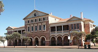
Coolgardie is a small town in Western Australia, 558 kilometres (347 mi) east of the state capital, Perth. It has a population of approximately 850 people.

The Goldfields Water Supply Scheme is a pipeline and dam project that delivers potable water from Mundaring Weir in Perth to communities in Western Australia's Eastern Goldfields, particularly Coolgardie and Kalgoorlie. The project was commissioned in 1896 and completed in 1903.
Grass Patch is a small town in the Goldfields-Esperance region of Western Australia, located 79 km north of Esperance on the Coolgardie-Esperance Highway. The town was named after a nearby farm of the same name that had been settled around 1896 and was renowned for bountiful crops and good grass. The town is part of the Shire of Esperance, and services the local farming community.
Goongarrie is an abandoned town in Western Australia, located in the Goldfield region of Western Australia 84 kilometres (52 mi) north of Kalgoorlie.
Scaddan is a small town in Western Australia located 783 kilometres (487 mi) east of Perth situated just off the Coolgardie-Esperance Highway between Norseman and Esperance in the Goldfields-Esperance region of Western Australia.
Mount Morgans, known as Mount Morgan until 1899, is an abandoned town in Western Australia 900 kilometres (559 mi) northeast of Perth and 40 kilometres (25 mi) southwest of Laverton on the original Malcolm-Laverton Road, in the Goldfields-Esperance region of Western Australia.
Dunnsville is an abandoned town in Western Australia located 46 km north-west of Coolgardie in the Goldfields-Esperance region of Western Australia.
Kunanalling is an abandoned town in Western Australia located between Coolgardie and Balgarri along the Coolgardie North Road in the Goldfields-Esperance region of Western Australia. It is located in the Shire of Coolgardie.
Kurrajong is an abandoned town located between Leonora and Leinster along the Old Agnew Road in the Goldfields–Esperance region of Western Australia.
Kurrawang is a town in Western Australia between Coolgardie and Kalgoorlie just off Great Eastern Highway in the Goldfields–Esperance region of Western Australia.
Mulgarrie is a ghost town, located between Kalgoorlie and Leonora in the Shire of Menzies in the Goldfields-Esperance region of Western Australia.
Mungari is a ghost town in Western Australia, located between Coolgardie and Kalgoorlie in the Goldfields-Esperance region of Western Australia.
Kintore is an abandoned town in Western Australia located 46 kilometres (29 mi) north-west of Kalgoorlie along the Coolgardie North Road in the Goldfields-Esperance region of Western Australia.
Callion is an abandoned town in the Goldfields-Esperance region in Western Australia. It is between Coolgardie and Leonora, in the Shire of Menzies.
Mulwarrie is an abandoned town in the North Coolgardie Goldfield of the Goldfields-Esperance region of Western Australia, 125 km northwest of Kalgoorlie, between Davyhurst and Mulline.
Niagara is an abandoned town located in the Goldfields-Esperance region in Western Australia, between Kalgoorlie and Leonora, 12 kilometres (7.5 mi) southwest of Kookynie.
The Municipality of Coolgardie was a local government area in Western Australia, centred on the town of Coolgardie.
