Norseman is a town located in the Goldfields-Esperance region of Western Australia along the Coolgardie-Esperance Highway, 726 kilometres (451 mi) east of Perth and 278 metres (912 ft) above sea level. It is also the starting point of the Eyre Highway, and the last major town in Western Australia before the South Australian border 720 kilometres (447 mi) to the east. At the 2016 census, Norseman had a population of almost 600.
Laverton, originally known as British Flag, is a town in the Goldfields-Esperance region of Western Australia, and the centre of administration for the Shire of Laverton. The town of Laverton is located at the western edge of the Great Victoria Desert, 957 kilometres (595 mi) north-northeast of the state capital, Perth, and 124 kilometres (77 mi) east-northeast of the town of Leonora, with an elevation of 461 metres (1,512 ft).

Southern Cross is a town in Western Australia, 371 kilometres east of state capital Perth on the Great Eastern Highway. It was founded by gold prospectors in 1888, and gazetted in 1890. It is the major town and administrative centre of the Shire of Yilgarn. At the 2016 census, Southern Cross had a population of 680.

Esperance is a town in the Goldfields–Esperance region of Western Australia, on the Southern Ocean coastline approximately 720 kilometres (450 mi) east-southeast of the state capital, Perth. The urban population of Esperance was 12,145 at June 2018. Its major industries are tourism, agriculture, and fishing.

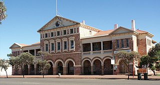
Coolgardie is a small town in Western Australia, 558 kilometres (347 mi) east of the state capital, Perth. It has a population of approximately 850 people.
Bullabulling is a small townsite located 526 km (327 mi) east of Perth, Western Australia on the Great Eastern Highway in the Goldfields-Esperance region.

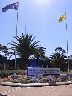
Kambalda is a small mining town about 60 kilometres (37 mi) from the mining city of Kalgoorlie in Western Australia, within the Goldfields. It is split into two townsites 4 kilometres (2.5 mi) apart, Kambalda East and Kambalda West; and is located on the western edge of a giant salt lake, Lake Lefroy. At the last census, Kambalda had a combined population of 2,468.
Mount Morgans, known as Mount Morgan until 1899, is an abandoned town in Western Australia 900 kilometres (559 mi) northeast of Perth and 40 kilometres (25 mi) southwest of Laverton on the original Malcolm-Laverton Road, in the Goldfields-Esperance region of Western Australia.
Mount Margaret was an abandoned town located 900 kilometres (559 mi) northeast of Perth and 31 kilometres (19 mi) southwest of Laverton in the Goldfields-Esperance region of Western Australia.

Widgiemooltha is an abandoned town in Western Australia 631 kilometres (392 mi) east of Perth between Kambalda and Norseman in the Goldfields-Esperance region of Western Australia. It is found on the southern shoreline of Lake Lefroy.

Beria is an abandoned town in the Goldfields-Esperance region of Western Australia, located 8 kilometres (5 mi) north of Laverton on the Laverton-Leonora Road.
Burbanks is an abandoned town in Western Australia located between Coolgardie and Londonderry in the Goldfields-Esperance region of Western Australia.
Dunnsville is an abandoned town in Western Australia located 46 km north-west of Coolgardie in the Goldfields-Esperance region of Western Australia.
Londonderry is a ghost town in Western Australia, located 14 km South West of Coolgardie in the Goldfields-Esperance region of Western Australia.
Horseshoe is an abandoned town in Western Australia located in the Murchison goldfields within the Mid West region of Western Australia situated between Meekatharra and Newman. The town is adjacent to the Peak Hill goldfields.
Kintore is an abandoned town in Western Australia located 46 km north-west of Kalgoorlie along the Coolgardie North Road in the Goldfields-Esperance region of Western Australia.
Callion is an abandoned town in the Goldfields-Esperance region in Western Australia. It is between Coolgardie and Leonora, in the Shire of Menzies.
Mulwarrie is an abandoned town in the North Coolgardie Goldfield of the Goldfields-Esperance region of Western Australia, 125 km northwest of Kalgoorlie, between Davyhurst and Mulline.
Niagara is an abandoned town located in the Goldfields-Esperance region in Western Australia, between Kalgoorlie and Leonora, 12 kilometres (7.5 mi) southwest of Kookynie.
Yerilla is an abandoned town located in the Goldfields-Esperance region in Western Australia. It is found between Kalgoorlie and Laverton.


