
Cue is a small town in the Mid West region of Western Australia, located 620 km north-east of Perth. At the 2016 census, Cue had a population of 178. Cue is administered through the Cue Shire Council, which has its chambers in the historic Gentlemans Club building. The current president is Ross Pigdon. The Cue Parliament is held twice yearly in May and November.

Meekatharra is a town in the Mid West region of Western Australia. Meekatharra is a Yamatji word meaning "place of little water". At the 2016 census, Meekatharra had a population of 708, with 34.0% being of Aboriginal descent.

Northampton is a town 52 kilometres (32 mi) north of Geraldton, in the Mid West region of Western Australia. At the 2011 census, the town had a population of 868.The town contains a National Trust building. The town lies on the North West Coastal Highway. Originally called The Mines, Northampton was gazetted in 1864 and named after the colony's Governor, John Hampton. The town was sited in the Nokanena Brook valley, between the hamlets around the two major copper mines in the area, the Wanerenooka and the Gwalla.
Tarcoola is a town in the Far North of South Australia 416 kilometres (258 mi) north-northwest of Port Augusta. At the 2016 census, Tarcoola had no people living within its boundaries.

Sandstone is a small town in the Mid West region of Western Australia 157 kilometres (98 mi) east of Mount Magnet and 661 kilometres (411 mi) north of the state capital, Perth. At the 2016 census, Sandstone and the surrounding Shire of Sandstone a population of 89 people, including 19 families. Sandstone is the administrative centre and only town in the Shire of Sandstone local government area.
Abbotts is an abandoned town in Western Australia located in the Murchison Goldfields region of Western Australia located 31 km (19 mi) north-west of Meekatharra on the Meekatharra – Mount Clere Road.

Austin is an abandoned town in the Murchison region of Western Australia. The town is located south of Cue on an island in Lake Austin and for this reason was also known as Lake Austin and The Island Lake Austin.
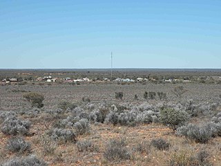
Boogardie is an abandoned town in the Mid West region of Western Australia.

Burtville is an abandoned town in the Goldfields-Esperance region of Western Australia, located 29 kilometres (18 mi) south east of Laverton.

Beria is an abandoned town in the Goldfields-Esperance region of Western Australia, located 8 kilometres (5 mi) north of Laverton on the Laverton-Leonora Road.
Burbanks is an abandoned town in Western Australia located between Coolgardie and Londonderry in the Goldfields-Esperance region of Western Australia.
Bardoc is an abandoned town in the Goldfields-Esperance region of Western Australia. It is situated between Kalgoorlie and Menzies along the Goldfields Highway.
Eulaminna is an abandoned town located between Leonora and Laverton along the Old Leonora Road in the Shire of Leonora and the Goldfields-Esperance region of Western Australia.
Gudarra is an abandoned town in the Goldfields-Esperance region of Western Australia. It is situated between Kalgoorlie and Menzies off the Goldfields Highway. The present-day Paddington Gold Mine is located near the old townsite.
Mulline is an abandoned town located in the Goldfields-Esperance region in Western Australia. It is found between Kalgoorlie and Leonora in the Shire of Menzies.
Yundamindera, also once known as The Granites, is an abandoned town located between Leonora and Laverton in the Shire of Leonora in the Goldfields–Esperance region of Western Australia.
Cuddingwarra is an abandoned town in the Mid West region of Western Australia. The town is located between Cue and Big Bell.
Mulwarrie is an abandoned town in the North Coolgardie Goldfield of the Goldfields-Esperance region of Western Australia, 125 km northwest of Kalgoorlie, between Davyhurst and Mulline.
Yarri is an abandoned town located in the Goldfields–Esperance region in Western Australia. It is found between Kalgoorlie and Laverton in the Shire of Menzies.
The Duketon Gold Project is a gold mining operation located between 100 km (62 mi) and 130 km (81 mi) north of Laverton. It is owned by the Australian mining company Regis Resources.
