
Narrikup is a small town between Albany and Mount Barker in the Great Southern region of Western Australia. At the 2006 census, Narrikup had a population of 515.

Meckering is a town 130 kilometres (80.8 mi) east of Perth, Western Australia along the Great Eastern Highway. Meckering is located within the Shire of Cunderdin.

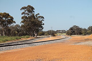
Hines Hill is a town located 240 km (150 mi) east of Perth, between the towns of Merredin and Doodlakine in Western Australia. The town is situated on the Great Eastern Highway and also on the edge of Lake Baandee. The town has one of the first privately owned weighbridges in Western Australia is located close to the town.
Yilliminning is a small town located in the southern Wheatbelt region of Western Australia, 212 kilometres (132 mi) southeast of the state capital, Perth and 23 kilometres (14 mi) east of Narrogin. At the 2006 census, Yilliminning had a population of 337.
Ajana is a townsite within the Shire of Northampton in Western Australia. It is located at the junction of Ajana-Kalbarri Road and Ajana Back Road, 53 kilometres (33 mi) by road north of Northampton and 531 kilometres (330 mi) west-northwest of Perth in the Mid West region.
Nyabing is a small town in the Great Southern region of Western Australia. The name is of Aboriginal origin and is thought to derive from the Aboriginal word "ne-yameng", which is the name of an everlasting flower Rhodanthe manglesii.
Wannamal is a town in the Wheatbelt region of Western Australia.

Widgiemooltha is an abandoned town in Western Australia 631 kilometres (392 mi) east of Perth between Kambalda and Norseman in the Goldfields-Esperance region of Western Australia. It is found on the southern shoreline of Lake Lefroy.
Dalyup is a small town in Western Australia located about 680 kilometres (423 mi) south east of Perth between Munglinup and Esperance on the South Coast Highway in the Goldfields-Esperance region of Western Australia.
Balkuling is an abandoned town 192 km east of Perth, Western Australia along the Quairading-York Road situated in the Wheatbelt region of Western Australia.
Varley is a small town located between Hyden and Lake King in the Wheatbelt region of Western Australia.
Mungari is a ghost town in Western Australia, located between Coolgardie and Kalgoorlie in the Goldfields-Esperance region of Western Australia.
Horseshoe is an abandoned town in Western Australia located in the Murchison goldfields within the Mid West region of Western Australia situated between Meekatharra and Newman. The town is adjacent to the Peak Hill goldfields.
Tuckanarra is a small town in the Shire of Cue in the Murchison region of Western Australia. The town is located between Cue and Meekatharra along the Great Northern Highway in the Mid West region of Western Australia.
Yandanooka is a small town in the Mid West region of Western Australia. The town is located between Mingenew and Three Springs on the Midlands Road.

Carbunup River is a small town in the South West region of Western Australia. At the 2021 census, it had a population of 112. It is situated between Dunsborough and Margaret River on the banks of the Carbunup River.
Holt Rock is a small town in the Wheatbelt region of Western Australia. It is situated between the towns of Hyden and Varley close to the edge of Lake Hurlstone.
Rothsay is an abandoned town in the Mid West region of Western Australia. It is situated between the towns of Dalwallinu and Mount Magnet
Mulwarrie is an abandoned town in the North Coolgardie Goldfield of the Goldfields-Esperance region of Western Australia, 125 km northwest of Kalgoorlie, between Davyhurst and Mulline.
Muntadgin is a townsite off the Great Eastern Highway on Brissenden Road, situated between the towns of Bruce Rock and Southern Cross in the Wheatbelt region of Western Australia. At the 2016 census, Muntadgin had a population of 51.
