The Shire of Denmark is a local government area in the Great Southern region of Western Australia, about 55 kilometres (34 mi) west of Albany and about 420 kilometres (261 mi) south-southeast of the state capital, Perth. The Shire of Denmark covers an area of 1,860 square kilometres (718 sq mi), and its seat of government is located in the townsite and locality of Denmark.
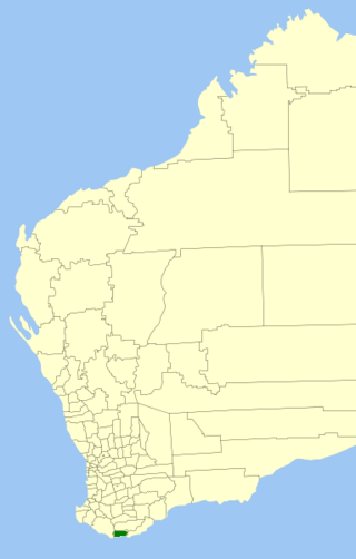
The Shire of Esperance is a local government area in the Goldfields–Esperance region of Western Australia, about 400 kilometres (250 mi) south of the town of Kalgoorlie and about 720 kilometres (450 mi) east-southeast of the state capital, Perth. The Shire covers an area of 42,547 square kilometres (16,427 sq mi), and its seat of government is the town of Esperance, where about three-quarters of the Shire's population resides.

The Shire of Jerramungup is a local government area in the Great Southern region of Western Australia, about 180 kilometres (112 mi) northeast of Albany and about 440 kilometres (273 mi) southeast of the state capital, Perth. The Shire covers an area of 6,507 square kilometres (2,512 sq mi) with Bremer Bay its largest town. The seat of government is the town of Jerramungup.
The Shire of Ravensthorpe is a local government area in the Great Southern region of Western Australia, about halfway between the city of Albany and the town of Esperance and about 530 kilometres (329 mi) southeast of the state capital, Perth. The Shire covers an area of 13,551 square kilometres (5,232 sq mi), and its seat of government is the town of Ravensthorpe.
Boscabel is a town and locality in the Shire of Kojonup, Great Southern region of Western Australia, located north of Kojonup. The Albany Highway passes through the locality, but not the townsite, from north to south.
Pingrup is a small town and locality in the Great Southern region of Western Australia. It is one of two localities in the Shire of Kent, the other being Nyabing, covering the west of the shire.
Cascade is a small town in Western Australia located 677 kilometres (421 mi) east of Perth along the South Coast between Ravensthorpe and Esperance in the Goldfields-Esperance region of Western Australia. The Griffiths, Fields and Cascade Nature Reserves are located within Cascade.

Coomalbidgup is a town and locality of the Shire of Esperance in the Goldfields-Esperance region of Western Australia. It is located on the South Coast Highway and the Southern Ocean. Almost the entire coast of the locality is covered by protected area, with the Stokes Inlet and the Stokes National Park in the west and two unnamed nature reserves in the east.
Dartnall is a rural locality of the Shire of Broomehill–Tambellup in the Great Southern region of Western Australia. The Great Southern Highway and the Great Southern Railway form the far western border of the locality.
Jacup is a rural locality of the Shire of Jerramungup in the Great Southern region of Western Australia. The South Coast Highway passes through the locality from west to east while the Fitzgerald River runs through it from north to south. The far south of Jacup is made up of a part of the Fitzgerald River National Park while, in the far north, a small section of the Lake Magenta Nature Reserve protrudes into Jacup.
West Fitzgerald is a rural locality of the Shire of Jerramungup in the Great Southern region of Western Australia. The South Coast Highway passes through the locality from west to east while its far south is made up of a part of the Fitzgerald River National Park.
West River is a rural locality of the Shire of Ravensthorpe in the Goldfields-Esperance region of Western Australia. The South Coast Highway passes through the locality from west to east. West River borders the Fitzgerald River National Park to the south and the townsite of Fitzgerald to the west. The West River and the Hammersley River originate in the locality. The Long Creek Nature Reserve as well as an unnamed nature reserve are located in the north of West River.

Kundip is an abandoned mining town of the Shire of Ravensthorpe in the Goldfields-Esperance region of Western Australia. It is located within the locality of Ravensthorpe, on the Hopetoun to Ravensthorpe Road.

Desmond is an abandoned mining town of the Shire of Ravensthorpe in the Goldfields-Esperance region of Western Australia. It is located within the locality of Ravensthorpe, on the Hopetoun to Ravensthorpe Road.

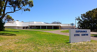
The suburb of Esperance is the central business district of the town of Esperance, in the Shire of Esperance, Goldfields-Esperance region of Western Australia. It is located on Esperance Bay, on the Southern Ocean.

Sinclair is a suburb of Esperance and a locality of the Shire of Esperance in the Goldfields-Esperance region of Western Australia. Esperance Senior High School is located in Sinclair.
Windabout is a suburb of Esperance and a locality of the Shire of Esperance in the Goldfields-Esperance region of Western Australia. The suburb is residential in the south-east, while the west is taken up by Esperance golf course and the north by parts of the Woody Lake Nature Reserve.
Monjingup is a locality of the Shire of Esperance in the Goldfields-Esperance region of Western Australia. The South Coast Highway and the Kalgoorlie to Esperance railway pass through Monjingup while the Coolgardie–Esperance Highway forms its eastern border. The western part of the townsite of Shark Lake is located in the north-east of Monjingup, while the Lake Warden Nature Reserve is located in the south-east.
Myrup is a locality of the Shire of Esperance in the Goldfields-Esperance region of Western Australia. The Coolgardie–Esperance Highway forms its western border of Myrup. The eastern part of the townsite of Shark Lake is located in the west of Myrup, while the Woody Lake Nature Reserve is located in the south-west.
Buraminya is a rural locality of the Shire of Esperance in the Goldfields-Esperance region of Western Australia. The locality is extensively covered by protected areas, the Dundas Nature Reserve and the Ngadju Indigenous Protected Area. Mount Buraminya, with a height of 233 metres (764 ft), is located in the south of Buraminya. Buraminya's eastern and south-eastern borders are formed by the boundary of Nuytsland Nature Reserve and Cape Arid National Park.

