List of major roads in Perth, Western Australia

Last updated

Freeways, highways, and arterial roads in Perth, Western Australia form the basis of the road network inside the Perth Metropolitan Region. Main Roads Western Australia controls and maintains all freeways and highways, as well as some arterial roads, [1] [2] collectively known as state roads. [3] [4] The remaining roads are the responsibility of local governments; [2] major roads provide links to various destinations within Perth Metropolitan Region. [5] [6] [7]

Some of these roads, or portions of them, are designated and signposted as part of a road route. [8] [9] National Highways and National Routes are road routes of national significance, whilst State Routes in Perth are allocated to the main routes connecting its urban centres. [8] Additionally, roads through areas of scenic or historic significance are designated as part of a Tourist Drive. [8] [9] Each route has a unique marker: National Highways have gold numbers on a green shield, National Routes have black numbers on a white shield, State Routes have white numbers on a blue shield, Tourist Drives have white numbers on a brown shield. [8]

Road [5] [6] [7] FromViaToNotes
Australian state route 55.svg Abernethy Road Belmont Kewdale Hazelmere State Route 55
Australian state route 30.svgAustralian Tourist Drive 205.svg Albany Highway Victoria Park Cannington Armadale State Route 30 / Tourist Drive 205. Continues south-east to Albany.
Australian state route 56.svg Alexander Drive Menora Dianella Landsdale State Route 56
Australian state route 14.svg Armadale Road Jandakot Forrestdale Armadale State Route 14
Bannister Road Canning Vale Thornlie
Beach Road Marmion Warwick Malaga
Australian state route 53.svg Beaufort Street Northbridge Mount Lawley Bedford State Route 53
Australian state route 14.svg Beeliar Drive Lake Coogee Beeliar Jandakot State Route 14
Australian state route 76.svg Benara Road Noranda Caversham State Route 76
Berrigan Drive Jandakot South Lake
Australian state route 72.svg The Boulevard City Beach Wembley State Route 72
Australian state route 40.svgAustralian Tourist Drive 205.svg Brookton Highway Kelmscott Roleystone Ashendon State Route 40 / Tourist Drive 205. Continues east to Brookton.
Australian state route 53.svgBroun Avenue Bedford Bayswater State Route 53
Australian state route 87.svg Burns Beach Road Iluka Currambine Neerabup State Route 87
Australian national route 1.svgAustralian state route 6.svg Canning Highway Fremantle Applecross Victoria Park National Route 1 / State Route 6
Australian state route 41.svgCanning Road Kalamunda Carmel Karragullen State Route 41
Australian state route 60.svg Charles Street Northbridge North Perth Joondanna State Route 60
Australian state route 12.svg Cockburn Road Hamilton Hill Coogee Naval Base State Route 12
Collier Road Morley Bassendean
Connolly Drive Currambine Clarkson Butler
Australian state route 36.svgCorfield Street Huntingdale Gosnells Champion Lakes State Route 36
Crimea Street Noranda Morley
Australian state route 71.svgAustralian Tourist Drive 204.svgCurtin Avenue Cottesloe North Fremantle State Route 71 / Tourist Drive 204
Drumpellier Drive Bennett Springs Whiteman Ellenbrook
Australian national route 1.svg Ennis Avenue Rockingham Warnbro Baldivis National Route 1
Farrington Road North Lake Leeming
Australian state route 56.svg Fitzgerald Street Northbridge North Perth Menora State Route 56
Australian state route 55.svgGarratt Road Bayswater Ascot State Route 55
Australian state route 83.svg Gnangara Road Madeley Cullacabardee Henley Brook State Route 83
Australian state route 8.svg Graham Farmer Freeway West Perth East Perth Rivervale State Route 8
Grand Boulevard Joondalup
Australian state route 55.svg Grand Promenade Dianella Bedford Bayswater State Route 55
Australian national highway 94.svgAustralian national route 1.svgAustralian state route 51.svgAustralian Tourist Drive 203.svg Great Eastern Highway Burswood Ascot South Guildford National Highway 94 / National Route 1 / State Route 51 / Tourist Drive 203. Continues east to Kalgoorlie
Guildford Mundaring The Lakes
Australian national highway 94.svg Great Eastern Highway Bypass South Guildford Hazelmere National Highway 94
Australian national highway 95.svgAustralian national route 1.svgAustralian Tourist Drive 203.svgAustralian Tourist Drive 359.svg Great Northern Highway Midland Upper Swan Bullsbrook National Highway 95 / National Route 1 / Tourist Drive 203 / Tourist Drive 359
Australian state route 51.svg Guildford Road Mount Lawley Bayswater Bassendean State Route 51
Australian state route 12.svg Hampton Road Fremantle Hamilton Hill State Route 12
Australian state route 82.svg Hepburn Avenue Hillarys Alexander Heights Ballajura State Route 82
Australian state route 27.svg High Road Riverton Lynwood State Route 27
Australian state route 7.svg High Street Fremantle Palmyra State Route 7
Hodges Drive Ocean Reef Heathridge Joondalup
Australian state route 85.svgAustralian Tourist Drive 359.svg Joondalup Drive Edgewater Joondalup Banksia Grove State Route 85 / Tourist Drive 359
Australian state route 41.svg Kalamunda Road South Guildford Maida Vale Kalamunda State Route 41
Karel Avenue Rossmoyne Leeming Jandakot
Australian state route 76.svgAustralian Tourist Drive 204.svg Karrinyup Road Trigg Karrinyup Balcatta State Route 76 / Tourist Drive 204
Australian state route 30.svg Kenwick Link Beckenham Kenwick Maddington State Route 30
Kewdale Road Welshpool Kewdale
Australian national route 1.svgAustralian state route 2.svg Kwinana Freeway Perth Cockburn Central Baldivis National Route 1 / State Route 2. Continues south to Ravenswood.
Australian national route 1.svgAustralian state route 7.svg Leach Highway Palmyra Rossmoyne Kewdale National Route 1 / State Route 7
Australian state route 61.svg Loftus Street Subiaco Leederville Mount Hawthorn State Route 61
Australian state route 51.svg Lord Street Perth Highgate Mount Lawley State Route 51
Malaga Drive Noranda Malaga
Australian national route 1.svgAustralian state route 22.svg Mandurah Road Kwinana Beach Secret Harbour Halls Head National Route 1 / State Route 22
Australian state route 26.svg Manning Road Manning Bentley Cannington State Route 26
Australian state route 81.svg Marangaroo Drive Marangaroo Alexander Heights Ballajura State Route 81
Australian state route 71.svg Marmion Avenue Karrinyup Ocean Reef Yanchep State Route 71
Marshall Road Dayton Bennett Springs Malaga
Mirrabooka Avenue Nollamara Mirrabooka Landsdale
Australian state route 2.svg Mitchell Freeway Perth Osborne Park Joondalup State Route 2
Australian state route 76.svg Morley Drive Balcatta Dianella Morley State Route 76
Australian state route 76.svgMorley Drive East Morley Kiara Eden Hill State Route 76
Australian national route 1.svgAustralian Tourist Drive 203.svg Morrison Road Woodbridge Midvale Swan View National Route 1 / Tourist Drive 203
Australian state route 5.svg Mounts Bay Road Crawley Perth State Route 5
Australian state route 22.svgMundijong Road Baldivis Oldbury Mundijong State Route 22
Australian state route 85.svgAustralian Tourist Drive 359.svg Neaves Road Carramar Mariginiup Bullsbrook State Route 85 / Tourist Drive 359
Australian state route 31.svg Nicholson Road Beckenham Canning Vale Oakford State Route 31
Australian state route 77.svg North Beach Road North Beach Karrinyup Gwelup State Route 77
North Lake Road Alfred Cove Bibra Lake Cockburn Central
Australian state route 84.svgAustralian Tourist Drive 204.svg Ocean Reef Road Ocean Reef Edgewater Landsdale State Route 84 / Tourist Drive 204
Australian state route 8.svg Orrong Road Rivervale Welshpool State Route 8
Australian national route 1.svgAustralian state route 18.svg Patterson Road Rockingham Kwinana Beach National Route 1 / State Route 18
Australian state route 64.svgPearson Street Floreat Woodlands State Route 64
Australian state route 13.svg Ranford Road Canning Vale Forrestdale State Route 13
Australian state route 3.svg Reid Highway North Beach Malaga Middle Swan State Route 3
Australian state route 5.svg Riverside Drive Perth East Perth State Route 5
Australian national route 1.svgAustralian state route 14.svg Rockingham Road Hamilton Hill Henderson Kwinana Beach National Route 1 / State Route 14
Australian national highway 94.svgAustralian national highway 95.svgAustralian state route 3.svg Roe Highway Middle Swan Beckenham Bibra Lake National Highway 94 / National Highway 95 / State Route 3
Russell Road Munster Success
Australian state route 18.svgAustralian Tourist Drive 202.svg Safety Bay Road Peron Safety Bay Baldivis State Route 18 / Tourist Drive 202
Australian state route 75.svg Scarborough Beach Road North Perth Innaloo Scarborough State Route 75
Australian state route 64.svgSelby Street Wembley Shenton Park State Route 64
Shenton Avenue Ocean Reef Joondalup
Australian state route 30.svg Shepperton Road Victoria Park East Victoria Park State Route 30
Australian state route 13.svg South Street South Fremantle Murdoch Canning Vale State Route 13
Australian state route 20.svg South Western Highway Armadale Byford Serpentine State Route 20 / State Route 22 / Tourist Drive 205
Australian state route 14.svgSpearwood Avenue North Coogee Spearwood Beeliar State Route 14
Australian state route 36.svgSpencer Road Langford Thornlie State Route 36
Australian state route 64.svg Stephenson Avenue Osborne Park Woodlands State Route 64
Australian state route 65.svg Floreat Mt Claremont State Route 65
Australian national route 1.svg Stock Road Attadale O'Connor Beeliar National Route 1
Australian state route 5.svg Stirling Highway Crawley Claremont Fremantle State Route 5
Australian state route 21.svg Thomas Road Kwinana Beach Oakford Byford State Route 21
Australian state route 61.svg Thomas Street Shenton Park Subiaco State Route 61
Australian state route 4.svg Tonkin Highway Bullsbrook Perth Airport Oakford State Route 4. Continues north to Muchea.
Australian state route 50.svg Toodyay Road Middle Swan Red Hill Gidgegannup State Route 50. Continues north-east to Toodyay.
Tydeman Road North Fremantle Fremantle Port
Vahland Avenue Riverton Willetton
Australian state route 72.svg Vincent Street Leederville Mount Lawley State Route 72
Australian state route 75.svg Walcott Street Mount Lawley Menora Coolbinia State Route 75
Warton Road Thornlie Southern River Banjup
Welshpool Road St James Welshpool
Australian state route 8.svg Welshpool Road East Welshpool Wattle Grove Carmel State Route 8
Australian state route 71.svgAustralian Tourist Drive 204.svg West Coast Highway Cottesloe City Beach Karrinyup State Route 71 / Tourist Drive 204
Australian state route 52.svgAustralian Tourist Drive 203.svg West Swan Road Guildford West Swan Upper Swan State Route 52 / Tourist Drive 203
Australian state route 83.svgAustralian Tourist Drive 204.svg Whitfords Avenue Hillarys Padbury Woodvale State Route 83 / Tourist Drive 204
Australian state route 53.svg William Street Mount Lawley Highgate Perth State Route 53
Yanchep Beach Road Yanchep Yanchep Beach

See also

Related Research Articles

<span class="mw-page-title-main">Highways in Australia</span>

Highways in Australia are generally high capacity roads managed by state and territory government agencies, though Australia's federal government contributes funding for important links between capital cities and major regional centres. Prior to European settlement, the earliest needs for trade and travel were met by narrow bush tracks, used by tribes of Indigenous Australians. The formal construction of roads began in 1788, after the founding of the colony of New South Wales, and a network of three major roads across the colony emerged by the 1820s. Similar road networks were established in the other colonies of Australia. Road construction programs in the early 19th century were generally underfunded, as they were dependent on government budgets, loans, and tolls; while there was a huge increase in road usage, due to the Australian gold rushes. Local government authorities, often known as Road Boards, were therefore established to be primarily responsible for funding and undertaking road construction and maintenance. The early 1900s saw both the increasingly widespread use of motorised transportation, and the creation of state road authorities in each state, between 1913 and 1926. These authorities managed each state's road network, with the main arterial roads controlled and maintained by the state, and other roads remaining the responsibility of local governments. The federal government became involved in road funding in the 1920s, distributing funding to the states. The depression of the 1930s slowed the funding and development of the major road network until the onset on World War II. Supply roads leading to the north of the country were considered vital, resulting in the construction of Barkly, Stuart, and Eyre Highways.

<span class="mw-page-title-main">Highway 1 (Australia)</span> Network of highways that circumnavigate Australia

Australia's Highway 1 is a network of highways that circumnavigate the country, joining all mainland capital cities except the national capital of Canberra. At a total length of approximately 14,500 km (9,000 mi) it is the longest national highway in the world, surpassing the Trans-Siberian Highway and the Trans-Canada Highway. Over a million people traverse some part of the highway network every day. It is the longest continuing highway in the world as the Pan-American Highway is separated by the Darién Gap and AH1 is separated by the Sea of Japan. However it is not the longest continuous stretch of highway as both the northern section of the Pan-American Highway and the continental section of AH1 still out-measure it.

A routenumber, designation or abbreviation is an identifying numeric designation assigned by a highway authority to a particular stretch of roadway to distinguish it from other routes and, in many cases, also to indicate its classification, general geographical location and/or orientation. The numbers chosen may be used solely for internal administrative purposes; however, in most cases they are also displayed on roadside signage and indicated on maps.

<span class="mw-page-title-main">Great Eastern Highway</span> Highway in Western Australia

Great Eastern Highway is a 590-kilometre-long (370 mi) road that links the Western Australian capital of Perth with the city of Kalgoorlie. A key route for road vehicles accessing the eastern Wheatbelt and the Goldfields, it is the western portion of the main road link between Perth and the eastern states of Australia. The highway forms the majority of National Highway 94, although the alignment through the Perth suburbs of Guildford and Midland, and the eastern section between Coolgardie and Kalgoorlie are not included. Various segments form parts of other road routes, including National Route 1, Alternative National Route 94, and State Route 51.

The Kwinana Freeway is a 72-kilometre (45 mi) freeway in and beyond the southern suburbs of Perth, Western Australia, linking central Perth with Mandurah to the south. It is the central section of State Route 2, which continues north as Mitchell Freeway to Clarkson, and south as Forrest Highway towards Bunbury. A 4-kilometre (2.5 mi) section between Canning and Leach highways is also part of National Route 1. Along its route are interchanges with several major roads, including Roe Highway and Mandjoogoordap Drive. The northern terminus of the Kwinana Freeway is at the Narrows Bridge, which crosses the Swan River, and the southern terminus is at Pinjarra Road, east of Mandurah.

The Mitchell Freeway is a 41.5-kilometre-long (25.8 mi) freeway in the northern suburbs of Perth, Western Australia, linking central Perth with the city of Joondalup. It is the northern section of State Route 2, which continues south as Kwinana Freeway and Forrest Highway. Along its length are interchanges with several major roads, including the Graham Farmer Freeway and Reid Highway. The southern terminus of the Mitchell Freeway is at the Narrows Bridge, which crosses the Swan River, and the northern terminus is at Romeo Road in Alkimos.
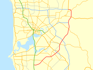
<span class="mw-page-title-main">Roe Highway</span> Highway in Perth, Western Australia

Roe Highway is a 35-kilometre-long (22 mi) limited-access highway and partial freeway in Perth, Western Australia, linking Kewdale with the city's north-eastern and south-western suburbs. The northern terminus is at Reid Highway and Great Northern Highway in Middle Swan, and the southern terminus is with Murdoch Drive at the Kwinana Freeway interchange in Bibra Lake. Roe Highway, in addition to Reid Highway, form State Route 3, a partial ring road around the outer suburbs of the Perth metropolitan area. Roe Highway also forms part of National Highway 94 from Great Eastern Highway Bypass to Great Eastern Highway, and National Highway 95 from Great Eastern Highway to Great Northern Highway.
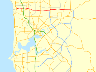
<span class="mw-page-title-main">Reid Highway</span> Highway in Perth, Western Australia

Reid Highway is a 23-kilometre (14 mi) east-west highway and partial freeway in the northern suburbs of Perth, Western Australia, linking North Beach with Middle Swan. As part of State Route 3, it forms half of Perth's outer ring road along with Roe Highway, which it joins onto at its eastern terminus.

Tonkin Highway is an 81-kilometre-long (50 mi) north–south highway and partial freeway in Perth, Western Australia, linking Perth Airport and Kewdale with the city's north-eastern and south-eastern suburbs. As of April 2020, the northern terminus is at the interchange with Brand Highway and Great Northern Highway in Muchea, and the southern terminus is at Thomas Road in Oakford. It forms the entire length of State Route 4, and connects to several major roads. Besides Brand Highway and Great Northern Highway, it also connects to Reid Highway, Great Eastern Highway, Leach Highway, Roe Highway, and Albany Highway.

<span class="mw-page-title-main">Mount Alexander Road</span> Road in Melbourne, Victoria

Mount Alexander Road is a major road in Melbourne's inner northern suburbs, connecting the northern edges of the city district to just south of Essendon Airport. It was named after its original destination: the Gold Fields of Mount Alexander, now known as Castlemaine.

Transport in Perth, Western Australia, is served by various means, among them an extensive highway/freeway network and a substantial system of commuter rail lines and bus routes. Public transport is managed by the Transperth agency.

Charles Street is a major road in the inner northern suburbs of Perth, Western Australia. It runs from Newcastle Street and extends up to London Street, providing a connection between Mitchell Freeway and Wanneroo Road. It is the southern section of part of State Route 60, which continues north along Wanneroo Road.

References

  1. "Metropolitan Roads Controlled by Main Roads Western Australia". Understanding Roads - Facts. Main Roads Western Australia. Archived from the original on 13 January 2013. Retrieved 7 November 2012.
  2. 1 2 "Metropolitan Road Fact Sheet". Main Roads Western Australia. 1 February 2011. Archived from the original (PDF) on 17 March 2012. Retrieved 25 October 2012.
  3. "State Road Network". Understanding Roads - Facts - Road Information Mapping. Main Roads Western Australia. Archived from the original on 18 February 2013. Retrieved 7 November 2012.
  4. "Western Australian Road Hierarchy". Main Roads Western Australia. Archived from the original (PDF) on 21 March 2012. Retrieved 7 November 2012.
  5. 1 2 Main Roads Western Australia (7 September 2017). "Map 1 – Perth City" (PDF) (Map). Perth Metropolitan Destinations. Not to scale. Government of Western Australia. Archived (PDF) from the original on 16 May 2018.
  6. 1 2 Main Roads Western Australia (24 September 2017). "Map 2 – Northern Metropolitan Area" (PDF) (Map). Perth Metropolitan Destinations. Not to scale. Government of Western Australia. Archived (PDF) from the original on 16 May 2018.
  7. 1 2 Main Roads Western Australia (7 September 2017). "Map 3 – Southern Metropolitan Area" (PDF) (Map). Perth Metropolitan Destinations. Not to scale. Government of Western Australia. Archived (PDF) from the original on 16 May 2018.
  8. 1 2 3 4 Distance book (12 ed.). Main Roads Western Australia. 2012. pp. 4–5. ISBN   0 7309 7657 2. Archived from the original on 24 October 2012. Retrieved 8 October 2012.
  9. 1 2 "State Map" (PDF). Western Australian Land Information Authority. 2010. Archived (PDF) from the original on 7 September 2012. Retrieved 3 November 2012.