Dianella is a suburb of Perth, Western Australia. It is within the local government area of the City of Stirling.

Inglewood is an inner-city suburb of Perth, Western Australia, 4 kilometres (2 mi) north-east of its central business district. It is located within the local government area of the City of Stirling.

Mount Lawley is an inner northern suburb of Perth, Western Australia. The suburb is bounded by the Swan River to the east, Vincent, Harold and Pakenham Streets to the south, Central Avenue and Alexander Drive to the north, and Norfolk Street to the west.

Bassendean is a north-eastern suburb of Perth, Western Australia. Its local government area is the Town of Bassendean.
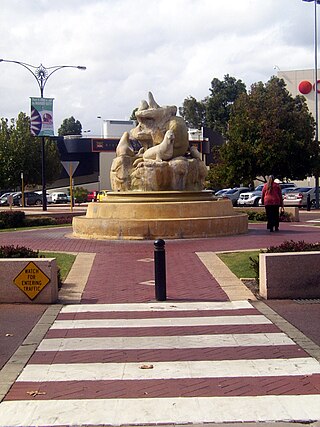
Morley is a suburb of Perth, within the City of Bayswater local government area, situated approximately 10 kilometres (6 mi) northeast of the Perth central business district. It contains the Galleria Shopping Centre, one of Perth's larger shopping centres. Morley bus station is located in the car park of the shopping centre. From the late 1950s, Morley began to develop as a major shopping and commercial centre.

Mount Lawley railway station is 3.2 kilometres (2.0 mi) from Perth railway station, in Western Australia, on the Midland Line and Airport line on the Transperth commuter rail network.

Maylands railway station is a suburban rail station in Maylands, a suburb of Perth, Western Australia. It is on the Midland and Airport lines, between Mount Lawley station and Meltham station. Maylands stationis 4.5 kilometres (2.8 mi), or eight minutes by train, from Perth station. Services on each line run every 12 minutes during peak and every 15 minutes between peak for a combined frequency of a train every 6 minutes during peak and every 7.5 minutes outside peak.

Bayswater railway station is a suburban rail station in Bayswater, a suburb of Perth, Western Australia. It is the junction station for Transperth's Midland and Airport lines, and the Ellenbrook line when it opens on 8 December 2024.

Bedford is a suburb 6 kilometres (4 mi) north-east of the central business district (CBD) of Perth, the capital of Western Australia. Named after Frederick Bedford, the Governor of Western Australia from 1903 to 1909, the suburb is within the City of Bayswater local government area. It is predominantly a low density residential suburb consisting of single-family detached homes, with clusters of commercial buildings along Beaufort Street, Grand Promenade and Walter Road.
Embleton is a suburb of Perth, the capital city of Western Australia, located 7 kilometres (4.3 mi) north-east of the central business district, between the suburbs of Morley and Bayswater. Its local government area is the City of Bayswater.

Barrack Street is one of two major cross-streets in the central business district of Perth, Western Australia. Together with St Georges Terrace, Wellington Street and William Street it defines the boundary of the main shopping precinct of the central city.

The Horseshoe Bridge in Perth, Western Australia is a traffic bridge that connects the Perth CBD to Northbridge, carrying William Street. It was constructed in 1904 to pass over the Fremantle railway line, with the horseshoe shape designed to fit the approach ramps into a constricted site.

Nedlands is a western suburb of Perth, the capital city of Western Australia. It is a part of the local government areas of the City of Nedlands and the City of Perth. It is about 7 kilometres (4 mi) from the Perth CBD via either Thomas Street or Mounts Bay Road.

Alexander Drive is a major north–south arterial road in the northern suburbs of Perth, Western Australia, connecting Perth's central business district (CBD) with Edith Cowan University's Mount Lawley campus and the Malaga industrial area, as well as newer development suburbs to Perth's north. It is used by Transperth bus routes, including the 360, 361 and 362. Alexander Drive was named after Mr S.B. Alexander, a former Wanneroo Road Board member. Alexander Drive runs through the following local government areas City of Wanneroo, City of Swan, City of Bayswater and City of Stirling.

Beechboro Road is a north–south arterial road located in the northeastern suburbs of Perth, Western Australia, connecting Morley and Bayswater with areas further north. Until the construction of the nearby section of Tonkin Highway between 1984 and 1992, and later, during the NorthLink WA road project between 2016 and 2019, Beechboro Road was one of northeastern Perth's most important routes. The road is discontinuous at Tonkin Highway, with the section from Tonkin Highway to Walter Road officially known as Beechboro Road North, and the section running through Bayswater as Beechboro Road South.

William Street is a suburban distributor and one of two major cross-streets in the central business district of Perth, Western Australia. Commencing in western Mount Lawley, its route takes it through the Northbridge café and nightclub district as well as the CBD.

Perth is a suburb in the Perth metropolitan region, Western Australia that includes both the central business district of the city, and a suburban area spreading north to the northern side of Hyde Park. It does not include the separate suburbs of Northbridge or Highgate. Perth is split between the City of Perth and the City of Vincent local authorities, and was named after the city of the same name in Scotland.

The Perth tramway network served Perth, the capital city of Western Australia, from 1899 until 1958. The network was initially run by a private company but was taken over by the state government in 1913. From a single line along Hay Street, the network expanded north as far as Osborne Park, east as far as Welshpool, south as far as Como, and west as far as Claremont. The tramways were gradually replaced by buses after World War II.

Walter Road is a road in the north-eastern suburbs of Perth, Western Australia. Formerly a continuous road, it is now discontinuous at Tonkin Highway. The western section of the road is known as Walter Road West, and the eastern section of the road is known as Walter Road East.
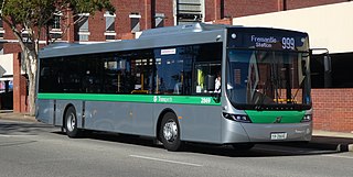
Buses in Perth, the capital city of Western Australia, are run under the Transperth brand. The system is owned and managed by the Public Transport Authority and operations are contracted out to private operators: Swan Transit, Path Transit and Transdev.

