Northbridge Perth, Western Australia | |||||||||||||||
---|---|---|---|---|---|---|---|---|---|---|---|---|---|---|---|
![]() William Street, Northbridge | |||||||||||||||
![]() | |||||||||||||||
Coordinates | 31°56′46″S115°51′14″E / 31.946°S 115.854°E | ||||||||||||||
Population | 1,420 (SAL 2021) [1] | ||||||||||||||
Postcode(s) | 6003 | ||||||||||||||
Area | 0.5 km2 (0.2 sq mi) [2] | ||||||||||||||
Location | 1 km (1 mi) N of the Perth CBD | ||||||||||||||
LGA(s) | City of Perth | ||||||||||||||
State electorate(s) | Perth | ||||||||||||||
Federal division(s) | Perth | ||||||||||||||
|
Northbridge is an inner city suburb of Perth, Western Australia, historically separated from Perth's central business district by the Fremantle and Joondalup railway lines. It is part of the City of Perth local government area.
Located immediately north of the CBD, Northbridge is officially bounded by William Street, Roe Street, Newcastle Street and the Mitchell Freeway.
The name Northbridge is often misapplied to areas and landmarks east of William Street and/or north of Newcastle Street,[ citation needed ] such as the Perth Cultural Centre, which are technically still part of the suburb of Perth.
The area is accessible by foot from Perth railway station and Perth Busport. It is served by a free Central Area Transit bus and also has a significant number of public car parks, both open and high rise.
The area is largely a mix of commercial, public and residential properties.
The area now known as Northbridge originally hosted freshwater swamps where the current railway station and railway lines are. [3]
Draining of the swamps commenced in the 1860s, by convict labour, facilitating the construction of more permanent buildings. [3] The gold boom of the 1890s saw the construction of many hotels for the accommodation of prospectors, including The Great Western Hotel (built 1896, now the Brass Monkey Hotel). [3] [4] The 1890s saw the area home to the state attorney-general and many other wealthy or influential people. [3]
Several private schools were also established in the late colonial area, such as Scotch College (1897) and Presbyterian Ladies' College (1915). [3] These schools have since relocated. Around the time of World War I, the area became a hub of European immigration, especially Greek and Macedonian. [3]
In the 1950s and 60s post-war European migration changed the culture of the city, creating an al-fresco lifestyle of restaurants, cafes and bars that people enjoy today. [3]
The area was once a part of the Perth central business district, and was known by informal names such as "North of the Bridge" and "North of the [railway] Line". It was split from Perth and officially gazetted as a suburb in 1982. [5]
Northbridge presently is a multicultural precinct, and contains a wide array of cuisine, including Asian and Mediterranean cuisine, and contains Perth's main nightlife district, which is centred on James Street and Lake Street. Northbridge's restaurant, cafe and bar scene varies from laneway bars and hole in the wall eateries, to prominent multi storey venues such as the Brass Monkey and Metro City concert club. Northbridge also hosts Perth's main Chinatown area centred around Chung Wah Lane. [6]
The area has a historical connection to the Greek and Italian communities, with Perth's first Orthodox Church located on Parker Street. [7] [8]
The main public open space area in the suburb is at Russell Square. The Northbridge Piazza also serves as an open air communal space, which has been used as a venue to show free movies, live music performances, and broadcasts of popular sporting events. [9]
In March 2018, Yagan Square was officially opened, a new public space between the CBD and Northbridge. The Digital Tower, the Marketplace and recreational areas are now available for tourists and residents.
In the early 2000s the Northbridge History Project was supported by the Government of Western Australia, on the recommendation of a report to the Premier Richard Court. The project finished in 2010.
Northbridge History Study Days were conducted in 2007, 2008, 2009 and 2010. [10]
During the project duration publications were produced, and an archive of the project was made, with publications and reports available on the project website. [11] [12]
The book published in 2009 compiling the Study Days papers [13] had the following items from two years:
Bus routes serving Fitzgerald Street:
The former separation of the Perth CBD and Northbridge has been changed through the Perth City Link project - which saw the former railway yard that was just to the west of the Perth railway station changed to an urban development project. Northbridge now connects through to the Perth CBD through Yagan Square and Manatj Park. [20]
Notable people from or who have lived in Northbridge include:
Balcatta is a suburb of Perth, Western Australia. Its local government area is the City of Stirling. It is a primarily middle-class suburb made up of mainly Italian, Greek and Macedonian families, as well as many families from other European countries. It is also one of the largest suburbs in the northern part of the Perth metropolitan area. Much of Balcatta is a commercial and industrial area.
Balga is a suburb of Perth, the capital city of Western Australia, 13 kilometres (8 mi) north of Perth city's central business district (CBD). Its local government area is the City of Stirling. Mark Irwin is the current mayor.
Dianella is a suburb of Perth, Western Australia. It is within the local government area of the City of Stirling.
Mirrabooka is a suburb of Perth, Western Australia. Its local government area is the City of Stirling. At the 2021 census it had a population of 8,000 people.
Nollamara is a suburb of Perth, Western Australia. Its local government area is the City of Stirling.
Tuart Hill is a suburb of Perth, Western Australia.
Armadale is a suburb of Perth within the City of Armadale, located on the south-eastern edge of the Perth metropolitan region. The major junction of the South Western and Albany Highways, which connect Perth with the South West and Great Southern regions of Western Australia respectively, is located within the suburb. It is also the terminus of the Armadale railway line, one of five major railway lines to service Perth.
Elizabeth Quay bus station, formerly the Esplanade Busport, is a Transperth bus station, located at the southern edge of the Perth CBD in Western Australia, next to the Perth Convention Exhibition Centre and Elizabeth Quay railway station. It has 35 stands and is served by 55 Transperth routes operated by Path Transit, Swan Transit and Transdev WA. It is also served by South West Coach Lines services.
Como is a suburb of Perth, Western Australia. Its local government area is the City of South Perth. The suburb has a population of 12,423. Canning Highway divides the suburb.
Burswood is an inner southeastern suburb of Perth, Western Australia, located immediately across the Swan River from Perth's central business district (CBD). Its local government area is the Town of Victoria Park. Burswood is the location of the State Tennis Centre, Perth Stadium, Belmont Park Racecourse, and the Crown Perth casino and hotel complex.
Alexander Heights is a suburb of Perth, Western Australia within the City of Wanneroo.
Welshpool is an inner southeastern suburb of Perth, Western Australia, located mostly within the City of Canning and partially within the Town of Victoria Park.
Cannington is a southern suburb of Perth, Western Australia. Its local government area is the City of Canning.
North Perth is a suburb of Perth, Western Australia, located within the City of Vincent.
East Victoria Park is an inner south-eastern suburb of Perth, Western Australia, located within the Town of Victoria Park.
Beckenham is a suburb of Perth, Western Australia, located within the City of Gosnells.
Malaga is a suburb of Perth, Western Australia, approximately 11 kilometres (6.8 mi) north of the CBD, in the City of Swan.
Stirling is a suburb of Perth, the capital city of Western Australia, about 10 km north of Perth's central business district (CBD) along the Mitchell Freeway. Its local government area is the City of Stirling, whose council offices and administration centre are located in the southwest of the mostly residential suburb.
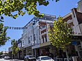
Perth is a suburb in the Perth metropolitan region, Western Australia that includes both the central business district of the city, and a suburban area spreading north to the northern side of Hyde Park. It does not include the separate suburbs of Northbridge or Highgate. Perth is split between the City of Perth and the City of Vincent local authorities, and was named after the city of the same name in Scotland.
Perth Busport is an underground central bus station in Perth, Western Australia, located underneath Wellington Street. It was officially opened by then Premier of Western Australia Colin Barnett and then Minister for Transport Dean Nalder on 13 July 2016.
{{citation}}
: CS1 maint: multiple names: authors list (link) CS1 maint: numeric names: authors list (link)