Highgate, Western Australia

Last updated

Highgate
Perth,  Western Australia
QueensHotelHighgate gobeirne.jpg
The Queens Hotel, Highgate
Highgate, Western Australia
Coordinates 31°56′24″S115°52′08″E / 31.94°S 115.869°E / -31.94; 115.869 (Highgate)
Population2,326 (SAL 2021) [1]
Postcode(s) 6003
Area0.4 km2 (0.2 sq mi)
Location2 km (1 mi) NNE of the Perth CBD
LGA(s) City of Vincent
State electorate(s) Perth
Federal division(s) Perth
Suburbs around Highgate:
North Perth Mount Lawley Mount Lawley
Perth Highgate Perth
Perth Perth Perth

Highgate is an inner metro suburb of Perth, Western Australia, located within the City of Vincent and north of the central business district of Perth. Highgate was named for the village of Highgate, Hawkhurst in Kent, England. Highgate is the smallest suburb in the Perth metropolitan region, with an area of just 0.4 km2 (0.2 sq mi).

Contents

Among the landmarks of the area is the Lincoln Street Vent, a disused Art Deco sewerage vent, designed by Russell Dumas and completed in 1935, alongside the disused Highgate Hill Police Station (which is also the site of the WAPOL Historical Society's Police Museum) [ citation needed ]). The vent, which proved to be a "white elephant", was secretly used as an antenna base by the Police Wireless Service during World War II.[ citation needed ]

The Lincoln Street Vent in Highgate, taken from the Stirling Towers apartment block. Police com tower gnangarra.JPG
The Lincoln Street Vent in Highgate, taken from the Stirling Towers apartment block.

St Mark's International College, an English as a second language (ESL) school operated between 1989 and 2010, at 375 Stirling Street, on the corner of Harold Street. [2] The St Mark's buildings were constructed from 1936, as a Catholic Christian Brothers boys' high school. This was known as CBHS Highgate until 1978, when it merged with St Mark's in Bedford (previously CBHS Bedford) and received that school's students. The name of the school was changed to St Mark's College Highgate in 1982. St Mark's was closed and sold several years later, when all students were transferred to Chisholm College, in Bedford. St Mark's re-development into an apartment complex was completed in 2013. [3] [4]

The suburb has two primary schools: Sacred Heart (a Catholic school) and Highgate Primary School (the second oldest government primary school in the state). Highgate Primary School has students from over 50 different nationalities and backgrounds. The school also has a highly successful chess team and rock band. Highgate Primary participates actively in local sporting events and teaches the Indonesian language as a special LOTE.

Transport

Bus

See also

Related Research Articles

Dianella is a suburb of Perth, Western Australia. It is within the local government area of the City of Stirling.

<span class="mw-page-title-main">Tuart Hill, Western Australia</span> Suburb of Perth, Western Australia

Tuart Hill is a suburb of Perth, Western Australia.

<span class="mw-page-title-main">Claremont, Western Australia</span> Suburb of Perth, Western Australia

Claremont is a western suburb of Perth, Western Australia, on the north bank of the Swan River.

<span class="mw-page-title-main">Rivervale, Western Australia</span> Suburb of Perth, Western Australia

Rivervale is an inner eastern suburb of Perth, Western Australia. It is near the Swan River, 5 kilometres (3 mi) from the Perth central business district, and within the City of Belmont.

Cloverdale is a suburb of Perth, the capital city of Western Australia, 10 kilometres (6 mi) east of Perth's CBD in the City of Belmont.

<span class="mw-page-title-main">Morley, Western Australia</span> Suburb of Perth, Western Australia

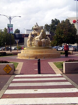
Morley is a suburb of Perth, within the City of Bayswater local government area, situated approximately 10 kilometres (6 mi) northeast of the Perth central business district. It contains the Galleria Shopping Centre, one of Perth's larger shopping centres. Morley bus station is located in the car park of the shopping centre. From the late 1950s, Morley began to develop as a major shopping and commercial centre.

<span class="mw-page-title-main">Elizabeth Quay bus station</span> Bus station in Perth, Western Australia

Elizabeth Quay bus station, formerly the Esplanade Busport, is a Transperth bus station, located at the southern edge of the Perth CBD in Western Australia, next to the Perth Convention Exhibition Centre and Elizabeth Quay railway station. It has 35 stands and is served by 55 Transperth routes operated by Path Transit, Swan Transit and Transdev WA. It is also served by South West Coach Lines services.

<span class="mw-page-title-main">Como, Western Australia</span> Suburb of Perth, Western Australia

Como is a suburb of Perth, Western Australia. Its local government area is the City of South Perth. The suburb has a population of 12,423. Canning Highway divides the suburb.

<span class="mw-page-title-main">Burswood, Western Australia</span> Suburb of Perth, Western Australia

Burswood is an inner southeastern suburb of Perth, Western Australia, located immediately across the Swan River from Perth's central business district (CBD). Its local government area is the Town of Victoria Park. Burswood is the location of the State Tennis Centre, Perth Stadium, Belmont Park Racecourse, and the Crown Perth casino and hotel complex.

<span class="mw-page-title-main">Carlisle, Western Australia</span> Suburb of Perth, Western Australia

Carlisle is a suburb of Perth, Western Australia. Its local government area is the Town of Victoria Park.

<span class="mw-page-title-main">Embleton, Western Australia</span> Suburb of Perth, Western Australia

Embleton is a suburb of Perth, the capital city of Western Australia, located 7 kilometres (4.3 mi) north-east of the central business district, between the suburbs of Morley and Bayswater. Its local government area is the City of Bayswater.

<span class="mw-page-title-main">Kewdale, Western Australia</span> Suburb of Perth, Western Australia

Kewdale is a suburb of Perth, Western Australia within the City of Belmont. Kew Street was one of the first roads in this district, hence the naming of the suburb.

<span class="mw-page-title-main">Bentley, Western Australia</span> Suburb of Perth, Western Australia

Bentley is a southern suburb of Perth, the capital city of Western Australia, 8 kilometres (5.0 mi) southeast of Perth's central business district. Its local government areas are the City of Canning and the Town of Victoria Park. Bentley is home to the main campus of Curtin University and Technology Park.

St James is a suburb shared between the Town of Victoria Park and the City of Canning in the Perth metropolitan area.

<span class="mw-page-title-main">Beaconsfield, Western Australia</span> Suburb of Perth, Western Australia

Beaconsfield is a suburb of Perth, Western Australia, located within the City of Fremantle. It was named after a property of the same name in the area in the 1880s; the name was officially adopted from the post office on 1 August 1894. The name's origin is unknown, but it probably comes from the town in England or the Earl of Beaconsfield, Benjamin Disraeli, a former Conservative Prime Minister of the United Kingdom.

<span class="mw-page-title-main">East Victoria Park, Western Australia</span> Suburb of Perth, Western Australia

East Victoria Park is an inner south-eastern suburb of Perth, Western Australia, located within the Town of Victoria Park.

<span class="mw-page-title-main">Lesmurdie, Western Australia</span> Suburb of Perth, Western Australia

Lesmurdie is a suburb of Perth, Western Australia, located within the City of Kalamunda. It was established in 1897 by Archibald Sanderson, a politician and journalist, who began buying properties in the area from the Canning Jarrah Timber Company to build up a rural retreat and fruit-growing property. He named it after Lesmurdie Cottage, a shooting box near Dufftown, Scotland that his father had rented. It was officially gazetted on 8 June 1959.

<span class="mw-page-title-main">Nedlands, Western Australia</span> Suburb of Perth, Western Australia

Nedlands is a western suburb of Perth, the capital city of Western Australia. It is a part of the local government areas of the City of Nedlands and the City of Perth. It is about 7 kilometres (4 mi) from the Perth CBD via either Thomas Street or Mounts Bay Road.

<span class="mw-page-title-main">Perth (suburb)</span> Suburb of Perth, Western Australia

Perth is a suburb in the Perth metropolitan region, Western Australia that includes both the central business district of the city, and a suburban area spreading north to the northern side of Hyde Park. It does not include the separate suburbs of Northbridge or Highgate. Perth is split between the City of Perth and the City of Vincent local authorities, and was named after the city of the same name in Scotland.

<span class="mw-page-title-main">Fremantle (suburb)</span> Suburb of Perth, Western Australia

Fremantle is a Western Australian suburb located in Perth at the mouth of the Swan River, and is situated 18 kilometres (11 mi) from the Perth central business district. One of the original settlements of the Swan River Colony established in 1829 is within the area known today as this suburb.

References

  1. Australian Bureau of Statistics (28 June 2022). "Highgate (WA) (suburb and locality)". Australian Census 2021 QuickStats. Retrieved 28 June 2022.  OOjs UI icon edit-ltr-progressive.svg
  2. Welcome to the Highgate Old Boys Association (HOBA); CBHS Highgate (1936–1978); Christian Brothers High School Highgate
  3. "Finbar buys Highgate college for $11.8 million". Business News. Perth. 8 February 2007. Retrieved 28 July 2022.
  4. "St Marks Apartments". Finbar Group. 2022. Retrieved 28 July 2022.
  5. "Route 40". Bus Timetable 103 (PDF). Transperth. 9 April 2024 [effective from 22 April 2024].
  6. "Route 41". Bus Timetable 103 (PDF). Transperth. 9 April 2024 [effective from 22 April 2024].
  7. "Route 42". Bus Timetable 103 (PDF). Transperth. 9 April 2024 [effective from 22 April 2024].
  8. "Route 43". Bus Timetable 103 (PDF). Transperth. 9 April 2024 [effective from 22 April 2024].
  9. "Route 67". Bus Timetable 106 (PDF). Transperth. 3 May 2023 [effective from 12 June 2023].
  10. "Route 68". Bus Timetable 106 (PDF). Transperth. 3 May 2023 [effective from 12 June 2023].
  11. "Route 950". Bus Timetable 202 (PDF). Transperth. 24 August 2023 [effective from 20 November 2023].
  12. "Route 980". Bus Timetable 215 (PDF). Transperth. 22 March 2024 [effective from 22 April 2024].