Mount Lawley, Western Australia

Last updated

Mount Lawley
Perth,  Western Australia
Astor MtLawley gobeirne.jpg
Mount Lawley, Western Australia
Coordinates 31°55′48″S115°52′29″E / 31.9301013°S 115.8746073°E / -31.9301013; 115.8746073 (Mount Lawley)
Population11,328 (SAL 2021) [1]
Established1900s
Postcode(s) 6050
Area4.0 km2 (1.5 sq mi)
Location4 km (2 mi) NE of Perth CBD
LGA(s)
State electorate(s) Perth, Mount Lawley
Federal division(s) Perth
Suburbs around Mount Lawley:
Menora Inglewood Inglewood
North Perth Mount Lawley Maylands
Perth Highgate East Perth

Mount Lawley is an inner northern suburb of Perth, Western Australia. The suburb is bounded by the Swan River to the east, Vincent, Harold and Pakenham Streets to the south, Central Avenue and Alexander Drive to the north, and Norfolk Street to the west. [2]

Contents

History

Before the establishment of the Swan River Colony, the area was occupied by the Yabbaru Bibbulman Noongar people, who used the nearby Boodjamooling wetland (later known as Third Swamp Reserve, and now as Hyde Park) as a camping, fishing and meeting ground. [3]

In 1865, Perth Suburban lots 140 to 149 were designated; these were bounded by Beaufort Street, Walcott Street, Lord Street and Lincoln Street. [4] The colony was granted representative government in 1870, at which time Vincent Street and Walcott Street became boundaries of the City of Perth.

The Tramways Act 1885 allowed for construction of Perth's first tramway network, with trams in the area servicing Vincent Street, Beaufort Street and Walcott Street.

The area was part of the subdivision of Highgate Hill, with the area north of Vincent Street still consisting of large acreage, where much of the land was owned by William Leeder. [5] Between 1889 and 1901, a number of estates were established in the area, beginning with the East Norwood Estate and including Mount Lawley Estate. Mount Lawley Estate was developed by R. T. Robinson and Sam Copley [6] and stretched northwards from Walcott Street. The area of Mount Lawley was formally proclaimed in 1901. [2] Mount Lawley was named in honour of Sir Arthur Lawley, the Governor of Western Australia from May 1901 to August 1902. His wife, Lady Annie Lawley, reputedly agreed to the naming of what was then primarily bushland in her husband's name on the condition that no licensed hotels be built in the suburb. [7]

The Beaufort Street trams were replaced by trolley buses during the 1950s, and subsequently by diesel buses when the trolley bus service ended in 1968. A number of arterial streets carrying traffic in and out of the city centre began to carry heavy loads of traffic in the 1970s, and the suburb saw a significant commercial and residential revival from this period on. [2]

Governance

Mount Lawley comes under the jurisdiction of the City of Vincent, the City of Stirling and City of Bayswater local government areas.

At the state government level, the suburb is in the electoral districts of Mount Lawley and Perth, and it is in the Division of Perth at the federal government level.

Geography

Mount Lawley is in the Perth Basin on the Swan Coastal Plain. Much of the modern suburb is located within the former Perth Wetlands area, with significant drainage work being conducted in the area between 1832 and the 1880s. [8]

Sites of interest

Astor Theatre

The Astor Theatre was constructed in 1914/15 and was originally named the "Lyceum Theatre", and subsequently the "State Theatre". It was redesigned in an Art Deco style in 1939 and received its current name in 1941. [9] It was listed on the State Register of Heritage Places in 1999. [10]

Western Australian Academy of Performing Arts

The Western Australian Academy of Performing Arts (WAAPA) was established in 1980 and teaches acting, musical theatre, directing, dance, jazz and contemporary music, classical music, arts management, production, design, and broadcasting. WAAPA's alumni include Heath Ledger, Hugh Jackman and Tim Minchin. [11]

Transport

Public transport

Mount Lawley is well positioned to take advantage of public transit in Perth. The Mount Lawley train station is in the east of the suburb, and provides access to the Midland railway line. There are also a number of bus routes which service the area. Buses benefit from dedicated bus lanes along Beaufort Street, which are operational during weekday peak traffic periods, and the 950 connects Mount Lawley with the University of Western Australia in Crawley.

Road infrastructure

The majority of the Mount Lawley road network is laid out in the regular grid pattern, which was the popular method at the time of subdivision.[ citation needed ]

The main collector road in Mount Lawley is Beaufort Street, which runs north–south linking Morley in the north to the Perth city centre in the south. Walcott Street is another collector road, running southeast–northwest through Mount Lawley, leading towards a main arterial, Wanneroo Road. Guildford Road / Lord Street is an arterial road running parallel to Beaufort Street linking to Graham Farmer Freeway, Tonkin Highway and Great Eastern Highway. Vincent Street connects Mount Lawley to the west, including North Perth and Leederville.

Education

Mount Lawley hosts a campus of Edith Cowan University as well as the Western Australian Academy of Performing Arts.

The suburb is home to Mount Lawley Senior High School (MLSHS), a state school which opened in 1955 which was extensively renovated with $40 million of Government funding in 2005–06.

In addition to MLSHS, the suburb hosts the Anglican girls' school Perth College, a private K–12 campus for both day and boarding students, and two primary schools, being Mount Lawley Primary School and St Paul's Primary School.

Related Research Articles

<span class="mw-page-title-main">Perth</span> Capital city of Western Australia

Perth is the capital and largest city of Western Australia and the fourth most populous city in Australia and Oceania, with a population of 2.2 million living in Greater Perth. Perth is part of the South West Land Division of Western Australia, with most of the metropolitan area on the Swan Coastal Plain between the Indian Ocean and the Darling Scarp. The city has expanded outward from the original British settlements on the Swan River, upon which the city's central business district and port of Fremantle are situated. Perth is located on the traditional lands of the Whadjuk Noongar people, where Aboriginal Australians have lived for at least 45,000 years.

<span class="mw-page-title-main">Inglewood, Western Australia</span> Suburb of Perth, Western Australia

Inglewood is an inner-city suburb of Perth, Western Australia, 4 kilometres (2 mi) north-east of its central business district. It is located within the local government area of the City of Stirling.
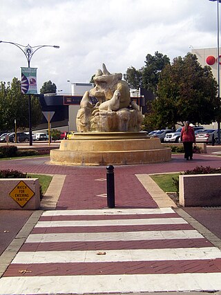
<span class="mw-page-title-main">City of Vincent</span> Local government area in Western Australia

The City of Vincent is a local government area of Western Australia. It covers an area of approximately 10.4 square kilometres (4.0 sq mi) in metropolitan Perth, the capital of Western Australia, and lies about 3 km from the Perth CBD. The City of Vincent maintains 139 km of roads and 104 ha of parks and gardens. It had a population of over 33,000 at the 2016 Census.

The Western Australian Academy of Performing Arts (WAAPA) at Edith Cowan University (ECU) was established in 1980 to provide performing arts tuition. WAAPA operates as a part of ECU, located at the ECU campus in Mount Lawley, a suburb in Perth, Western Australia.

<span class="mw-page-title-main">Bedford, Western Australia</span> Suburb of Perth, Western Australia

Bedford is a suburb 6 kilometres (4 mi) north-east of the central business district (CBD) of Perth, the capital of Western Australia. Named after Frederick Bedford, the Governor of Western Australia from 1903 to 1909, the suburb is within the City of Bayswater local government area. It is predominantly a low density residential suburb consisting of single-family detached homes, with clusters of commercial buildings along Beaufort Street, Grand Promenade and Walter Road.

Wembley is a western suburb of Perth, Western Australia, located within the Town of Cambridge. Its postcode is 6014.

<span class="mw-page-title-main">Electoral district of Perth</span> State electoral district of Western Australia

The Electoral district of Perth is a Legislative Assembly electorate in the state of Western Australia. Perth is named for the capital city of Western Australia whose central business district falls within its borders. It is one of the oldest electorates in Western Australia, with its first member having been elected in the inaugural 1890 elections of the Legislative Assembly.

<span class="mw-page-title-main">South Perth, Western Australia</span> Suburb of Perth, Western Australia

South Perth is a residential suburb of Perth, Western Australia that adjoins the southern shore of Perth Water on the Swan River; it is 3 kilometres (2 mi) south of the central business district. The suburb adjoins two major arterial roads—Canning Highway and the Kwinana Freeway, and is within the City of South Perth local government area.

<span class="mw-page-title-main">Military Strongmen</span> 1997 single by Jebediah

"Military Strongmen" is a song by Australian alternative rock band, Jebediah. It was released as a single as the second single from the band's debut studio album Slightly Odway on 11 October 1997 as the and peaked at No. 65 on the ARIA Singles Chart and was voted in at number 33 in Triple J's Hottest 100 music poll for 1997.

<span class="mw-page-title-main">Victoria Park, Western Australia</span> Suburb of Perth, Western Australia

Victoria Park is an inner south eastern suburb of Perth, Western Australia. Its local government area is the Town of Victoria Park.

<span class="mw-page-title-main">Alexander Drive</span> Road in Perth, Western Australia

Alexander Drive is a major north–south arterial road in the northern suburbs of Perth, Western Australia, connecting Perth's central business district (CBD) with Edith Cowan University's Mount Lawley campus and the Malaga industrial area, as well as newer development suburbs to Perth's north. It is used by Transperth bus routes, including the 360, 361 and 362. Alexander Drive was named after Mr S.B. Alexander, a former Wanneroo Road Board member. Alexander Drive runs through the following local government areas City of Wanneroo, City of Swan, City of Bayswater and City of Stirling.

<span class="mw-page-title-main">William Street, Perth</span> Street in CBD Perth, Western Australia

William Street is a suburban distributor and one of two major cross-streets in the central business district of Perth, Western Australia. Commencing in western Mount Lawley, its route takes it through the Northbridge café and nightclub district as well as the CBD.

<span class="mw-page-title-main">Beaufort Street</span> Road in Perth, Western Australia

Beaufort Street is a major road in the inner north-eastern suburbs of Perth, Western Australia, connecting the Morley area to the Perth central business district. For most of its length, it is a single-carriageway, two-way road with two lanes in each direction.

Transport in Perth, Western Australia, is served by various means, among them an extensive highway / freeway network and a substantial system of commuter rail lines and bus routes. Public transport is managed by the Transperth agency.

<span class="mw-page-title-main">Cygnet Cinema</span> Heritage listed cinema in Como, Western Australia

Cygnet Cinema is located at 16 Preston Street, Como, Western Australia. It was the first purpose built sound cinema in the suburbs immediately south of the city in the inter-war period. The Cygnet Cinema opened in 1938 and was built by local identity and film entrepreneur James Stiles. It is an excellent example of the art deco style of architect William Leighton and is included on the State's Heritage Register.

<span class="mw-page-title-main">Electoral district of Mount Lawley</span> State electoral district of Western Australia

Mount Lawley is an electorate in the state of Western Australia. Mount Lawley is named for the inner north-eastern Perth suburb of Mount Lawley, which falls within its borders.

<span class="mw-page-title-main">Astor Theatre, Perth</span> Heritage-listed movie theatre in Mount Lawley, Western Australia

The Astor Theatre is located at 659 Beaufort Street, Mount Lawley, Western Australia. It comprises a single, two and three-storey masonry inter-war Art Deco style theatre and retail building.

<span class="mw-page-title-main">Trams in Perth</span> Tramway Network in Perth

The Perth tramway network served Perth, the capital city of Western Australia, from 1899 until 1958. The network was initially run by a private company but was taken over by the state government in 1913. From a single line along Hay Street, the network expanded north as far as Osborne Park, east as far as Welshpool, south as far as Como, and west as far as Claremont. The tramways were gradually replaced by buses after World War II.

<span class="mw-page-title-main">Trolleybuses in Perth</span> Former bus transport in Perth, Western Australia

The Perth trolleybus system in Western Australia linked the capital Perth's central business district with its inner suburbs on the northern side of the Swan River. It was the first permanent trolleybus network to open in Australia, in 1933, and also the last to close, in 1969.

<span class="mw-page-title-main">Guildford Road</span> Road in Perth, Western Australia

Guildford Road is a major road in Perth, Western Australia, linking the inner-city suburb of Mount Lawley with Guildford in the north-east. The ten-kilometre-long (6.2 mi) road runs mostly parallel to the Swan River, on its northern side, and is part of State Route 51, which runs between Perth's CBD and Midvale. Guildford Road is maintained and controlled by Main Roads Western Australia, which uses the internal designation "H026 Guildford Road" for Guildford Road, as well as Bridge Street and James Street in Guildford. In the 1930s, the name Great Eastern Highway was coined to describe the road, but was actually used for the road on the other side of the Swan River.

References

  1. Australian Bureau of Statistics (28 June 2022). "Mount Lawley (Suburb and Locality)". Australian Census 2021 QuickStats. Retrieved 28 June 2022.  OOjs UI icon edit-ltr-progressive.svg
  2. 1 2 3 "A Brief History of the Suburb of Mount Lawley" (PDF). Town of Vincent. Archived from the original (PDF) on 17 March 2012. Retrieved 1 August 2012.
  3. "Hyde Park Conservation Plan" (PDF). Town of Vincent. Retrieved 28 September 2015.
  4. Map of Perth, 18L, CONS 3868, Item 301. Viewed at the State Records Office, Perth, Western Australia.
  5. DOLA Nomenclature Section, "Origins and Histories of Perth Suburbs", typescript.
  6. "How Half-a-Crown Became Half a Million". The Mirror (Perth) . Vol. 6, no. 290. Western Australia. 9 April 1927. p. 12. Retrieved 7 January 2022 via National Library of Australia.
  7. "Captain Sir Arthur Lawley 1901–1902". The Constitutional Centre of Western Australia. Retrieved 4 August 2012.
  8. "Perth's Lost Lakes" . Retrieved 1 August 2012.
  9. Heritage Assessment – Astor Theatre. HCWA.
  10. WA Register of Heritage Places – Astor Theatre". HCWA.
  11. "WAAPA website" . Retrieved 1 August 2012.