
Calder Park is a suburb of Melbourne, Victoria, Australia, 23 km north-west of Melbourne's central business district. It is located within the City of Brimbank local government area.

The District of Belconnen is one of the original eighteen districts of the Australian Capital Territory (ACT), used in land administration. The district is subdivided into 27 divisions (suburbs), sections and blocks. The district of Belconnen is largely composed of Canberra suburbs.

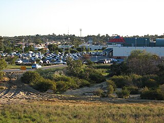
Innaloo is a suburb of Perth, the capital city of Western Australia, 9 km (5.6 mi) from Perth's central business district in the local government area of the City of Stirling.

North Beach is a northern coastal suburb of Perth, the capital city of Western Australia 16 kilometres (10 mi) from Perth's central business district via Mitchell Freeway and Reid Highway. Its local government area is the City of Stirling.

Osborne Park is a suburb of Perth, Western Australia in the local government area of the City of Stirling.

Woodlands is a suburb of Perth, Western Australia. Its local government area is the City of Stirling and it is in the federal Division of Curtin.

The City of Wanneroo is a local government area with city status in the northern suburbs of Perth, Western Australia. It is centred approximately 25 kilometres (15.5 mi) north of Perth's central business district and forms part of the northern boundary of the Perth metropolitan area. Wangara encompasses the federal divisions of Cowan, Moore and Pearce.

Watermans Bay is a northern coastal suburb of Perth, the capital city of Western Australia. Its local government area is the City of Stirling.
Madeley is a suburb of Perth, the capital city of Western Australia 20 kilometres (12 mi) north of Perth's central business district. Its local government area is the City of Wanneroo. Previously part of Landsdale, much of the suburb was rural in character until the 1990s, with market gardening a common activity. From 2001 onwards, extensive property development resulted in massive population growth, with the Property Investor Magazine of December 2007 estimating a growth rate of 33.3% per year.
Tamala Park is an unpopulated locality in Perth, Western Australia. It sits on the border between the City of Wanneroo and the City of Joondalup local authorities, and separates the Clarkson-Butler region from the suburbs of Joondalup.

Beeliar is a suburb of Perth, Western Australia, located within the City of Cockburn. The name refers to the Beeliar people, a group of Aboriginal Australians who had land rights over the southern half of Perth's metropolitan area. The suburb contains the Thomsons Lake Nature Reserve.

Russell is a suburb of Canberra, Australia in the North Canberra district. Russell is one of the smallest suburbs in Canberra, comprising a number of government offices but no private residences. It is probably best known for the headquarters of the Australian Defence Force, which is housed in the Russell Offices complex.
West End is a western suburb of Geraldton, Western Australia. Its local government area is the City of Greater Geraldton.
Hynam is a town and locality in the Australian state of South Australia located in the state's south-east within the Limestone Coast region on the border with the state of Victoria about 302 kilometres south east of the state capital of Adelaide and about 11 kilometres east of the municipal seat of Naracoorte.

Hansborough is a locality along the former Morgan railway line adjacent to the Thiele Highway, in South Australia's Mid North region. It is situated 9 kilometres south-west of Eudunda and 18 kilometres north-east of Kapunda. The Light River runs through the locality.
Munno Para is a northern suburb of Adelaide, South Australia. It is located in the City of Playford.

Cobblebank is a developing outer suburb located 31km west of the CBD of Melbourne, Victoria, Australia. Its local government area is the City of Melton. The suburb was gazetted by the Office of Geographic Names on 9 February 2017, following a proposal for eleven new suburbs by the City of Melton. The new name officially came into effect in mid-2017. Prior to the suburb's creation, the area was part of Melton South.

Harkness is a suburb in the outer west of Melbourne, Victoria, Australia. Its local government area is the City of Melton. The suburb was gazetted by the Office of Geographic Names on 9 February 2017, following a proposal for eleven new suburbs by the City of Melton. The new name officially took effect from 23 August 2017.

Portsmith is a suburb of Cairns in the Cairns Region, Queensland, Australia. In the 2016 census, the population of Portsmith was 195.

Norwest is a suburb of the Hills District within Greater Western Sydney, in the state of New South Wales, Australia, located 35 kilometres north-west of the Sydney central business district. The Norwest Business Park is located within Norwest and the adjacent suburb of Bella Vista. The council chambers for The Hills Shire Council are also located within this suburb.


