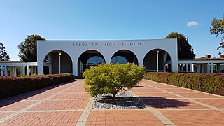
Dianella, Western Australia

Last updated

Dianella
Perth,  Western Australia
Dianella, Western Australia
Coordinates 31°53′17″S115°52′26″E / 31.888°S 115.874°E / -31.888; 115.874
Population24,169 (SAL 2021) [1]
Established1960s
Postcode(s) 6059
Area10.7 km2 (4.1 sq mi)
Location9 km (6 mi) from the Perth CBD
LGA(s)
State electorate(s)
Federal division(s)
Suburbs around Dianella:
Westminster Mirrabooka Noranda
Nollamara Dianella Morley
Yokine
Menora
Inglewood Bedford

Dianella is a suburb of Perth, Western Australia. It is within the local government area of the City of Stirling.

Contents

Dianella was named after the botanical title of a small blue lily, Dianella revoluta , a narrow-leafed plant that was plentiful in the area prior to residential development.

History

Early development of the area was slow, as the sandy soil, part of the Banksia sandplain, was considered unsuitable for agriculture. Much of Dianella was subdivided in the 1880s by the Intercolonial Investment Company of Sydney, but growth was still slow and by 1919, the only development was along Walter Road, a track leading to dairy farms in the Morley area. Dianella comprised localities known as North Inglewood, East Yokine, Morley Park and Bedford Park. They were amalgamated into Dianella in 1958, which generated some growth.

Development progressed during the 1960s and housing construction first occurred north from Walter Road and Grand Promenade, with St Andrews, Montclair Rise and Dress Circle Estates being the last major areas to be developed in the early 2000s. The character of housing ranges from modest post-war homes to large, modern two storey dwellings.

Dianella was Perth and Western Australia's media centre; with three of Perth's major commercial television stations based there until Channel 7 relocated to Osborne Park in 2015. Channel 9 and Channel 10 left the suburb in 2016 and are now in St Georges Terrace [2] and Subiaco, [3] respectively.

Recreation facilities

There are a number of small parks in Dianella and a large regional open space. Vicinity Centres Dianella is the major shopping centre in the suburb, with several smaller local stores. Education is provided by a number of primary schools as well as high schools in Mirrabooka and Morley.

Dianella Regional Open Space is at the junction of Alexander Drive and Morley Drive and provides a landscape feature for the suburb as well as sporting facilities. The area is home to a number of sporting codes, including lacrosse, football, little athletics, soccer and cricket as well as many more indoor sports..

Demography

Dianella lies at the heart of Perth's small Jewish community. [4] Although this is the third largest Jewish community in Australia, numbers have never reached more than 6000 members (the most recent Australian census put Western Australia's entire Jewish community at 5,300 members). Dianella itself is home to a number of community institutions such as a Jewish day school (Carmel), a sports club, an aged home (Maurice Zeffert Home) and a small synagogue known as "Dianella Shul". A number of streets in the region are named after Jewish icons such as Menora, Maccabean and Golda Meir. Despite a small but steady stream of Jewish immigration from South Africa and China, specifically Kaifeng, the community in Dianella and surrounding suburbs is shrinking as many young people leave Perth, mainly heading to the larger Australian Jewish communities in Melbourne and Sydney.

Dianella is also part of Perth's small Greek community, the second biggest hub for the Greek Orthodox Community in Perth, the biggest being in the centre of Northbridge. During the early 1990s, the Greek community of Perth wanted a Greek Orthodox College so that children of Greek origin could learn the Greek language and to be engaged in the Greek culture while going to school. Today, there is a Greek day school (St Andrew's Grammar) which is located in the St Andrews Land Estate and a small Greek Orthodox Church (Agios Nectarios) located in the northern sector of the suburb just next to the Dress Circle Land Estate. Next to the Greek Orthodox College there is a Greek retirement home (Hellenic Community Aged Care). Some streets in the northern sector of the suburb have names of Greek origin such as Hellenic Drive in the St Andrews Land Estate.

Transport

Bus

Related Research Articles

<span class="mw-page-title-main">Kensington, Western Australia</span> Suburb of Perth, Western Australia

Kensington is a residential suburb 3 km from Perth's central business district. Kensington is located within the City of South Perth and Town of Victoria Park local government areas.

<span class="mw-page-title-main">Waterford, Western Australia</span> Suburb of Perth, Western Australia

Waterford is a small riverside suburb of Perth, the state capital of Western Australia. Its local government area is the City of South Perth.

<span class="mw-page-title-main">Riverton, Western Australia</span> Suburb of Perth, Western Australia

Riverton is a southeastern suburb of Perth, the capital city of Western Australia. Its local government area is the City of Canning.

<span class="mw-page-title-main">Ardross, Western Australia</span> Suburb of Perth, Western Australia

Ardross is a suburb of Perth, Western Australia, located within the City of Melville. It was once an area of land acquired by the Scotsman, Sir Alexander Percival Matheson in 1896. In Matheson's subdivision of the adjoining suburb of Applecross, he created "Ardross Street" naming it after either the town of Ardrossan on the Scottish west coast or Ardross Castle, located about 40 kilometres north of Inverness. The suburb derives its name from this street.

<span class="mw-page-title-main">Alexander Heights, Western Australia</span> Suburb of Perth, Western Australia

Alexander Heights is a suburb of Perth, Western Australia within the City of Wanneroo.

<span class="mw-page-title-main">Alfred Cove, Western Australia</span> Suburb of Perth, Western Australia

Alfred Cove is a southern suburb of Perth, Western Australia. Its local government area is the City of Melville.

<span class="mw-page-title-main">Applecross, Western Australia</span> Suburb of Perth, Western Australia

Applecross is an affluent riverside suburb of Perth, Western Australia, bounded by Canning Highway and the Swan River. It is located within the City of Melville.

Wembley is a western suburb of Perth, Western Australia, located within the Town of Cambridge. Its postcode is 6014.

<span class="mw-page-title-main">Bentley, Western Australia</span> Suburb of Perth, Western Australia

Bentley is a southern suburb of Perth, the capital city of Western Australia, 8 kilometres (5.0 mi) southeast of Perth's central business district. Its local government areas are the City of Canning and the Town of Victoria Park. Bentley is home to the main campus of Curtin University and Technology Park.

<span class="mw-page-title-main">Cannington, Western Australia</span> Suburb of Perth, Western Australia

Cannington is a southern suburb of Perth, Western Australia. Its local government area is the City of Canning.

Shelley is a suburb of Perth, Western Australia, located within the City of Canning.

St James is a suburb shared between the Town of Victoria Park and the City of Canning in the Perth metropolitan area.
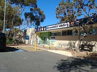
<span class="mw-page-title-main">Willetton, Western Australia</span> Suburb of Perth, Western Australia

Willetton is a large southern suburb of Perth, Western Australia. Its local government area is the City of Canning.

<span class="mw-page-title-main">Wilson, Western Australia</span> Suburb of Perth, Western Australia

Wilson is a suburb of Perth, Western Australia, located within the City of Canning on the north bank of the Canning River. It is a fairly old suburb with parks and close proximity to prominent shopping centres in South Perth. It is favoured by Curtin University students, the reason being its convenient access to the university. Bus numbers 72 and 75 travel through this suburb. The suburb contains Castledare, Kent Street Weir, Canning River and Lo Quay River Cafe. Wilson is located quite closely to various park, some of those being Cetenary Park, Thomas Moore Park, and Alderley Park.

<span class="mw-page-title-main">North Perth, Western Australia</span> Suburb of Perth, Western Australia

North Perth is a suburb of Perth, Western Australia, located within the City of Vincent.

<span class="mw-page-title-main">Ellenbrook, Western Australia</span> Suburb of Perth, Western Australia

Ellenbrook is a northeastern suburb of Perth, Western Australia, about 30 km (19 mi) from Perth's central business district (CBD), located within the City of Swan. Ellenbrook, and its neighbouring suburbs of The Vines and Aveley, are unusual for Perth in being a significant distance from neighbouring suburbs. Given this relative isolation and the distance from the CBD, Ellenbrook has been designed and developed as a self-sustainable community. Since the upgrade of Gnangara Road and the completion of the Tonkin Highway Northlink, access to Ellenbrook has improved. The Morley–Ellenbrook railway line is well underway as at June 2021 and this will enable better public transport. At the time of the 2016 census there were 22,681 people living in the gazetted suburb, by June 2018, it was estimated that the urban population for Ellenbrook and surrounds had grown to 41,382. It is envisioned that Ellenbrook will eventually become a satellite city, with a population of 80,000.

<span class="mw-page-title-main">Belmont, Western Australia</span> Suburb of Perth, Western Australia

Belmont is a suburb of Perth, the capital city of Western Australia, and is located 7 kilometres (4 mi) east of Perth's central business district (CBD) on the southern bank of the Swan River. Its local government area is the City of Belmont.

<span class="mw-page-title-main">Nedlands, Western Australia</span> Suburb of Perth, Western Australia

Nedlands is a western suburb of Perth, the capital city of Western Australia. It is a part of the local government areas of the City of Nedlands and the City of Perth. It is about 7 kilometres (4 mi) from the Perth CBD via either Thomas Street or Mounts Bay Road.

<span class="mw-page-title-main">Perth Busport</span> Underground bus station in Perth, Western Australia

Perth Busport is an underground bus station, located underneath Wellington Street, Perth, Western Australia. It was officially opened by then Premier of Western Australia Colin Barnett and then Minister for Transport Dean Nalder on 13 July 2016.

<span class="mw-page-title-main">Buses in Perth</span> Public transport system serving Perth, Western Australia

Buses in Perth, the capital city of Western Australia, are run under the Transperth brand. The system is owned and managed by the Public Transport Authority and operations are contracted out to private operators: Swan Transit, Path Transit and Transdev.

References

  1. Australian Bureau of Statistics (28 June 2022). "Dianella (suburb and locality)". Australian Census 2021 QuickStats. Retrieved 28 June 2022.  OOjs UI icon edit-ltr-progressive.svg
  2. Abraham, Claire (19 September 2016). "9NEWS Perth paves the way with Australia's most modern news studio". Nine News . Retrieved 7 December 2016.
  3. "TEN Perth to begin broadcasting from brand new studios". TV Tonight. 1 December 2016. Retrieved 6 December 2016.
  4. Fitzpatrick, Sarah (18 June 2013). "Life full for city's Jews". PerthNow. Retrieved 18 February 2022.
  5. "Route 20". Bus Timetable 71 (PDF). Transperth. 8 February 2023 [effective from 12 March 2023].
  6. "Route 67". Bus Timetable 106 (PDF). Transperth. 3 May 2023 [effective from 12 June 2023].
  7. "Route 68". Bus Timetable 106 (PDF). Transperth. 3 May 2023 [effective from 12 June 2023].
  8. "Route 360". Bus Timetable 76 (PDF). Transperth. 4 August 2023 [effective from 10 September 2023].
  9. "Route 361". Bus Timetable 76 (PDF). Transperth. 4 August 2023 [effective from 10 September 2023].
  10. "Route 362". Bus Timetable 76 (PDF). Transperth. 4 August 2023 [effective from 10 September 2023].
  11. "Route 370". Bus Timetable 72 (PDF). Transperth. 24 October 2023 [effective from 17 December 2023].
  12. "Route 371". Bus Timetable 70 (PDF). Transperth. 15 November 2022 [effective from 18 December 2022].
  13. "Route 377". Bus Timetable 75 (PDF). Transperth. 13 November 2023 [effective from 17 December 2023].
  14. "Route 378". Bus Timetable 75 (PDF). Transperth. 13 November 2023 [effective from 17 December 2023].
  15. "Route 960". Bus Timetable 210 (PDF). Transperth. 28 August 2023 [effective from 20 November 2023].
  16. "Route 970". Bus Timetable 211 (PDF). Transperth. 24 October 2023 [effective from 17 December 2023].
  17. "Route 980". Bus Timetable 215 (PDF). Transperth. 16 November 2022 [effective from 18 December 2022].
  18. "Route 998". CircleRoute Timetable 200 (PDF). Transperth. 29 August 2023 [effective from 20 November 2023].
  19. "Route 999". CircleRoute Timetable 200 (PDF). Transperth. 29 August 2023 [effective from 20 November 2023].