Perth is the capital and largest city of the Australian state of Western Australia. It is the fourth most populous city in Australia and Oceania, with a population of 2.1 million living in Greater Perth in 2020. Perth is part of the South West Land Division of Western Australia, with most of the metropolitan area on the Swan Coastal Plain between the Indian Ocean and the Darling Scarp. The city has expanded outward from the original British settlements on the Swan River, upon which the city's central business district and port of Fremantle are situated. Perth is located on the traditional lands of the Whadjuk Noongar people, where Aboriginal Australians have lived for at least 45,000 years.

Toodyay, known as Newcastle between 1860 and 1910, is a town on the Avon River in the Wheatbelt region of Western Australia, 85 kilometres (53 mi) north-east of Perth. The first European settlement occurred in the area in 1836. After flooding in the 1850s, the townsite was moved to its current location in the 1860s. It is connected by railway and road to Perth. During the 1860s, it was home to bushranger Moondyne Joe.

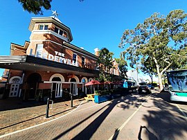
Subiaco is an inner-western suburb of Perth, the capital of Western Australia. It is approximately 3 km (1.9 mi) west of Perth's central business district, in the City of Subiaco local government area. Historically a working-class suburb containing a mixture of industrial and commercial land uses, since the 1990s the area has been one of Australia's most celebrated urban redevelopment projects. It remains a predominantly low-rise, urban village neighbourhood centred around Subiaco train station and Rokeby Road.

Swanbourne is a western coastal suburb of Perth, Western Australia, located within the City of Nedlands. It is an affluent, upper middle class residential area with older Federation style homes, many being renovated. The suburb was established in the late 19th century. New housing estates have been built recently through the redevelopment of areas such as the Swanbourne Senior High School, Swanbourne Primary School and Lakeway Drive-In Cinema sites.

Graham Farmer Freeway is a 6.4-kilometre (4.0 mi) inner-city freeway in Perth, Western Australia. It links Rivervale and Burswood with West Perth and Leederville, providing an east-west bypass of Perth's central business district.

East Perth is an inner suburb of Perth, Western Australia, located next to the Perth central business district. Claise Brook and Claisebrook Cove are within the suburb. Formerly characterised by industrial land uses and urban blight, the redevelopment of East Perth was, and remains, the largest inner-city urban renewal project in the state. The design of the new residential neighbourhoods was strongly influenced by the new urbanism movement.

The Electoral district of Perth is a Legislative Assembly electorate in the state of Western Australia. Perth is named for the capital city of Western Australia whose central business district falls within its borders. It is one of the oldest electorates in Western Australia, with its first member having been elected in the inaugural 1890 elections of the Legislative Assembly.

The Horseshoe Bridge in Perth, Western Australia is a traffic bridge that connects the Perth CBD to Northbridge, carrying William Street. It was constructed in 1904 to pass over the Fremantle railway line, with the horseshoe shape designed to fit the approach ramps into a constricted site.

A coffee palace was an often large and elaborate residential hotel that did not serve alcohol, most of which were built in Australia in the late 19th century.

William Street is a suburban distributor and one of two major cross-streets in the central business district of Perth, Western Australia. Commencing in western Mount Lawley, its route takes it through the Northbridge café and nightclub district as well as the CBD.

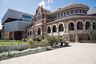
Perth Institute of Contemporary Arts (PICA) is a contemporary visual and performance arts venue located in a heritage-listed building in Perth, Western Australia.

The official Chinatown of Perth, Western Australia is bounded by Roe Street and James Street in the inner city suburb of Northbridge. Located within Chinatown are 13 restaurants and businesses. Many more Asian businesses are found further north around William Street near Brisbane Street, an area known informally for this reason as the "real Chinatown", and throughout both the Perth metropolitan region and the rest of Western Australia.

Riverside Drive in Perth, Western Australia, is a road on the northern side of Perth Water. It was built on reclaimed land in the 1930s, and links The Causeway to the Narrows Bridge.

Russell Square in Perth, Western Australia is a large public space between Aberdeen Street and James Street in Northbridge. It was named after Lord John Russell.

Northbridge is an inner city suburb of Perth, Western Australia, historically separated from Perth's central business district by the Fremantle and Joondalup railway lines. It is part of the City of Perth local government area.
James Street is a street which serves the Perth suburbs Perth and Northbridge. It is the main east-west road in the centre of Northbridge.
Aberdeen Street is a street in the Perth suburbs of Perth and Northbridge that runs from Lord Street in the east to the Mitchell Freeway in the west. The street has 42 locally listed places of significance, 18 of which are also listed on the State Register of Heritage Places.
Lord Street is a road in East Perth, Western Australia. It starts from Victoria Square near Royal Perth Hospital and runs north-east for 2.1 kilometres (1.3 mi) to end at Walcott Street, Mount Lawley.