
Hamersley is a residential suburb 14 kilometres north-northwest of the central business district of Perth, the capital of Western Australia, and six kilometres (4 mi) from the Indian Ocean. The suburb adjoins two major arterial roads—Mitchell Freeway to the west and Reid Highway to the south—and is within the City of Stirling local government area. It was built during the late 1960s and 1970s as part of the Government of Western Australia's response to rapidly increasing land prices across the metropolitan area.

Mount Lawley is an inner northern suburb of Perth, Western Australia. The suburb is bounded by the Swan River to the east, Vincent, Harold and Pakenham Streets to the south, Central Avenue and Alexander Drive to the north, and Norfolk Street to the west.
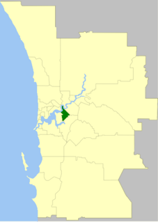
The Town of Victoria Park is a local government area of Western Australia. It covers an area of 17.62 km² in metropolitan Perth, the capital of Western Australia. It had a population of approximately 35,000 as at the 2016 Census.

The City of Vincent is a local government area of Western Australia. It covers an area of approximately 10.4 square kilometres (4.0 sq mi) in metropolitan Perth, the capital of Western Australia, and lies about 3 km from the Perth CBD. The City of Vincent maintains 139 km of roads and 104 ha of parks and gardens. It had a population of over 33,000 at the 2016 Census.

The City of Wanneroo is a local government area with city status in the northern suburbs of Perth, Western Australia. It is centred approximately 25 kilometres (15.5 mi) north of Perth's central business district and forms part of the northern boundary of the Perth metropolitan area. Wangara encompasses the federal divisions of Cowan, Moore and Pearce.
Mitchell Freeway is a 36-kilometre-long (22 mi) freeway in the northern suburbs of Perth, Western Australia, linking central Perth with the city of Joondalup. It is the northern section of State Route 2, which continues south as Kwinana Freeway and Forrest Highway. Along its length are interchanges with several major roads, including Graham Farmer Freeway and Reid Highway. The southern terminus of the Mitchell Freeway is at the Narrows Bridge, which crosses the Swan River, and the northern terminus is at Hester Avenue, Clarkson, a suburb within the City of Wanneroo.
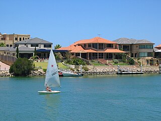
Mindarie is an outer coastal suburb of Perth, Western Australia. It is located 36 kilometres (22 mi) north of Perth's central business district, and forms part of the City of Wanneroo local government area.

Merriwa is a coastal, northern suburb of Perth, Western Australia, 36 kilometres (22 mi) north of the central business district. It is part of the City of Wanneroo local government area. It is a predominantly residential suburb, containing two RAAF retirement villages.

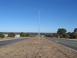
Reid Highway is a 23-kilometre (14 mi) east-west highway and partial freeway in the northern suburbs of Perth, Western Australia, linking North Beach with Middle Swan. As part of State Route 3, it forms half of Perth's outer ring road along with Roe Highway, which it joins onto at its eastern terminus.

Marmion Avenue is a 40-kilometre (25 mi) arterial road in the northern coastal suburbs of Perth, Western Australia, linking Trigg in the south with Yanchep in the north. It forms part of State Route 71 along with West Coast Highway, which it joins onto at its southern terminus.
Ocean Reef Road is an arterial east-west road in Perth, Western Australia. It is located within the northern suburbs of Perth, from Ocean Reef in the west, to Landsdale in the east, with a portion travelling northwards along the coast to Iluka.

King Street is located in the central business district (CBD) of Perth, Western Australia. The street has a very European feel with its early 20th century, low-rise architecture and restored facades.

The City of Fremantle is a local government area in the south of Perth, Western Australia. The City covers an area of 19.0 square kilometres (7.3 sq mi), and lies about 19 kilometres (12 mi) southwest of the Perth central business district.
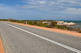
Indian Ocean Drive is a coastal highway in the Australian state of Western Australia which services the coastal communities along the Indian Ocean immediately north of the state capital Perth, linking the northern suburb of Yanchep with the Brand Highway, just south of Dongara. In terms of regions, most of it exists in the Wheatbelt coastal region. The road provides travellers between Perth and Geraldton a 30-minute shorter and more scenic route than the inland Brand Highway which mainly services heavy traffic.

Gnangara Road is an arterial east-west road in Perth, Western Australia. It is located within the northern suburbs of Perth, from Madeley in the west, to Henley Brook in the east. Gnangara Road provides a connection between Great Northern Highway and Wanneroo Road. The construction of the Ocean Reef Road extension in 2011 altered the road network in the Landsdale area in Landsdale. The plans show Gnangara Road as discontinuous between Mirrabooka Avenue and Alexander Drive, with the Mirrabooka Avenue and Ocean Reef Road extensions linking the two sections. Following construction, those linking road sections were named as Gnangara Road, allowing the road to remain continuous.
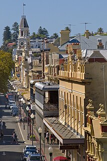
High Street is the main street running through the City of Fremantle, Western Australia. The street passes by historic landmarks, including the Round House, the Fremantle Town Hall, and the Fremantle War Memorial, through the Fremantle West End Heritage area and through two town squares. Trams operated along High Street for 47 years, between 1905 and 1952. Running east–west, High Street continues as Leach Highway, a major arterial road, at Stirling Highway, linking Fremantle with Perth Airport although the stretch of road between Stirling Highway and Carrington Street is known locally—and signed—as High Street.

Walyalup Koort, also known as Kings Square , is a town square in Fremantle, Western Australia. It is bounded by Queen, Newman, William, and Adelaide Streets. Though the square was originally a public reserve, it has been the site of Saint John's Church of England since 1843, and the Fremantle Town Hall since 1887. High Street was extended through and beyond the square in the 1880s, but the portion through the square was closed off in the 1960s. Today Kings Square functions as a civic and cultural centre of Fremantle, with modern events taking place adjacent to the historic buildings.
