Yangebup is a southern suburb of Perth, Western Australia in the City of Cockburn. It takes its name from the nearby Yangebup Lake.

Jandakot is a southern suburb of Perth, Western Australia, located within the City of Cockburn local government area. It is best known for Jandakot Airport that is situated entirely within the suburb, the airport being "the busiest general aviation airport in Australia in terms of aircraft movements", the sixth-busiest civilian airport in Australia in the fiscal year ending 30 June 2018, and in the 2011 fiscal year even the busiest civilian airport in Australia.

Success Park 'n' Ride was a Transperth bus station located next to the current Cockburn Central Train/Bus Interchange. It was established on 21 March 1999 and decommissioned on 22 December 2007. After that it was superseded by its nearby station in Cockburn Central.
Huntingdale is a southeastern suburb of Perth, Western Australia. It is part of the City of Gosnells local government area, which suggested the name of the suburb in 1974 as it was used by local developers as a promotional name. It is largely a residential suburb with associated schools and small businesses, mainly existing to service local residents. Homes in the area include a section of older residences constructed mainly in the 1970s, while there was significant new development from the 1990s onward in the southern portion of Huntingdale. There are some remaining pockets of semi-rural land comprising remnants of horticultural and chicken-farming enterprises, but in the early 2000s these were fast being taken over for new residential developments.

Forrestdale is a suburb of Perth, Western Australia, located within the City of Armadale. It is named after John Forrest, the first premier of Western Australia.

Canning Vale is a southern suburb of Perth, 22 km (13.7 mi) from the central business district. Its local government areas are the City of Canning and the City of Gosnells.
East Cannington is a southeastern suburb of Perth, Western Australia. Its local government area is the City of Canning.

Willetton is a large southern suburb of Perth, Western Australia. Its local government area is the City of Canning.

Atwell is a suburb within the metropolitan area of Perth, Western Australia, situated 21 kilometres (13 mi) south of Perth City, and located in the City of Cockburn local government area.

Aubin Grove is a suburb of Perth, Western Australia in the City of Cockburn. The suburb was approved in 2003.

Banjup is a suburb of Perth, Western Australia, located within the City of Cockburn. Its postcode is 6164. It is approximately 25 km (16 mi) south of the Perth central business district.
North Lake is a suburb located 18 kilometres (11 mi) south of the central business district of Perth, the capital of Western Australia, and 8 kilometres (5 mi) from the Indian Ocean. Named after the eponymous lake, the suburb and lake are located within the City of Cockburn local government area.
Wattleup is a southern suburb of Perth, Western Australia, located within the City of Cockburn. In the mid 1990's to the early 2000's, planning was undertaken to redevelop the suburb as part of the Hope Valley-Wattleup Redevelopment Project, also known as "Latitude 32". This was to involve the acquisition and demolition of the townsite, and its rezoning and redevelopment for industrial use. The townsite of Wattleup was located at the western end of the suburb, at the intersection of Wattleup Road and Rockingham Road. Wattleup had many market gardens in the past. They provided agricultural produce for the town of Fremantle.

Southern River is a suburb of Perth, Western Australia, located within the City of Gosnells.

Seville Grove is a suburb of Perth, Western Australia in the City of Armadale.

Cockburn Central station is a bus and railway station on the Transperth network. It is located at the juncture of the Mandurah and – once completed – Thornlie lines, 20.5 kilometres (12.7 mi) from Perth station inside the median strip of the Kwinana Freeway serving the suburb of Cockburn Central.

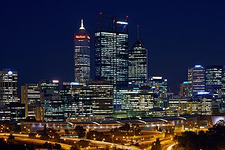
Perth is a suburb in the Perth metropolitan region, Western Australia that includes both the central business district of the city, and a suburban area spreading north to the northern side of Hyde Park. It does not include the separate suburbs of Northbridge or Highgate. Perth is split between the City of Perth and the City of Vincent local authorities, and was named after the city of the same name in Scotland.

Piara Waters is a southeastern suburb of Perth, Western Australia within the City of Armadale. Previously part of Forrestdale and gazetted in 2007, Piara Waters is located approximately 20 kilometres (12 mi) south-southeast of Perth.
Haynes is a suburb of Perth, Western Australia, located within the City of Armadale. This rural and semi-rural suburb is located on the city's fringe, and in the 2010s began to be subdivided for urban purposes.

Treeby is a southern suburb of Perth, Western Australia, located within the City of Cockburn. It is located on the east side of the Kwinana Freeway, close to Cockburn Central.


