Wandi, Western Australia

Last updated

Wandi
Perth,  Western Australia
Honeywood Primary School, Wandi, Western Australia, March 2020.jpg
Honeywood Primary School, Wandi
Wandi, Western Australia
Coordinates 32°11′49″S115°53′13″E / 32.197°S 115.887°E / -32.197; 115.887
Population4,324 (SAL 2021) [1]
Postcode(s) 6167
Area12.4 km2 (4.8 sq mi) [2]
LGA(s) City of Kwinana
State electorate(s) Kwinana
Federal division(s) Brand
Suburbs around Wandi:
Wattleup Banjup Forrestdale
Hope Valley Wandi Oakford
The Spectacles Anketell Oakford

Wandi is a suburb of Perth, Western Australia in the City of Kwinana at its northern border. The suburb was approved on 14 March 1978.

The suburb is zoned Special Rural, which prevents the loss of trees from clearing. The area is mainly divided into 2-hectare (5-acre) lots. The land of Wandi is bushland, and some of it is part of the Jandakot Regional Park.

The Western boundary is the Kwinana Freeway. Market gardens in the western area bounded by the freeway and Lyon Road are being developed into a residential area name Honeywood.

The suburb is approximately 27 kilometres (17 mi) from Perth city.

Wandi holding George Atkinson, grandson of the original George Atkinson, 1947. The Atkinson family part-owned Anchorage Butchers and employed Wandi as a stockman. Wandi holding George Atkinson, grandson of the original George Atkinson, 1947.jpg
Wandi holding George Atkinson, grandson of the original George Atkinson, 1947. The Atkinson family part-owned Anchorage Butchers and employed Wandi as a stockman.

Wandi was named after a highly regarded Aboriginal stockman, who drove northwest cattle from Robb Jetty to nearby holding paddocks, as well as driving sheep into paddocks around Cockburn Sound. For the first four decades of the twentieth century Wandi worked for Anchorage Butchers, owned by Copley, Atkinson and Negus. For at least some of this time, he lived in the racing quarters of George Atkinson's South Fremantle home, working the many racehorses he owned. [3] Wandi died in 1955 at the age of 76. [4]

A rare, and possibly the last, chuditch or western quoll (Dasyurus geoffroii ), an endangered carnivorous marsupial not seen in the Perth area for nearly twenty years, was caught by a rabbit trap in Wandi in March 2009. [5]

In the early 2010s, an estate called Honeywood came to the town. It grew pretty fast from 782 in the 2006 census to 2,854 people at the 2016 census. Honeywood Primary School was the first school to open in Wandi and was opened officially in 2018. As of 2021, Honeywood Primary School is the only school in Wandi.

Related Research Articles

<span class="mw-page-title-main">City of Kwinana</span> Local government area in Western Australia

The City of Kwinana is a local government area of Western Australia. It covers an area of approximately 118 square kilometres in metropolitan Perth, and lies about 38 km south of Perth central business district, via the Kwinana Freeway. Kwinana maintains 287 km of roads and had a population of almost 39,000 as at the 2016 Census.

<span class="mw-page-title-main">Bull Creek, Western Australia</span> Suburb of Perth, Western Australia

Bull Creek is a suburb of Perth, Western Australia, located within the local government area of City of Melville. The suburb lies to the south of a creek of the same name, which flows into the Canning River.

<span class="mw-page-title-main">Leeming, Western Australia</span> Suburb of Perth, Western Australia

Leeming is a southern suburb of Perth, Western Australia. It is divided between the three local government areas of the City of Melville, the City of Cockburn (south) and the City of Canning (north-east). It is located approximately 17 kilometres (11 mi) south of the Perth central business district and 13 kilometres (8.1 mi) east of Fremantle.

<span class="mw-page-title-main">Baldivis, Western Australia</span> Suburb of Perth, Western Australia

Baldivis is a semi-rural residential suburb 46 kilometres (29 mi) south of Perth, Western Australia, and 11 kilometres (6.8 mi) southeast of the regional centre of Rockingham. It is located within the City of Rockingham local government area.

Bateman is a suburb of Perth, Western Australia, located within the City of Melville.

<span class="mw-page-title-main">Canning Vale, Western Australia</span> Suburb of Perth, Western Australia

Canning Vale is a southern suburb of Perth, 22 km (13.7 mi) from the central business district. Its local government areas are the City of Canning and the City of Gosnells.

<span class="mw-page-title-main">Cannington, Western Australia</span> Suburb of Perth, Western Australia

Cannington is a southern suburb of Perth, Western Australia. Its local government area is the City of Canning.

<span class="mw-page-title-main">Willetton, Western Australia</span> Suburb of Perth, Western Australia

Willetton is a large southern suburb of Perth, Western Australia. Its local government area is the City of Canning.

<span class="mw-page-title-main">Bertram, Western Australia</span> Suburb of Perth, Western Australia

Bertram is a suburb of Perth, Western Australia, located within the City of Kwinana. Bertram derives its name from the family name of a Group Settler of the 1920s who owned land in the area. It was established as a locality name on 17 December 1998.

<span class="mw-page-title-main">Leda, Western Australia</span> Suburb of Perth, Western Australia

Leda is a southern suburb of Perth, Western Australia within the City of Kwinana. Leda is one of the five main suburbs of Kwinana.

<span class="mw-page-title-main">Wellard, Western Australia</span> Suburb of Perth, Western Australia

Wellard is a suburb of Perth, Western Australia, located within the City of Kwinana.

<span class="mw-page-title-main">Atwell, Western Australia</span> Suburb of Perth, Western Australia

Atwell is a suburb within the metropolitan area of Perth, Western Australia, situated 21 kilometres (13 mi) south of Perth City, and located in the City of Cockburn local government area.

North Lake is a suburb located 18 kilometres (11 mi) south of the central business district of Perth, the capital of Western Australia, and 8 kilometres (5 mi) from the Indian Ocean. Named after the eponymous lake, the suburb and lake are located within the City of Cockburn local government area.

South Lake is a suburb of Perth, Western Australia within the City of Cockburn. South Lake is located approximately 22 km (14 mi) south of the Perth CBD.

Success is a southern suburb of Perth, the capital city of Western Australia, located within the City of Cockburn.
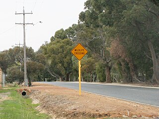
<span class="mw-page-title-main">Wattle Grove, Western Australia</span> Suburb of Perth, Western Australia

Wattle Grove is a suburb of Perth, Western Australia, located within the City of Kalamunda.

<span class="mw-page-title-main">Cockburn Central, Western Australia</span> Suburb of Perth, Western Australia

Cockburn Central is a suburb of Perth, the capital city of Western Australia, and is 24 kilometres (15 mi) south of Perth's central business district (CBD) along the Kwinana Freeway. Its local government area is the City of Cockburn, and it is intended by the Government to serve as a regional centre for the area. It was approved as a name by the Geographic Names Committee in 2007.
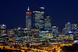
<span class="mw-page-title-main">Perth (suburb)</span> Suburb of Perth, Western Australia

Perth is a suburb in the Perth metropolitan region, Western Australia that includes both the central business district of the city, and a suburban area spreading north to the northern side of Hyde Park. It does not include the separate suburbs of Northbridge or Highgate. Perth is split between the City of Perth and the City of Vincent local authorities, and was named after the city of the same name in Scotland.

<span class="mw-page-title-main">Nambeelup, Western Australia</span> Town in Western Australia

Nambeelup is a small town and dormitory suburb of the city of Mandurah in the Peel Region of Western Australia.

<span class="mw-page-title-main">Treeby, Western Australia</span> Suburb of Perth, Western Australia

Treeby is a southern suburb of Perth, Western Australia, located within the City of Cockburn. It is located on the east side of the Kwinana Freeway, close to Cockburn Central.

References

  1. Australian Bureau of Statistics (28 June 2022). "Wandi (suburb and locality)". Australian Census 2021 QuickStats. Retrieved 28 June 2022.  OOjs UI icon edit-ltr-progressive.svg
  2. Australian Bureau of Statistics (27 June 2017). "2016 Community Profiles: Wandi (State Suburb)". 2016 Census of Population and Housing. Retrieved 30 November 2021. OOjs UI icon edit-ltr-progressive.svg
  3. Bryan Atkinson, pers. comm. 30 October 2012
  4. Death entry for Wandi Dixon, Western Australian Online Index, Registry of Births, Deaths and Marriages, http://www.bdm.dotag.wa.gov.au/_apps/pioneersindex/default.aspx
  5. "Home".

Commons-logo.svg Media related to Wandi, Western Australia at Wikimedia Commons