Beeliar Drive

Last updated

Beeliar Drive

Beeliar Drive 2021.jpg
Beeliar Drive looking west towards the intersection with Midgegoroo Avenue in Success
Beeliar Drive
General information
TypeRoad
Length7.7 km (4.8 mi)
Opened1991
Route number(s) Australian state route 14.svg State Route 14 [1] (Spearwood Avenue to Armadale Road)
Major junctions
East endSolomon Road Jandakot
 
West endMayor Road Lake Coogee
Location(s)
Major suburbs Cockburn Central, Success, Yangebup, Beeliar

Beeliar Drive is a major arterial road in the southwestern part of the Perth Metropolitan Area. It provides an important and unbroken east-west link between Kwinana Freeway and Stock Road providing access to residential developments in Beeliar, Yangebup and Lake Coogee in the west to commercial and industrial development in Cockburn Central, Jandakot and Success in the east. It is one of Perth's more recent arterial road constructions with development of the road occurring between the early 1990s and early 2020s.

Contents

It commences at a roundabout with Rockingham Road in Lake Coogee as an continuation of Mayor Road and follows a gently curving pattern reflecting its original Noongar name in a due easterly direction 7.7 kilometres (4.8 mi) to terminate at a roundabout interchange with Armadale Road/Solomon Road in Jandakot. The road is signed as State Route 14 east of the Spearwood Avenue roundabout. As of 2021, Beeliar Drive is a four-lane dual carriageway for the vast majority of its length; the section west of Stock Road is two lanes while the section between Kwinana Freeway and Wentworth Parade is six lanes.

History

"Beeliar" is a Noongar word that translates to "river" or "water running through". [2] [3] [4] with the word lending its name to a number of features in southwestern Perth.

Prior to the 1990s the main east-west road connection in the area was Yangebup Road. Due to ongoing development in south-western Perth which the planned Kwinana Freeway extension was expected to exacerbate in conjunction with concerns the development would have on the ecologically sensitive Beeliar Wetlands the decision was made to realign the existing Yangebup Road corridor away from its existing location on the southern bank of Yangebup Lake to the south along the lake's watershed with neighbouring Kogolup Lake. [5] Construction of the new two-lane alignment occurred in 1991 and was timed to finish in line with the freeway extension, upon which it was renamed Beeliar Drive. Originally running from the freeway as far as Lorimer Road (now Spearwood Avenue), both the Kwinana Freeway and Beeliar Drive projects meant the original main road between Fremantle and Armadale, Forrest Road, was severed. The section west of the freeway was renamed North Lake Road and realigned to terminate at Beeliar Drive. The section east of the freeway, now renamed Armadale Road, was realigned to be an eastern continuation of Beeliar Drive, initially as a at-grade intersection with the Kwinana Freeway before being converted to a diamond interchange around the turn of the millennium.

A two-lane extension from Spearwood Avenue to Watson Road (in the vicinity of the existing Yangebup Road corridor) commenced in 2001 and included a grade-separated railway underpass to replace two separate at-level crossings on Yangebup Road. [6] In 2009, Beeliar Drive was extended to Stock Road, severing Yangebup Road's connection to the highway. Yangebup Road is now a series of local streets, with the section immediately south of the lake now a pathway.

Staged duplication of Beeliar Drive commenced in the early 2000s, with the section from Kwinana Freeway to Spearwood Avenue completed by 2006. [7] Prior to the early 2010s, Beeliar Drive was a single carriageway from Hammond Road to Dunraven Drive, near Spearwood Avenue. When Spearwood Avenue was fully extended and completed, Beeliar Drive too was upgraded to a dual carriageway. Beeliar Drive was also a single carriageway from Spearwood Avenue to Stock Road prior to 2016. [8] Four-laning was extended to just east of the Stock Road intersection in 2016-17 with the intersection itself upgraded in 2021. [9] Due to ongoing development of Cockburn Central and Success the section of Beeliar Drive between Kwinana Freeway and Wentworth Parade was upgraded to six lanes in 2014 with significant changes made to the old North Lake Road intersection, now renamed Midgegooroo Avenue. [10]

Current upgrades

Armadale Road to North Lake Road Bridge

The bridge under construction in March 2021 Bridge between Armadale Road and North Lake Road under construction, March 2021 03.jpg
The bridge under construction in March 2021

This project involves the construction of a bridge over Kwinana Freeway with north-facing on and off ramps and have Armadale Road redirect to connect with North Lake Road instead of Beeliar Drive. This will remove another one of the state's black spots, the Beeliar Drive / Midgegooroo Avenue intersection, reduce congestion on the Kwinana Freeway interchange, and improve access to Cockburn Central railway station. As a result of the upgrade the old section of Armadale Road was renamed Beeliar Drive which now extends into the Jandakot industrial area, terminating at a roundabout interchange with Armadale Road. Beeliar Drive continues as Solomon Road east of the interchange.

This project will link with the Kwinana Freeway northbound widening from Russell Road to Roe Highway, as well as the Armadale Road widening. Construction began in late 2018 / early 2019, with completion occurring in December 2021. [11]

Major intersections

LGALocationkmmiDestinationsNotes
Cockburn Lake Coogee 00.0 Rockingham Road north, south / Mayor Road west  Spearwood, Fremantle, Henderson Roundabout; Beeliar Drive continues as Mayor Road west of this point
Lake CoogeeYangebupBeeliar tripoint 0.30.19Australian national route 1.svg Stock Road (National Route 1)  O'Connor, Fremantle, Rockingham Traffic light intersection
YangebupBeeliar boundary1.00.62Durnin AvenueRoundabout
2.51.6Australian state route 14.svg Spearwood Avenue (State Route 14)  Spearwood, Coogee, Munster Roundabout, State Route 14 western concurrency terminus
Cockburn CentralSuccess boundary5.23.2Kemp RoadRoundabout
5.53.4Hammond Road  South Lake, Hammond Park Traffic light intersection
6.54.0Wentworth ParadeTraffic light intersection
6.74.2Midgegoroo Avenue north / Cockburn Gateway Shopping City access south  North Lake, Kardinya, Fremantle Traffic light intersection, Midgegoroo Avenue connects North Lake Road to Beeliar Drive. Provides access to Cockburn Central railway station
Cockburn Central Jandakot Atwell Success quadripoint7.24.5Australian state route 2.svg Kwinana Freeway (State Route 2)  Joondalup, Perth, Mandurah Diamond interchange
AtwellJandakot boundary7.74.8Australian state route 14.svg Armadale Road (State Route 14) west, east / Solomon Road north  North Lake, Fremantle, Forrestdale, Armadale Roundabout interchange favouring Armadale Road. Continues as Solomon Road north. Provides access to Cockburn Central railway station
1.000 mi = 1.609 km; 1.000 km = 0.621 mi

See also

Australia road sign W5-29.svg Australian Roadsportal

Related Research Articles

The Kwinana Freeway is a 72-kilometre (45 mi) freeway in and beyond the southern suburbs of Perth, Western Australia, linking central Perth with Mandurah to the south. It is the central section of State Route 2, which continues north as Mitchell Freeway to Clarkson, and south as Forrest Highway towards Bunbury. A 4-kilometre (2.5 mi) section between Canning and Leach highways is also part of National Route 1. Along its route are interchanges with several major roads, including Roe Highway and Mandjoogoordap Drive. The northern terminus of the Kwinana Freeway is at the Narrows Bridge, which crosses the Swan River, and the southern terminus is at Pinjarra Road, east of Mandurah.

<span class="mw-page-title-main">Jandakot, Western Australia</span> Suburb of Perth, Western Australia

Jandakot is a southern suburb of Perth, Western Australia, located within the City of Cockburn local government area. It is best known for Jandakot Airport that is situated entirely within the suburb, the airport being "the busiest general aviation airport in Australia in terms of aircraft movements", the sixth-busiest civilian airport in Australia in the fiscal year ending 30 June 2018, and in the 2011 fiscal year even the busiest civilian airport in Australia.

<span class="mw-page-title-main">Mandurah line</span> Commuter rail line in Perth, Western Australia

The Mandurah line is a commuter railway and service on the Transperth network in Western Australia that runs from Perth south to the state's second largest city Mandurah. The service is operated by Transperth Train Operations, a division of the Public Transport Authority. The line is 70.1 kilometres (43.6 mi) long and has 12 stations. At its northern end, the line begins as a continuation of the Yanchep line at Perth Underground, and ends as a continuation of the Yanchep line at Elizabeth Quay. The first 1.3 kilometres (0.81 mi) of the line is underground, passing under the Perth central business district. The line surfaces and enters the median of the Kwinana Freeway just north of the Swan River. It continues south down the freeway's median for 30 kilometres (19 mi), before veering south-west towards Rockingham. The final stretch of the line goes south from Rockingham to Mandurah.

The Mitchell Freeway is a 41.5-kilometre-long (25.8 mi) freeway in the northern suburbs of Perth, Western Australia, linking central Perth with the city of Joondalup. It is the northern section of State Route 2, which continues south as Kwinana Freeway and Forrest Highway. Along its length are interchanges with several major roads, including the Graham Farmer Freeway and Reid Highway. The southern terminus of the Mitchell Freeway is at the Narrows Bridge, which crosses the Swan River, and the northern terminus is at Romeo Road in Alkimos.

<span class="mw-page-title-main">Atwell, Western Australia</span> Suburb of Perth, Western Australia

Atwell is a suburb within the metropolitan area of Perth, Western Australia, situated 21 kilometres (13 mi) south of Perth City, and located in the City of Cockburn local government area.

<span class="mw-page-title-main">Beeliar, Western Australia</span> Suburb of Perth, Western Australia

Beeliar is a suburb of Perth, Western Australia, located within the City of Cockburn. The name refers to the Beeliar people, a group of Aboriginal Australians who had land rights over the southern half of Perth's metropolitan area. The suburb contains the Thomsons Lake Nature Reserve.

New MetroRail was a division of the Public Transport Authority in Western Australia. It was responsible for managing extensions to Perth's railway network. The project doubled Perth's rail network, which is operated by Transperth, and was completed in 2007, after various projects were completed. Costing $1.6 billion, the project was the largest public transport project ever undertaken by the Western Australian government and effectively doubled the size of Perth's railway network. A similar agency Metronet was created in 2017 for future Perth rail extensions.
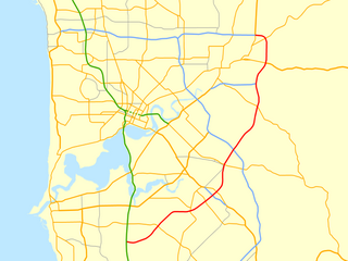
<span class="mw-page-title-main">Roe Highway</span> Highway in Perth, Western Australia

Roe Highway is a 35-kilometre-long (22 mi) limited-access highway and partial freeway in Perth, Western Australia, linking Kewdale with the city's north-eastern and south-western suburbs. The northern terminus is at Reid Highway and Great Northern Highway in Middle Swan, and the southern terminus is with Murdoch Drive at the Kwinana Freeway interchange in Bibra Lake. Roe Highway, in addition to Reid Highway, form State Route 3, a partial ring road around the outer suburbs of the Perth metropolitan area. Roe Highway also forms part of National Highway 94 from Great Eastern Highway Bypass to Great Eastern Highway, and National Highway 95 from Great Eastern Highway to Great Northern Highway.
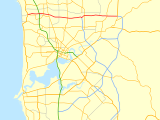
<span class="mw-page-title-main">Reid Highway</span> Highway in Perth, Western Australia

Reid Highway is a 23-kilometre (14 mi) east-west highway and partial freeway in the northern suburbs of Perth, Western Australia, linking North Beach with Middle Swan. As part of State Route 3, it forms half of Perth's outer ring road along with Roe Highway, which it joins onto at its eastern terminus.

Tonkin Highway is an 81-kilometre-long (50 mi) north–south highway and partial freeway in Perth, Western Australia, linking Perth Airport and Kewdale with the city's north-eastern and south-eastern suburbs. As of April 2020, the northern terminus is at the interchange with Brand Highway and Great Northern Highway in Muchea, and the southern terminus is at Thomas Road in Oakford. It forms the entire length of State Route 4, and connects to several major roads. Besides Brand Highway and Great Northern Highway, it also connects to Reid Highway, Great Eastern Highway, Leach Highway, Roe Highway, and Albany Highway.

<span class="mw-page-title-main">Leach Highway</span> Highway in Perth, Western Australia

Leach Highway is a 23-kilometre (14 mi) east-west arterial highway in the southern suburbs of Perth, Western Australia, primarily linking Kewdale and Perth Airport with the city of Fremantle.

<span class="mw-page-title-main">Marmion Avenue</span> Road in Perth, Western Australia

Marmion Avenue is a 40-kilometre (25 mi) arterial road in the northern coastal suburbs of Perth, Western Australia, linking Trigg in the south with Yanchep in the north. It forms part of State Route 71 along with West Coast Highway, which it joins onto at its southern terminus.

<span class="mw-page-title-main">Hepburn Avenue</span> Road in Perth, Western Australia

Hepburn Avenue is an arterial east–west road in the northern suburbs of Perth, Western Australia. The road links Sorrento in the west with Malaga and Whiteman in the east. It also connects the residential developments that span its length with several local facilities, as well as major road routes into central Perth.

Armadale Road is a major road in the south and south east of the Perth Metropolitan Area. It serves three purposes: firstly, providing a main route from Armadale to Fremantle; secondly, connecting Armadale to the Kwinana Freeway; and thirdly, since 2005, connecting it to the Tonkin Highway which ferries traffic to the eastern suburbs, Perth Airport and the Forrestfield and Kewdale industrial areas.

<span class="mw-page-title-main">Mounts Bay Road</span> Road in Perth, Western Australia

Mounts Bay Road is a major road in Perth, Western Australia, extending southwest from the central business district along the north bank of the Swan River, at the base of Kings Park.

<span class="mw-page-title-main">Spearwood–Armadale railway line</span> Former railway line in Perth, Western Australia

The Spearwood–Armadale railway line was a Western Australian Government Railways line connecting Spearwood to Armadale south of Perth.

<span class="mw-page-title-main">Kwinana freight railway</span> Freight railway in Perth, Western Australia

The Kwinana freight railway lines are a network of railways predominantly servicing the heavy industrial areas at Kwinana Beach south of Perth and to provide for the transport of freight servicing Fremantle Harbour, Kewdale Intermodal Facility and other freight destinations in Perth. While some lines were constructed in the 1900s, most of the network was constructed in the 1950s and 1960s.

<span class="mw-page-title-main">Treeby, Western Australia</span> Suburb of Perth, Western Australia

Treeby is a southern suburb of Perth, Western Australia, located within the City of Cockburn. It is located on the east side of the Kwinana Freeway, close to Cockburn Central.

<span class="mw-page-title-main">Yangebup Lake</span> Lake in Perth, Western Australia

Yangebup Lake is a freshwater lake in the suburb of Yangebup, 18 kilometres (11 mi) south-west of the central business district of Perth, the capital of Western Australia. It is part of Beeliar Regional Park.

<span class="mw-page-title-main">North Lake Road</span> Road in Perth, Western Australia

North Lake Road is a major road in the southwestern suburbs of the Perth metropolitan area functioning as an intermediate arterial collector positioned between the limited-access Stock Road to the west and Kwinana Freeway to the east. North Lake Road's northern terminus is at Canning Highway with its southern end at Armadale Road with the Kwinana Freeway exit as of December 2021. North Lake Road was part of the old State Route 14 until the early 2010s when upgrades and extensions to the more south-westerly Spearwood Avenue and Beeliar Drive resulted in its status being revoked.

References

  1. Distance book (12 ed.). Main Roads Western Australia. 2012. pp. 4–5. ISBN   978-0-7309-7657-8. Archived from the original on 24 October 2012. Retrieved 29 August 2021.
  2. Bindon, Peter; Chadwick, Ross; Western Australian Museum, eds. (2011). A Nyoongar wordlist: from the south-west of Western Australia (2nd ed.). Welshpool, W.A: Western Australian Museum. ISBN   978-1-920843-59-5.
  3. Beeliar: Perth's Noongar place names , retrieved 17 May 2021
  4. Collard, Len; Bracknell, Clint (2012). "Beeliar Boodjar: An introduction to Aboriginal history in the City of Cockburn, Western Australia". Australian Aboriginal Studies. 2012 (1): 86–91. ISSN   0729-4352.
  5. "Yangebup Road realignment" (PDF). Environmental Protection Authority. Retrieved 29 August 2021.
  6. "SUMMARY OF MINUTES OF ORDINARY COUNCIL MEETING HELD ON TUESDAY, 15 MAY 2001 AT 7:30 P.M." CITY OF COCKBURN. Retrieved 29 August 2021.
  7. "SUMMARY OF MINUTES OF ORDINARY COUNCIL MEETING HELD ON TUESDAY, 15 FEBRUARY 2005 AT 7:00 PM". City of Cockburn. Retrieved 29 August 2021.
  8. "Google Maps".
  9. "Stock Road and Beeliar Drive Intersection Upgrade". Main Roads. Archived from the original on 29 August 2021. Retrieved 29 August 2021.
  10. "Regional Major Roadworks". City of Cockburn. Retrieved 29 August 2021.
  11. Cipriano, Belinda (14 March 2018). "Sod turning marks the start of Armadale Road upgrades". Cockburn Gazette. Community News. Archived from the original on 17 December 2018. Retrieved 17 December 2018.