The City of Cockburn is a local government area in the southern suburbs of the Western Australian capital city of Perth about 8 kilometres (5 mi) south of Fremantle and about 24 kilometres (15 mi) south of Perth's central business district. The City covers an area of 167.5 square kilometres (64.7 sq mi) and had a population of over 104,000 as at the 2016 Census.
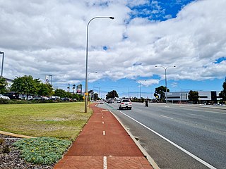
The Kwinana Freeway is a 72-kilometre (45 mi) freeway in and beyond the southern suburbs of Perth, Western Australia, linking central Perth with Mandurah to the south. It is the central section of State Route 2, which continues north as Mitchell Freeway to Clarkson, and south as Forrest Highway towards Bunbury. A 4-kilometre (2.5 mi) section between Canning and Leach highways is also part of National Route 1. Along its route are interchanges with several major roads, including Roe Highway and Mandjoogoordap Drive. The northern terminus of the Kwinana Freeway is at the Narrows Bridge, which crosses the Swan River, and the southern terminus is at Pinjarra Road, east of Mandurah.
Leeming is a southern suburb of Perth, Western Australia. It is divided between the three local government areas of the City of Melville, the City of Cockburn (south) and the City of Canning (north-east). It is located approximately 17 kilometres (11 mi) south of the Perth central business district and 13 kilometres (8.1 mi) east of Fremantle.

Jandakot is a southern suburb of Perth, Western Australia, located within the City of Cockburn local government area. It is best known for Jandakot Airport that is situated entirely within the suburb, the airport being "the busiest general aviation airport in Australia in terms of aircraft movements", the sixth-busiest civilian airport in Australia in the fiscal year ending 30 June 2018, and in the 2011 fiscal year even the busiest civilian airport in Australia.

Thornlie Station is a railway station on the Transperth network. It is the terminus of the Thornlie spur of the Armadale Line, seventeen kilometres (11 mi) from Perth Station serving the suburb of Thornlie, Western Australia.

The Mandurah line is a commuter railway and service on the Transperth network in Western Australia that runs from Perth south to the state's second largest city Mandurah. The service is operated by Transperth Train Operations, a division of the Public Transport Authority. The line is 70.1 kilometres (43.6 mi) long and has 12 stations. At its northern end, the line begins as a continuation of the Joondalup line at Perth Underground, and ends as a continuation of the Joondalup line at Elizabeth Quay. The first 1.3 kilometres (0.81 mi) of the line is underground, passing under the Perth central business district. The line surfaces and enters the median of the Kwinana Freeway just north of the Swan River. It continues south down the freeway's median for 30 kilometres (19 mi), before veering south-west towards Rockingham. The final stretch of the line goes south from Rockingham to Mandurah.

Canning Vale is a southern suburb of Perth, 16 km (9.9 mi) from the central business district. Its local government areas are the City of Canning and the City of Gosnells.

Atwell is a suburb within the metropolitan area of Perth, Western Australia, situated 21 kilometres (13 mi) south of Perth City, and located in the City of Cockburn local government area.

Banjup is a suburb of Perth, Western Australia, located within the City of Cockburn. Its postcode is 6164. It is approximately 25 km (16 mi) south of the Perth central business district.
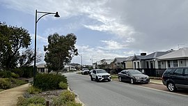
Success is a southern suburb of Perth, the capital city of Western Australia, located within the City of Cockburn.
New MetroRail was a division of the Public Transport Authority in Western Australia. It was responsible for managing extensions to Perth's railway network. The project doubled Perth's rail network, which is operated by Transperth, and was completed in 2007, after various projects were completed. Costing $1.6 billion, the project was the largest public transport project ever undertaken by the Western Australian government and effectively doubled the size of Perth's railway network. A similar agency Metronet was created in 2017 for future Perth rail extensions.

Roe Highway is a 35-kilometre-long (22 mi) limited-access highway and partial freeway in Perth, Western Australia, linking Kewdale with the city's north-eastern and south-western suburbs. The northern terminus is at Reid Highway and Great Northern Highway in Middle Swan, and the southern terminus is with Murdoch Drive at the Kwinana Freeway interchange in Bibra Lake. Roe Highway, in addition to Reid Highway, form State Route 3, a partial ring road around the outer suburbs of the Perth metropolitan area. Roe Highway also forms part of National Highway 94 from Great Eastern Highway Bypass to Great Eastern Highway, and National Highway 95 from Great Eastern Highway to Great Northern Highway.

Thomas Road is a major west–east road in the far southern suburbs of Perth, Western Australia, connecting Rockingham Road in Kwinana's industrial area with Kwinana's urban area, before bridging Perth's agricultural fringe to meet the South Western Highway in Byford, just south of Armadale. Thomas Road was the terminus of the Kwinana Freeway from 1993 until 2002, and presently serves as the terminus of Tonkin Highway after its extension beyond Albany Highway in 2003.
Armadale Road is a major road in the south and south east of the Perth Metropolitan Area. It serves three purposes: firstly, providing a main route from Armadale to Fremantle; secondly, connecting Armadale to the Kwinana Freeway; and thirdly, since 2005, connecting it to the Tonkin Highway which ferries traffic to the eastern suburbs, Perth Airport and the Forrestfield and Kewdale industrial areas.
Ranford Road is a major road in the southeastern suburbs of Perth, Western Australia, and services a number of housing estates in Canning Vale and Southern River, as well as forming part of one of the two major routes between the port city of Fremantle and Armadale. It continues from South Street, a major east-west route in the southern suburbs which also provides access to the Kwinana Freeway and Murdoch railway station.

Cockburn Central is a suburb of Perth, the capital city of Western Australia, and is 24 kilometres (15 mi) south of Perth's central business district (CBD) along the Kwinana Freeway. Its local government area is the City of Cockburn, and it is intended by the Government to serve as a regional centre for the area. It was approved as a name by the Geographic Names Committee in 2007.
Atwell College is an independent public secondary school in the southern Perth suburb of Atwell, Western Australia.

Aubin Grove railway station is a commuter railway station serving Atwell, Aubin Grove, Hammond Park and Success, which are suburbs of Perth, Western Australia. It is on the Mandurah line, which is part of the Transperth network, and is located immediately north of Russell Road in the median of the Kwinana Freeway. It has two platform faces on a singular island platform, which is linked to either side of the freeway by a pedestrian overpass. Services run every 10 minutes during peak and every 15 minutes between peak. The journey to Perth railway station is 23.8 kilometres (14.8 mi) and takes 21 minutes. The station has a bus interchange with four bus stands and seven regular bus routes.
Beeliar Drive is a major arterial road in the southwestern part of the Perth Metropolitan Area. It provides an important and unbroken east-west link between Kwinana Freeway and Stock Road providing access to residential developments in Beeliar, Yangebup and Lake Coogee in the west to commercial and industrial development in Cockburn Central, Jandakot and Success in the east. It is one of Perth's more recent arterial road constructions with development of the road occurring between the early 1990s and early 2020s.

North Lake Road is a major road in the southwestern suburbs of the Perth metropolitan area functioning as an intermediate arterial collector positioned between the limited-access Stock Road to the west and Kwinana Freeway to the east. North Lake Road's northern terminus is at Canning Highway with its southern end at Armadale Road with the Kwinana Freeway exit as of December 2021. North Lake Road was part of the old State Route 14 until the early 2010s when upgrades and extensions to the more south-westerly Spearwood Avenue and Beeliar Drive resulted in its status being revoked.