Harrisdale, Western Australia

Last updated

Harrisdale
Perth,  Western Australia
Harrisdale, Western Australia
Coordinates 32°06′43″S115°55′55″E / 32.112°S 115.932°E / -32.112; 115.932
Population11,667 (SAL 2021) [1]
Established2007
Postcode(s) 6112
Area5.8 km2 (2.2 sq mi)
LGA(s) City of Armadale
State electorate(s) Darling Range
Federal division(s) Burt
Suburbs around Harrisdale:
Canning Vale Canning Vale Canning Vale
Canning Vale Harrisdale Southern River
Piara Waters Piara Waters Forrestdale

Harrisdale is a southeastern suburb of Perth, Western Australia and is one of the western suburbs of the City of Armadale. It was gazetted in 2007, and has a population of 9,076 as of the 2016 Australian census. [2] The population of the developing area is expected to grow to over 10,000 by 2031. [3]

Contents

On 12 April 2008, a joint venture was announced between the Government of Western Australia and Cedar Woods Properties Limited to develop a 30-hectare (74-acre) site in the northwest of the suburb of Harrisdale with an emphasis on affordable housing and sustainable living. [4] The development, known as Harrisdale Green, commenced construction in July 2010 and will accommodate up to 500 homes. [5] [6] [ needs update ]

The suburb is bounded by Warton Road to the northwest, Ranford Road to the northeast, Skeet Road to the southeast and Nicholson Road to the southwest. [7]

Carey Baptist College is a co-educational school that occupies a 12-hectare (30-acre) site in Harrisdale. It was established by the Carey Community Baptist Church in 1998 and provides education from kindergarten through to Year 12. [8]

Harrisdale Senior High School is a public high school in Harrisdale that opened in 2017.

The Harrisdale Swamp Bushland occupies a significant portion of the suburb's west. It is a banksia woodland dominated by Banksia attenuata and Banksia menziesii . The mammal species Quenda occurs in this area. [9]

Transport

Bus

Related Research Articles

<span class="mw-page-title-main">Armadale, Western Australia</span> Suburb of Perth, Western Australia

Armadale is a suburb of Perth within the City of Armadale, located on the south-eastern edge of the Perth metropolitan region. The major junction of the South Western and Albany Highways, which connect Perth with the South West and Great Southern regions of Western Australia respectively, is located within the suburb. It is also the terminus of the Armadale railway line, one of five major railway lines to service Perth.

<span class="mw-page-title-main">Bull Creek, Western Australia</span> Suburb of Perth, Western Australia

Bull Creek is a suburb of Perth, Western Australia, located within the local government area of City of Melville. The suburb lies to the south of a creek of the same name, which flows into the Canning River.

<span class="mw-page-title-main">Yangebup, Western Australia</span> Suburb of Perth, Western Australia

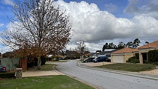
Yangebup is a southern suburb of Perth, Western Australia in the City of Cockburn. It takes its name from the nearby Yangebup Lake.

<span class="mw-page-title-main">Jandakot, Western Australia</span> Suburb of Perth, Western Australia

Jandakot is a southern suburb of Perth, Western Australia, located within the City of Cockburn local government area. It is best known for Jandakot Airport that is situated entirely within the suburb, the airport being "the busiest general aviation airport in Australia in terms of aircraft movements", the sixth-busiest civilian airport in Australia in the fiscal year ending 30 June 2018, and in the 2011 fiscal year even the busiest civilian airport in Australia.

<span class="mw-page-title-main">Thornlie railway station</span> Railway station in Perth, Western Australia

Thornlie railway station is a temporarily closed railway station on the Transperth network. It was the terminus of the Thornlie line, a spur of the Armadale Line, seventeen kilometres (11 mi) from Perth Station serving the suburb of Thornlie, Western Australia. Under construction is the Thornlie-Cockburn Link which will link to Cockburn Central railway station along the Mandurah line via two new stations, Nicholson Road railway station and Ranford Road railway station.

Huntingdale is a southeastern suburb of Perth, Western Australia. It is part of the City of Gosnells local government area, which suggested the name of the suburb in 1974 as it was used by local developers as a promotional name. It is largely a residential suburb with associated schools and small businesses, mainly existing to service local residents. Homes in the area include a section of older residences constructed mainly in the 1970s, while there was significant new development from the 1990s onward in the southern portion of Huntingdale. There are some remaining pockets of semi-rural land comprising remnants of horticultural and chicken-farming enterprises, but in the early 2000s these were fast being taken over for new residential developments.

<span class="mw-page-title-main">Forrestdale, Western Australia</span> Suburb of Perth, Western Australia

Forrestdale is a suburb of Perth, Western Australia, located within the City of Armadale. It is named after John Forrest, the first premier of Western Australia.

<span class="mw-page-title-main">Murdoch, Western Australia</span> Suburb of Perth, Western Australia, Western Australia

Murdoch is a suburb of Perth, Western Australia, located within the City of Melville. Murdoch University, St John of God Hospital Murdoch and Fiona Stanley Hospital are located in Murdoch. The suburb is named after Sir Walter Murdoch.

<span class="mw-page-title-main">Canning Vale, Western Australia</span> Suburb of Perth, Western Australia

Canning Vale is a southern suburb of Perth, 22 km (13.7 mi) from the central business district. Its local government areas are the City of Canning and the City of Gosnells.

<span class="mw-page-title-main">Cannington, Western Australia</span> Suburb of Perth, Western Australia

Cannington is a southern suburb of Perth, Western Australia. Its local government area is the City of Canning.

<span class="mw-page-title-main">Willetton, Western Australia</span> Suburb of Perth, Western Australia

Willetton is a large southern suburb of Perth, Western Australia. Its local government area is the City of Canning.

<span class="mw-page-title-main">Atwell, Western Australia</span> Suburb of Perth, Western Australia

Atwell is a suburb within the metropolitan area of Perth, Western Australia, situated 21 kilometres (13 mi) south of Perth City, and located in the City of Cockburn local government area.

<span class="mw-page-title-main">Banjup, Western Australia</span> Suburb of Perth, Western Australia

Banjup is a suburb of Perth, Western Australia, located within the City of Cockburn. Its postcode is 6164. It is approximately 25 km (16 mi) south of the Perth central business district.

Success is a southern suburb of Perth, the capital city of Western Australia, located within the City of Cockburn.

<span class="mw-page-title-main">Beckenham, Western Australia</span> Suburb of Perth, Western Australia

Beckenham is a suburb of Perth, Western Australia, located within the City of Gosnells.

<span class="mw-page-title-main">Southern River, Western Australia</span> Suburb of Perth, Western Australia

Southern River is a suburb of Perth, Western Australia, located within the City of Gosnells.

<span class="mw-page-title-main">Seville Grove, Western Australia</span> Suburb of Perth, Western Australia

Seville Grove is a suburb of Perth, Western Australia in the City of Armadale.

<span class="mw-page-title-main">Piara Waters, Western Australia</span> Suburb of Perth, Western Australia

Piara Waters is a southeastern suburb of Perth, Western Australia within the City of Armadale. Previously part of Forrestdale and gazetted in 2007, Piara Waters is located approximately 20 kilometres (12 mi) south-southeast of Perth.

Haynes is a suburb of Perth, Western Australia, located within the City of Armadale. This rural and semi-rural suburb is located on the city's fringe, and in the 2010s began to be subdivided for urban purposes.

<span class="mw-page-title-main">Treeby, Western Australia</span> Suburb of Perth, Western Australia

Treeby is a southern suburb of Perth, Western Australia, located within the City of Cockburn. It is located on the east side of the Kwinana Freeway, close to Cockburn Central.

References

  1. Australian Bureau of Statistics (28 June 2022). "Harrisdale (suburb and locality)". Australian Census 2021 QuickStats. Retrieved 28 June 2022.  OOjs UI icon edit-ltr-progressive.svg
  2. Australian Bureau of Statistics (27 June 2017). "Harrisdale (State Suburb)". 2016 Census QuickStats. Retrieved 14 January 2018. OOjs UI icon edit-ltr-progressive.svg
  3. "Harrisdale" (PDF). City Of Armidale Population and Household Forecasts. forecast.id. Archived from the original (PDF) on 6 July 2011. Retrieved 2 October 2010.
  4. "Launch of Western Australia's affordable eco-village". Government of Western Australia. 12 April 2008. Archived from the original on 11 March 2012. Retrieved 2 October 2010.
  5. "Harrisdale Green". Landport. Department of Housing. Archived from the original on 20 February 2011. Retrieved 2 October 2010.
  6. "Harrisdale Green". Cedar Woods and Department of Housing. Archived from the original on 11 September 2010. Retrieved 2 October 2010.
  7. "Harrisdale". Street-directory Australia. Virtual Map (Australia) Ltd. Retrieved 2 October 2010.
  8. "Carey Baptist College". Archived from the original on 6 July 2011. Retrieved 2 October 2010.
  9. Froend, Dr. R.; et al. (September 2004). "Study of Ecological Water Requirements on the Gnangara and Jandakot Mounds under Section 46 of the Environmental Protection Act" (PDF). Water and Rivers Commission. Archived from the original (PDF) on 4 March 2011. Retrieved 2 October 2010.
  10. "Route 233". Bus Timetable 17 (PDF). Transperth. 11 January 2024 [effective from 28 January 2024].
  11. "Route 518". Bus Timetable 17 (PDF). Transperth. 11 January 2024 [effective from 28 January 2024].
  12. "Route 519". Bus Timetable 17 (PDF). Transperth. 11 January 2024 [effective from 28 January 2024].

Commons-logo.svg Media related to Harrisdale, Western Australia at Wikimedia Commons