
Great Eastern Highway is a 590-kilometre-long (370 mi) road that links the Western Australian capital of Perth with the city of Kalgoorlie. A key route for road vehicles accessing the eastern Wheatbelt and the Goldfields, it is the western portion of the main road link between Perth and the eastern states of Australia. The highway forms the majority of National Highway 94, although the alignment through the Perth suburbs of Guildford and Midland, and the eastern section between Coolgardie and Kalgoorlie are not included. Various segments form parts of other road routes, including National Route 1, Alternative National Route 94, and State Route 51.
The Kwinana Freeway is a 72-kilometre (45 mi) freeway in and beyond the southern suburbs of Perth, Western Australia, linking central Perth with Mandurah to the south. It is the central section of State Route 2, which continues north as Mitchell Freeway to Clarkson, and south as Forrest Highway towards Bunbury. A 4-kilometre (2.5 mi) section between Canning and Leach highways is also part of National Route 1. Along its route are interchanges with several major roads, including Roe Highway and Mandjoogoordap Drive. The northern terminus of the Kwinana Freeway is at the Narrows Bridge, which crosses the Swan River, and the southern terminus is at Pinjarra Road, east of Mandurah.

The Mandurah line is a commuter railway and service on the Transperth network in Western Australia that runs from Perth south to the state's second largest city Mandurah. The service is operated by Transperth Train Operations, a division of the Public Transport Authority. The line is 70.1 kilometres (43.6 mi) long and has 12 stations. At its northern end, the line begins as a continuation of the Joondalup line at Perth Underground, and ends as a continuation of the Joondalup line at Elizabeth Quay. The first 1.3 kilometres (0.81 mi) of the line is underground, passing under the Perth central business district. The line surfaces and enters the median of the Kwinana Freeway just north of the Swan River. It continues south down the freeway's median for 30 kilometres (19 mi), before veering south-west towards Rockingham. The final stretch of the line goes south from Rockingham to Mandurah.
The Mitchell Freeway is a 41.5-kilometre-long (25.8 mi) freeway in the northern suburbs of Perth, Western Australia, linking central Perth with the city of Joondalup. It is the northern section of State Route 2, which continues south as Kwinana Freeway and Forrest Highway. Along its length are interchanges with several major roads, including the Graham Farmer Freeway and Reid Highway. The southern terminus of the Mitchell Freeway is at the Narrows Bridge, which crosses the Swan River, and the northern terminus is at Romeo Road in Alkimos.

The Causeway is an arterial traffic crossing in Perth, Western Australia, linking the inner-city suburbs of East Perth and Victoria Park. It is carried over the Swan River at the eastern end of Perth Water by two bridges on either side of Heirisson Island. The current Causeway is the third structure to have been built across the river at this point.

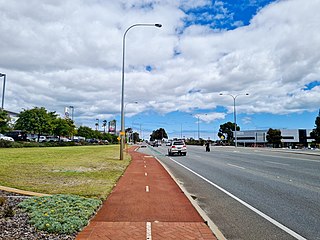
Roe Highway is a 35-kilometre-long (22 mi) limited-access highway and partial freeway in Perth, Western Australia, linking Kewdale with the city's north-eastern and south-western suburbs. The northern terminus is at Reid Highway and Great Northern Highway in Middle Swan, and the southern terminus is with Murdoch Drive at the Kwinana Freeway interchange in Bibra Lake. Roe Highway, in addition to Reid Highway, form State Route 3, a partial ring road around the outer suburbs of the Perth metropolitan area. Roe Highway also forms part of National Highway 94 from Great Eastern Highway Bypass to Great Eastern Highway, and National Highway 95 from Great Eastern Highway to Great Northern Highway.

Reid Highway is a 23-kilometre (14 mi) east-west highway and partial freeway in the northern suburbs of Perth, Western Australia, linking North Beach with Middle Swan. As part of State Route 3, it forms half of Perth's outer ring road along with Roe Highway, which it joins onto at its eastern terminus.

Canning Bridge railway station is a railway station on the Transperth network. It is located on the Mandurah line, four kilometres from Perth station inside the median strip of the Kwinana Freeway located adjacent to the suburb of Como.
Tonkin Highway is an 81-kilometre-long (50 mi) north–south highway and partial freeway in Perth, Western Australia, linking Perth Airport and Kewdale with the city's north-eastern and south-eastern suburbs. As of April 2020, the northern terminus is at the interchange with Brand Highway and Great Northern Highway in Muchea, and the southern terminus is at Thomas Road in Oakford. It forms the entire length of State Route 4, and connects to several major roads. Besides Brand Highway and Great Northern Highway, it also connects to Reid Highway, Great Eastern Highway, Leach Highway, Roe Highway, and Albany Highway.

Canning Highway is an arterial road in Perth, Western Australia, linking the inner Perth suburb of Victoria Park in the north-east, to the port city of Fremantle in the south-west.

Leach Highway is a 23-kilometre (14 mi) east-west arterial highway in the southern suburbs of Perth, Western Australia, primarily linking Kewdale and Perth Airport with the city of Fremantle.

Oakford is an outer suburb of Perth, Western Australia, within the Shire of Serpentine-Jarrahdale. The suburb was named in 1982, taking its name from a townsite briefly declared in the area in 1926.

Patterson Road is a major road between Kwinana and Rockingham and is part of Australia's National Route 1 for part of its length. The first part goes through Kwinana's heavy industrial area. After the Ennis Avenue turnoff which takes Highway 1 with it, Patterson Road becomes State Route 18 and goes through the Rockingham Beach area until it turns into Railway Terrace one block from the ocean at Mangles Bay, which is part of the Indian Ocean.
Transport in Perth, Western Australia, is served by various means, among them an extensive highway / freeway network and a substantial system of commuter rail lines and bus routes. Public transport is managed by the Transperth agency.
Armadale Road is a major road in the south and south east of the Perth Metropolitan Area. It serves three purposes: firstly, providing a main route from Armadale to Fremantle; secondly, connecting Armadale to the Kwinana Freeway; and thirdly, since 2005, connecting it to the Tonkin Highway which ferries traffic to the eastern suburbs, Perth Airport and the Forrestfield and Kewdale industrial areas.

Forrest Highway is a 95-kilometre-long (59 mi) highway in Western Australia's Peel and South West regions, extending Perth's Kwinana Freeway from east of Mandurah down to Bunbury. Old Coast Road was the original Mandurah–Bunbury route, dating back to the 1840s. Part of that road, and the Australind Bypass around Australind and Eaton, were subsumed by Forrest Highway. The highway begins at Kwinana Freeway's southern terminus in Ravenswood, continues around the Peel Inlet to Lake Clifton, and heads south to finish at Bunbury's Eelup Roundabout. There are a number of at-grade intersections with minor roads in the shires of Murray, Waroona, and Harvey including Greenlands Road and Old Bunbury Road, both of which connect to South Western Highway near Pinjarra.

Cycling in Perth, Western Australia is common on the roads and paths for recreation, commuting and sport. Between 1998 and 2009 the number of cyclists in Perth increased 450%.
Beeliar Drive is a major arterial road in the southwestern part of the Perth Metropolitan Area. It provides an important and unbroken east-west link between Kwinana Freeway and Stock Road providing access to residential developments in Beeliar, Yangebup and Lake Coogee in the west to commercial and industrial development in Cockburn Central, Jandakot and Success in the east. It is one of Perth's more recent arterial road constructions with development of the road occurring between the early 1990s and early 2020s.

The Thornlie line is a temporarily closed suburban railway line and service in Perth, Western Australia, operated by the Public Transport Authority as part of the Transperth system. The Thornlie line is a branch of the Armadale line and runs for 2.9 kilometres (1.8 mi) parallel to the Kwinana freight railway between the Armadale line at Kenwick and Thornlie station. Thornlie line services continued north of Kenwick along the Armadale line to Perth station, stopping at most stations, in contrast to Armadale line services, which skipped most stations along that section. Thornlie line services have been suspended since 20 November 2023, and are planned to recommence in mid-2025.

