
Burwood is a suburb of Melbourne, Victoria, Australia, 14 km east of Melbourne's Central Business District, located within the Cities of Monash and Whitehorse local government areas. Burwood recorded a population of 15,147 at the 2021 census.
Ashwood is a suburb in Melbourne, Victoria, Australia, 14 km south east of Melbourne's Central Business District, located within the City of Monash local government area. Ashwood recorded a population of 7,154 at the 2021 census.

Mount Waverley is a suburb in Melbourne, Victoria, Australia, 16 km (9.9 mi) south-east of Melbourne's Central Business District, located within the City of Monash local government area. Mount Waverley recorded a population of 35,340 at the 2021 census.
Dianella is a suburb of Perth, Western Australia. It is within the local government area of the City of Stirling.

Gwelup is a suburb of Perth, the capital city of Western Australia 12 km north of Perth's central business district (CBD) along the Mitchell Freeway. Its local government area is the City of Stirling.

Trigg is a suburb of Perth, Western Australia. Its local government area is the City of Stirling. Trigg Island is a small island off the coast of the suburb of Trigg.

The City of Gosnells is a local government area in the southeastern suburbs of the Western Australian capital city of Perth, located northwest of Armadale and about 20 kilometres (12 mi) southeast of Perth's central business district. The City covers an area of 128 square kilometres (49.42 sq mi), a portion of which is state forest rising into the Darling Scarp to the east, and had a population of approximately 118,000 at the 2016 Census. The largest activity centre in the City is the Central Maddington shopping centre. District centres exist in the Gosnells town centre, Thornlie and Canning Vale.
Clayton South is a suburb in Melbourne, Victoria, Australia, 20 km south-east of Melbourne's Central Business District, located within the City of Kingston local government area. Clayton South recorded a population of 13,381 at the 2021 census.

Huntingdale is a suburb in Melbourne, Victoria, Australia, 16 km south-east of Melbourne's Central Business District, located within the City of Monash local government area. Huntingdale recorded a population of 1,949 at the 2021 census.
Oakleigh East is a suburb in Melbourne, Victoria, Australia 16 km south-east of Melbourne's Central Business District, located within the City of Monash local government area. Oakleigh East recorded a population of 6,804 at the 2021 census.
Oakleigh South is a suburb in Melbourne, Victoria, Australia, 17 km south-east of Melbourne's Central Business District, located within the Cities of Kingston and Monash local government areas. Oakleigh South recorded a population of 9,851 at the 2021 census.
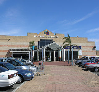
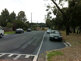
Thornlie is a large residential suburb of Perth, the capital city of Western Australia, located 15 kilometres (9.3 mi) south-east of the city's central business district. It is a part of the City of Gosnells local government area. The Canning River runs through the northern side of the suburb. Since the 1950s the suburb has developed in approximately five stages; north-east Thornlie (1950s–60s), south Thornlie (1970s–80s), Crestwood (1970s), Castle Glen (1980s) and Forest Lakes.

Coogee is a southern coastal suburb of Perth, Western Australia, located within the City of Cockburn.

Cooloongup is an outer southern suburb of Perth, Western Australia, the capital city of Western Australia, located within the City of Rockingham. It consists mainly of residential dwellings.

East Fremantle is a suburb of Perth, Western Australia, located 13 kilometres (8.1 mi) south-west of the central business district. The suburb is mainly residential, and is coterminous with the Town of East Fremantle local government area.
Lockridge is a suburb of Perth, in the Bassendean division of Western Australia, and the City of Swan local government area.

Gardenvale is a suburb in Melbourne, Victoria, Australia, 10 km (6.2 mi) south-east of Melbourne's Central Business District, located within the City of Glen Eira local government area. Gardenvale recorded a population of 1,019 at the 2021 census.

Richmond is an inner suburb of Adelaide, South Australia. It is located on Kaurna land in the City of West Torrens.
Southern River College is an independent public co-educational high day school in the City of Gosnells, located on Southern River Road in Gosnells, a suburb of Perth, Western Australia.

Treeby is a southern suburb of Perth, Western Australia, located within the City of Cockburn. It is located on the east side of the Kwinana Freeway, close to Cockburn Central.
