Karrinyup is a suburb of Perth, the capital city of Western Australia, and is located 12 km north of Perth's central business district. Its local government area is the City of Stirling.

Mount Lawley is an inner northern suburb of Perth, Western Australia. The suburb is bounded by the Swan River to the east, Vincent, Harold and Pakenham Streets to the south, Central Avenue and Alexander Drive to the north, and Norfolk Street to the west.

Osborne Park is a suburb of Perth, Western Australia in the local government area of the City of Stirling.

Yangebup is a southern suburb of Perth, Western Australia in the City of Cockburn. It takes its name from the nearby Yangebup Lake.

Edgewater is a suburb of Perth, Western Australia 23 kilometres (14 mi) north of Perth's central business district. Edgewater was approved as a suburb name in 1974, and its local government area is the City of Joondalup. It is named after its location on the western edge of Lake Joondalup, which is surrounded by Yellagonga Regional Park.

Coolbellup is a suburb in Perth, Western Australia, located 15 kilometres (9.3 mi) south of the central business district within the local government area of the City of Cockburn.

Jandakot is a southern suburb of Perth, Western Australia, located within the City of Cockburn local government area. It is best known for Jandakot Airport that is situated entirely within the suburb, the airport being "the busiest general aviation airport in Australia in terms of aircraft movements", the sixth-busiest civilian airport in Australia in the fiscal year ending 30 June 2018, and in the 2011 fiscal year even the busiest civilian airport in Australia.

Ballajura is a suburb of Perth, Western Australia, in the City of Swan local government area. Ballajura is located 14 km north of the Perth CBD. The postcode for the suburb is 6066.

Nowergup is a rural locality about 40 kilometres (25 mi) north of Perth, Western Australia. It is in the local government area of the City of Wanneroo.

Kewdale is a suburb of Perth, Western Australia within the City of Belmont. Kew Street was one of the first roads in this district, hence the naming of the suburb.

Floreat is a residential suburb 8 kilometres (5 mi) west-northwest of the central business district of Perth, the capital of Western Australia. It is bordered on Underwood Avenue, Selby Street, Cromarty Road and Durston Road. It is the head of the Town of Cambridge, which has its municipal offices and library in the suburb. The name of the suburb stems from the Latin word for "flourish" or "prosper", which is also the motto of the City of Perth, of which Floreat was a part when it was first built.

Neerabup is a rural locality in Perth, the capital of Western Australia, within the local government area of the City of Wanneroo.
Pinjar is a rural locality in Perth, Western Australia. Its local government area is the City of Wanneroo.

Mandogalup is a suburb of Perth, Western Australia, located within the City of Kwinana. Its postcode is 6167.

Henderson is a suburb of Perth, Western Australia, located within the City of Cockburn.
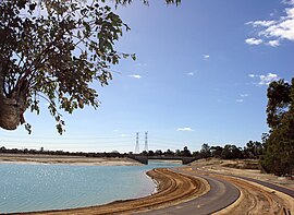
North Lake is a suburb located 18 kilometres (11 mi) south of the central business district of Perth, the capital of Western Australia, and 8 kilometres (5 mi) from the Indian Ocean. Named after the eponymous lake, the suburb and lake are located within the City of Cockburn local government area.
South Lake is a suburb of Perth, Western Australia in the City of Cockburn.
The Vines is a suburb of Perth, Western Australia, developed as a country club estate in 1987. Homes consist of mostly large lots of 1⁄4–1 acre (0.10–0.40 ha) situated around the golf courses. It is in the Swan Valley region of Western Australia, and was approved as a suburb name in 1996.
The Lakes is an outer northeastern locality of Perth, the capital city of Western Australia, located within the Shire of Mundaring. It is located 51 kilometres (32 mi) east of the Perth CBD, at the junction of the Great Eastern Highway and the Great Southern Highway, and is the easternmost suburb within the Metropolitan Region Scheme. At the 2011 census, The Lakes had a population of 45.

Northbridge is an inner city suburb of Perth, Western Australia, historically separated from Perth's central business district by the Fremantle and Joondalup railway lines. It is part of the City of Perth local government area.